Groundwater level monitoring method for geological exploration
A groundwater level and water level monitoring technology, applied in the field of geological exploration, can solve problems such as inconvenience of use and insufficient monitoring results, and achieve the effect of comprehensive detection range
- Summary
- Abstract
- Description
- Claims
- Application Information
AI Technical Summary
Problems solved by technology
Method used
Image
Examples
Embodiment 1
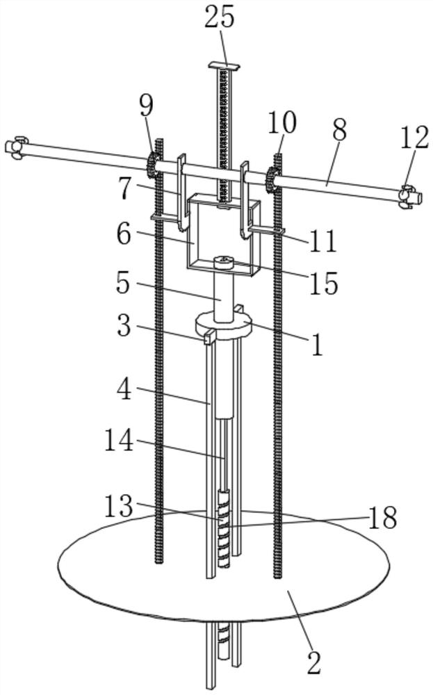
[0034] like Figure 1-7 As shown, the water level monitoring system in step S1 includes a support ring 1 supported and fixed by an external frame and a floating plate 2 floating on the liquid surface of the water area to be surveyed. The support ring 1 is supported and fixed by an external frame, and the external frame It can be a support frame erected on the shore of the water area, and the erection method of the frame body is adapted to the actual landform.
[0035] The floating plate 2 floats on the liquid surface of the water area to be detected, so that the change of the water level in the water area can be sensed through the fluctuation of the floating plate 2. The arc contour of the support ring 1 is fixed with a connecting column 3, and the lower surface of the connecting column 3 is fixed Limited position plunger 4. The surface of the limit plunger 4 penetrates through the floating plate 2 and is connected with the floating plate 2 in a limit sliding manner. The limi...
Embodiment 2
[0040] Basically the same as the first embodiment, in this embodiment, an adjustment device is provided on the floating plate 2, and through the setting of the adjustment device, the water level monitoring camera 12 can be further adjusted in the horizontal direction when the water level changes. to obtain more comprehensive monitoring data.
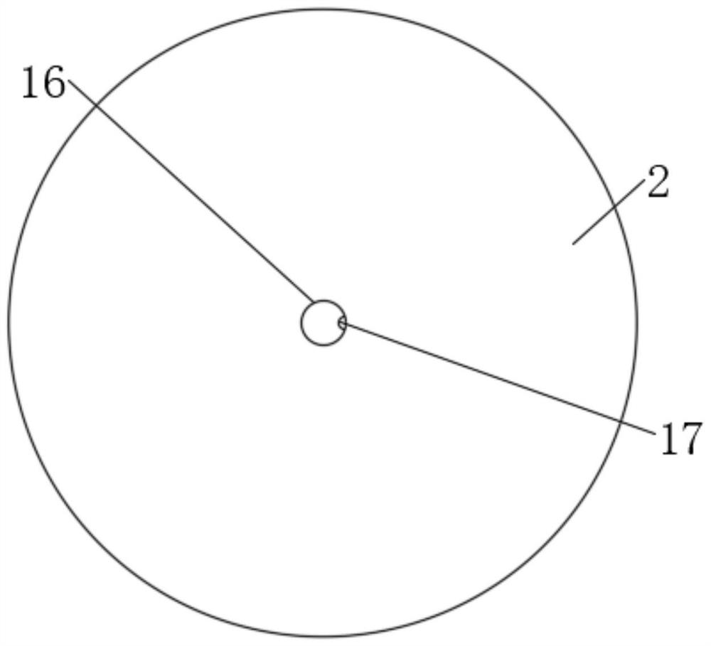
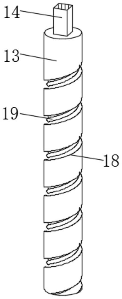
[0041] The adjusting device includes a vertical rotating rod 13, the top of the vertical rotating rod 13 is coaxially fixed with a rectangular sliding rod 14, the top of the rotating column 5 is provided with a rectangular mounting hole 15 for the rectangular sliding rod 14 to be installed, and the upper surface of the floating plate 2 is provided with a rectangular mounting hole 15. The center of the circle is provided with a movable through hole 16 for the vertical rotating rod 13 to pass through, the inner wall of the movable through hole 16 is fixed with a guide sliding block 17, and the arc profile of the vertical rotating rod 13 is ...
Embodiment 3
[0045] Basically the same as the second embodiment, in this embodiment, the inner wall of the outer spiral groove 18 is provided with a display device for visualizing the height of the water level change. People can quickly get the water level changes on the spot.
[0046] The display device includes a rubber sealing tube 19 spirally wound on the inner wall of the outer spiral groove 18. The inner wall of the rubber sealing tube 19 is wrapped with a pressure-sensitive switch module 20. The pressure-sensitive switch module 20 is composed of a plurality of pressure-sensitive switch units 21 linearly arranged.
[0047] refer to figure 1 , figure 2 , image 3 , Image 6 and Figure 7 .
[0048] With the up and down movement of the floating plate 2, the guide slider 17 will contact and squeeze the rubber sealing tube 19 at different places on the inner wall of the outer spiral groove 18, so that the pressure-sensitive switch module 20 wrapped in the rubber sealing tube 19 wil...
PUM
 Abstract
Description
Claims
Application Information
 - R&D Engineer
- R&D Manager
- IP Professional
- Industry Leading Data Capabilities
- Powerful AI technology
- Patent DNA Extraction
Browse by: Latest US Patents, China's latest patents, Technical Efficacy Thesaurus, Application Domain, Technology Topic, Popular Technical Reports.
© 2024 PatSnap. All rights reserved.Legal|Privacy policy|Modern Slavery Act Transparency Statement|Sitemap|About US| Contact US: help@patsnap.com


