
Multifunctional geographic information surveying and mapping device

A surveying and mapping device and geographic information technology, applied in surveying devices, surveying and navigation, surveying instruments, etc., can solve problems such as inconvenient use of surveying and mapping devices, easy sliding, and large deviations in measurement data, so as to facilitate transportation and high-speed driving , Avoid slow moving speed and ensure the effect of accuracy

Inactive Publication Date: 2022-05-31
明阳
View PDF0 Cites 4 Cited by
  • Summary
  • Abstract
  • Description
  • Claims
  • Application Information

AI Technical Summary

Problems solved by technology

[0003] In the prior art, it is inconvenient to use the surveying and mapping device in some rainy areas. The surveying and mapping device is unstable, easy to slide, poor in balance, and the measurement data will have a large deviation

Method used


Image

  • Multifunctional geographic information surveying and mapping device
  • Multifunctional geographic information surveying and mapping device
  • Multifunctional geographic information surveying and mapping device

Examples


Embodiment Construction

[0050] The following will clearly and completely describe the technical solutions in the embodiments of the present invention with reference to the accompanying drawings in the embodiments of the present invention. Obviously, the described embodiments are only some, not all, embodiments of the present invention. Based on the embodiments of the present invention, all other embodiments obtained by persons of ordinary skill in the art without making creative efforts belong to the protection scope of the present invention.

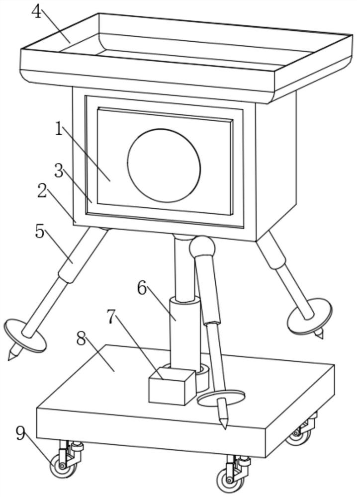
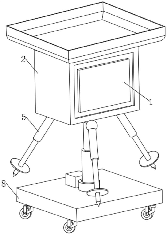
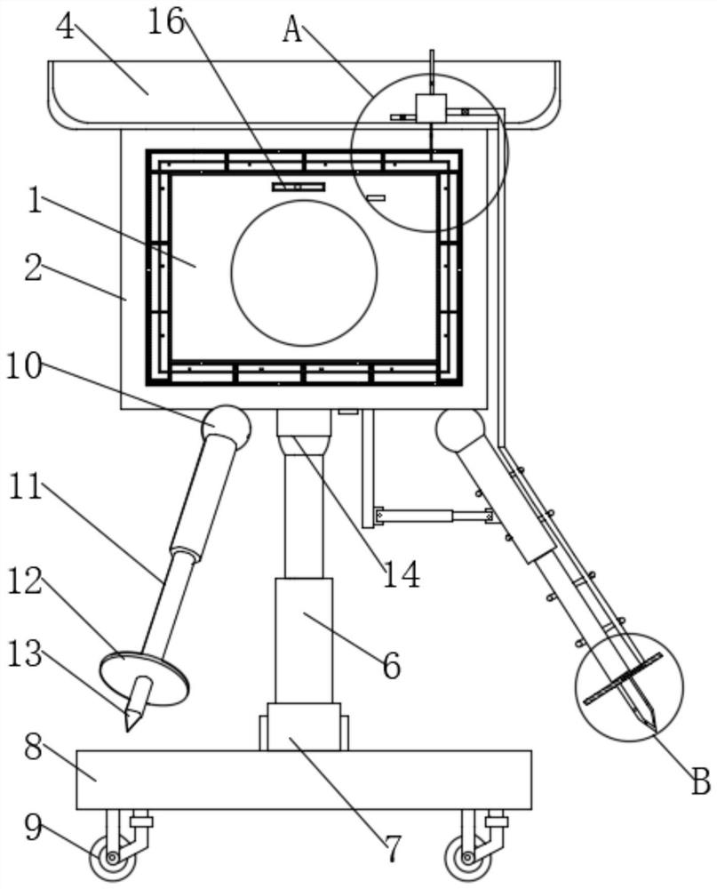
[0051] The present invention provides such Figure 1-7 A geographic information surveying and mapping device with multiple functions is shown, including a surveying and mapping device 1, the surveying and mapping device 1 is installed on a fixed frame 2, the fixed frame 2 has a rectangular frame structure, and an access box 4 is arranged above the fixed frame 2, An inner rubber ring 3 is fixedly arranged on the inner wall of the fixed frame 2, and the inner ru...


PUM


Abstract

The invention discloses a multifunctional geographic information surveying and mapping device, and relates to the field of geographic information surveying and mapping devices.The multifunctional geographic information surveying and mapping device comprises a surveying and mapping device body, the surveying and mapping device body is installed on a fixed frame, the fixed frame is of a rectangular frame structure, and a receiving box is arranged above the fixed frame; an inner rubber ring is fixedly arranged on the inner wall of the fixing frame, the surveying and mapping device can be used on rainy days or muddy roads, the limitation is low, the balance of the surveying and mapping device in the measurement process is guaranteed through the inclination adjusting assembly and the fine adjustment assembly, and the accuracy of geographic information surveying and mapping data is guaranteed.

Description

technical field [0001] The invention relates to the field of geographic information surveying and mapping devices, in particular to a geographic information surveying and mapping device with multiple functions. Background technique [0002] Simply put, geographic information surveying and mapping devices are instruments and devices designed and manufactured for surveying and mapping operations such as data collection, processing, and output. Instruments for angle measurement, height measurement, mapping and photogrammetry. [0003] In the prior art, it is inconvenient to use the surveying and mapping device in some rainy areas. The surveying and mapping device is unstable, easy to slide, poorly balanced, and the measurement data will have a large deviation. [0004] Therefore, it is necessary to invent a multifunctional geographical information surveying and mapping device to solve the above problems. Contents of the invention [0005] The object of the present invention...

Claims


Application Information

Patent Timeline
Patent Type & Authority Applications(China)
IPC IPC(8): G01C15/00
CPCG01C15/00
Inventor 刘伟明阳曾雯雯
Owner 明阳
Learn More