Path planning method for water unmanned ship

A path planning, unmanned technology on water, applied in vehicle position/route/height control, non-electric variable control, instruments and other directions, it can solve the problem that the robot is difficult to find the path, easy to swing back and forth, unable to find the target point, etc. Global search capability, simple rules, and easy-to-implement effects

Pending Publication Date: 2022-02-22
WEIHAI OCEAN VOCATIONAL COLLEGE
View PDF0 Cites 1 Cited by
  • Summary
  • Abstract
  • Description
  • Claims
  • Application Information

AI Technical Summary

Problems solved by technology

For example, it is difficult for the robot to find the path between similar obstacles, it is easy to swing back and forth when walking in a narrow passage, and it is impossible to find the target point when there are obstacles near the target point, etc.

Method used


Image

  • Path planning method for water unmanned ship
  • Path planning method for water unmanned ship
  • Path planning method for water unmanned ship

Examples


Embodiment Construction

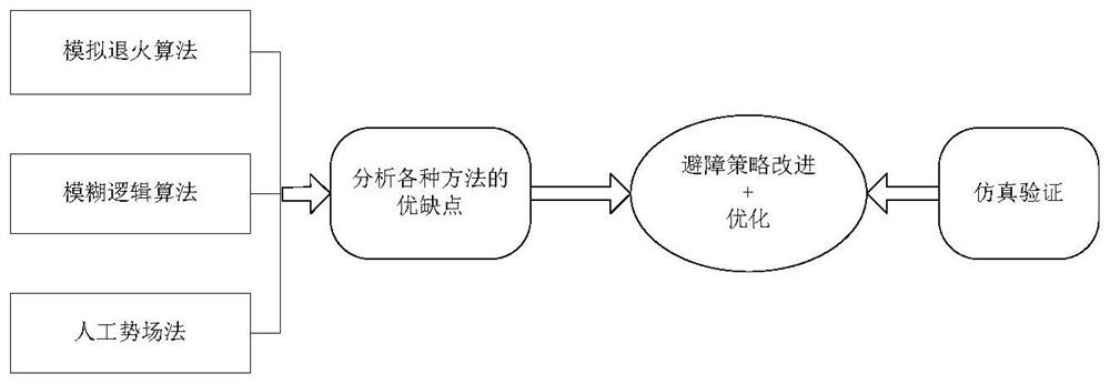
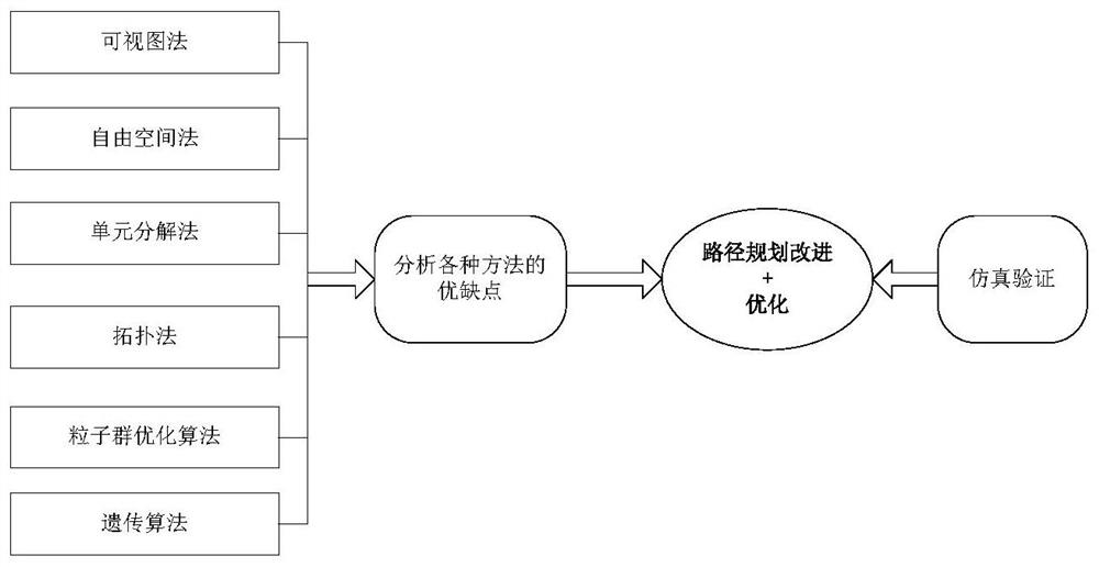
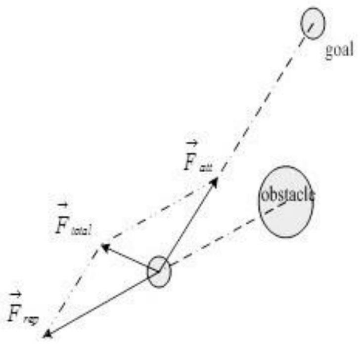
[0097] The specific embodiment of the present invention will be further described below in conjunction with accompanying drawing and specific embodiment:

[0098] combine Figure 1-7 , a path planning method for an unmanned ship on water, comprising the following steps:

[0099] (1) Construct the mathematical model of surface unmanned ship motion (mathematical model includes dynamic model and motion model); the motion model of surface unmanned ship includes ground coordinate system η=[x, y, ψ] T And motion coordinate system v=[u,v,r]T , to establish a corresponding relationship between these two coordinate systems, and through coordinate transformation, the relationship between the two coordinate systems on the horizontal plane for the surface unmanned ship is obtained as shown in formulas (1) and (2):

[0100] η=R(ψ)ν (1)

[0101]

[0102] Among them, x, y are the position coordinates of the surface unmanned ship; u is the surge velocity, v is the sway velocity, r is the...


PUM


Abstract

The invention discloses a path planning method for an overwater unmanned ship, and relates to the field of path planning. The water unmanned ship path planning method comprises the following steps: constructing a mathematical model of the movement of the water unmanned ship; analyzing an optimization target of the water unmanned ship in path planning; according to the established mathematical model, obtaining dynamics and kinematics models of the unmanned ship, and describing a ship motion law; researching the autonomous obstacle avoidance strategy of the water unmanned ship in the local area; performing optimal control research on global path planning of the water unmanned ship, wherein the global path planning refers to path planning made after all surrounding related environments are known, and the global planning needs to grasp all environment information in a motion space and arrange path planning according to the information; and researching a plurality of global path planning methods, seeking an optimal control algorithm, and finally performing simulation verification on the obstacle avoidance strategy and the path planning algorithm.

Description

technical field [0001] The invention relates to the field of path planning, in particular to a path planning method for an unmanned ship on water. Background technique [0002] In the study of how the surface unmanned ship can safely and effectively drive in the complex and changeable sea environment, avoid potential risks according to effective means, and reach the destination with the optimal path, the main research is local autonomous obstacle avoidance and global path Planned technical route. In the global path planning, the environmental information is completely known, including the position and shape of obstacles, etc. Based on this, the environmental information model is established, and then the optimal solution is obtained by using the relevant path search algorithm. Global planning is based on known information in the environment, while local planning is real-time dynamic planning based on changes in the external environment. Local planning is to plan the path f...

Claims


Application Information

Patent Timeline
IPC IPC(8): G05D1/02
CPCG05D1/0206
Inventor 王攀攀
Owner WEIHAI OCEAN VOCATIONAL COLLEGE
Why Eureka
Try Eureka