Seismic network positioning capability assessment method

A technology of positioning capability and seismic station, applied in geophysical measurement, instrument and other directions, can solve the problem of difficult to fully evaluate the positioning capability of seismic network

Active Publication Date: 2021-11-16
NORTHWEST INST OF NUCLEAR TECH
View PDF2 Cites 2 Cited by
  • Summary
  • Abstract
  • Description
  • Claims
  • Application Information

AI Technical Summary

Problems solved by technology

[0011] The purpose of the present invention is to solve the problem that the existing methods are difficult to fully evaluate the positioning ability of the seismic station network based on actual observation data, and provide a seismic station based on the signal detection probability of the seismic station, the error of the travel time model, and the error of the arrival time measurement. Evaluation Method of Station Network Positioning Capability

Method used


Image

  • Seismic network positioning capability assessment method
  • Seismic network positioning capability assessment method
  • Seismic network positioning capability assessment method

Examples


Embodiment Construction

[0035] The present invention will be described in detail below in conjunction with the accompanying drawings and specific embodiments.

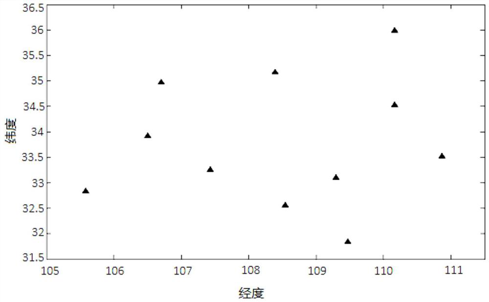
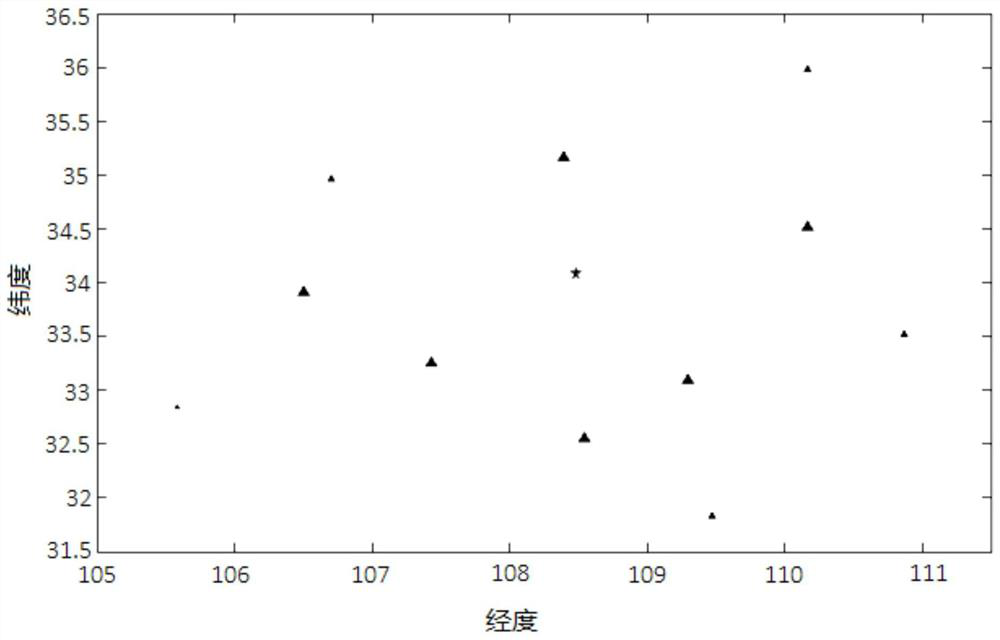
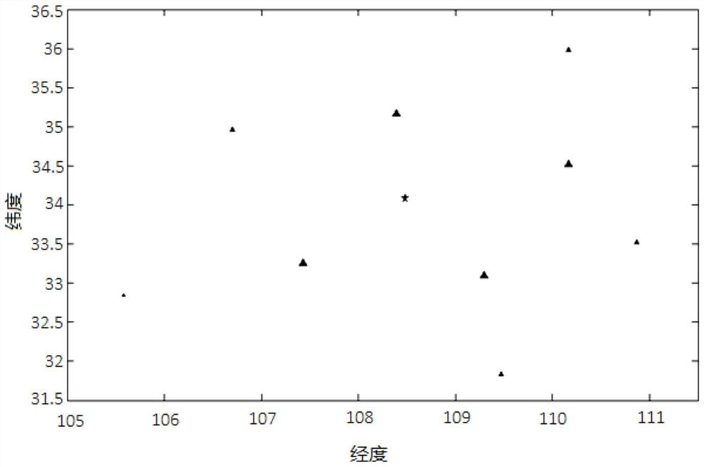
[0036] The layout of the seismic network in a certain area is as follows: figure 1 As shown, the seismic network includes 11 seismic stations, the latitude and longitude coordinates of each seismic station, the distance between each seismic station and the epicenter location, and the P wave signal detection probability of each seismic station for an example earthquake of magnitude 2.5 at the epicenter: Table 1 shows.

[0037] Table 1

[0038]

[0039]

[0040] Using the monitoring capability evaluation method of seismic stations, it has been determined that the detection probability of earthquake P-wave signal with magnitude M=2.5 at the position coordinates of each seismic station is 34.08 (latitude) and 108.48 (longitude), as shown in column 5 in Table 1. Take the variance σ of the traveltime model errors of all seismic stations T ...


PUM


Abstract

The invention relates to the field of seismic detection, in particular to a seismic network positioning capability assessment method, and aims to solve the problem that the existing method is difficult to fully assess the seismic network positioning capability based on actual observation data. According to the method, seismic stations participating in seismic positioning with the magnitude of M at a certain position are selected according to the seismic signal detection probability of the seismic stations, then a horizontal position positioning error covariance matrix of a seismic source is determined, the semi-major axis a and the semi-minor axis b of a current positioning coverage ellipse are calculated, the area of the current positioning coverage ellipse is obtained, and through multiple times of repetition, and finally, the seismic network positioning capability is evaluated. According to the method, the positioning capability of the seismic network on the earthquake at any position can be fully evaluated, and the earthquake with the earthquake magnitude of M does not need to actually occur at the position.

Description

technical field [0001] The invention relates to the field of seismic detection, in particular to a positioning capability evaluation method of a seismic network. Background technique [0002] The real position of the seismic network is The source location result of an earthquake is in and represents the true horizontal position of the source, Represents the true depth of the seismic source. Under the 1-α confidence level, the distribution of the horizontal position positioning error of the seismic source satisfies: [0003] [0004] Among them, χ α 2 (2) means χ with 2 degrees of freedom 2 upper alpha quantile of the distribution, C m is the positioning error covariance matrix, and its specific element values ​​are determined by the partial derivative of the seismic phase travel time from the source position to each seismic station participating in the positioning with respect to the source position and the residual error of the observed data at that time. T...

Claims


Application Information

Patent Timeline
Patent Type & Authority Applications(China)
IPC IPC(8): G01V13/00
CPCG01V13/00
Inventor 王红春徐雄靳平薛方正卢娜
Owner NORTHWEST INST OF NUCLEAR TECH
Why Eureka
Try Eureka