Multi-source data-based urban three-student space identification and pattern analysis method
A technology of spatial recognition and multi-source data, applied in the field of geographic information science, can solve problems such as low data fineness, single data source, and greater influence of subjective factors, and achieve high reliability, accurate and fast recognition
- Summary
- Abstract
- Description
- Claims
- Application Information
AI Technical Summary
Problems solved by technology
Method used
Image
Examples
Embodiment Construction
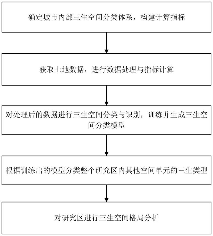
[0040] Such as figure 1 It is a schematic flow chart of the method of the present invention: the multi-source data-based urban three-life space identification and pattern analysis method provided by the present invention includes the following steps:
[0041] S1. Determine the three-life space classification system within the city, and construct calculation indicators;
[0042] S2. Obtain land multi-source data, perform data processing and index calculation;
[0043] S3. Classify and identify the three-life space on the processed data, train and generate the three-life space classification model;
[0044] S4. Classify the three types of life in other spatial units in the entire research area according to the trained model;
[0045] S5. Analyze the spatial pattern of the three life forms in the study area.
[0046] The step S1 is specifically to classify multi-source data to obtain the classification and calculation indicators and calculation methods of life, production and ...
PUM
 Abstract
Description
Claims
Application Information
 - R&D
- Intellectual Property
- Life Sciences
- Materials
- Tech Scout
- Unparalleled Data Quality
- Higher Quality Content
- 60% Fewer Hallucinations
Browse by: Latest US Patents, China's latest patents, Technical Efficacy Thesaurus, Application Domain, Technology Topic, Popular Technical Reports.
© 2025 PatSnap. All rights reserved.Legal|Privacy policy|Modern Slavery Act Transparency Statement|Sitemap|About US| Contact US: help@patsnap.com


