Map updating method and equipment
A map update and equipment technology, applied in the field of wireless communication, can solve the problems of inability to reflect road status and related changes in real time, long update cycle, etc., and achieve the effect of short data collection cycle, short update cycle and cost reduction.
- Summary
- Abstract
- Description
- Claims
- Application Information
AI Technical Summary
Problems solved by technology
Method used
Image

Examples
Embodiment Construction
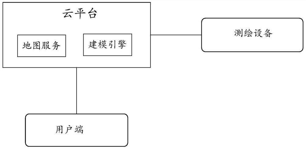
[0112] In order to make the purpose, technical solutions and advantages of the embodiments of the present invention more clear, the following will clearly and completely describe the technical solutions of the embodiments of the present invention in conjunction with the drawings of the embodiments of the present invention. Apparently, the described embodiments are some, not all, embodiments of the present invention. All other embodiments obtained by those skilled in the art based on the described embodiments of the present invention belong to the protection scope of the present invention.
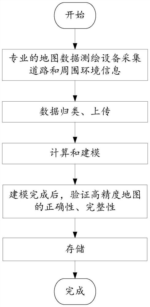
[0113] see figure 2 , the traditional high-precision map modeling process is as follows:
[0114] 1. Professional map data surveying and mapping equipment collects road and surrounding environment information through radar, camera, and positioning equipment. The professional map data surveying and mapping equipment can be in the form of vehicles, drones, etc. The map data surveying and ma...
PUM
 Abstract
Description
Claims
Application Information
 - R&D
- Intellectual Property
- Life Sciences
- Materials
- Tech Scout
- Unparalleled Data Quality
- Higher Quality Content
- 60% Fewer Hallucinations
Browse by: Latest US Patents, China's latest patents, Technical Efficacy Thesaurus, Application Domain, Technology Topic, Popular Technical Reports.
© 2025 PatSnap. All rights reserved.Legal|Privacy policy|Modern Slavery Act Transparency Statement|Sitemap|About US| Contact US: help@patsnap.com