Road data processing method and device, electronic equipment and medium
A road data and processing method technology, applied in the field of devices, electronic equipment and media, and road data processing methods, can solve problems such as lack of road names
- Summary
- Abstract
- Description
- Claims
- Application Information
AI Technical Summary
Problems solved by technology
Method used
Image
Examples
no. 1 example
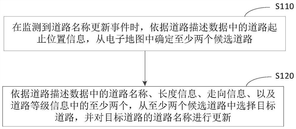
[0050] figure 1It is a flow chart of a road data processing method provided according to the first embodiment of the present application, and this embodiment is applicable to how to process road data. The method can be executed by a road data processing device, which can be implemented in the form of software and / or hardware, and can be integrated into a computing device carrying road data processing functions. like figure 1 As shown, the road data processing method provided in this embodiment may include:
[0051] S110. When a road name update event is detected, determine at least two candidate roads from the electronic map according to the road start and end position information in the road description data.
[0052] In this embodiment, road description data refers to data used to describe roads. Optionally, the road described by each road description data uniquely corresponds to one road in the actual scene. Further, each road description data may include but not limite...
no. 2 example
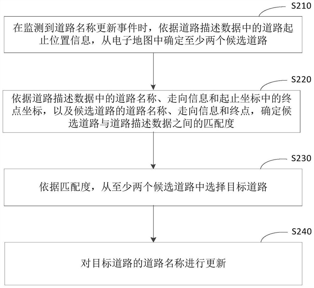
[0068] figure 2 It is a flow chart of a road data processing method provided according to the second embodiment of the present application. This embodiment provides an optional solution for determining a target road on the basis of the above embodiments. like figure 2 As shown, the road data processing method provided in this embodiment may include:
[0069] S210. When a road name update event is detected, determine at least two candidate roads from the electronic map according to the road start and end position information in the road description data.
[0070] S220. Determine the matching degree between the candidate road and the road description data according to the road name, direction information, and end point coordinates in the start and end coordinates in the road description data, as well as the road name, direction information, and end point of the candidate road.
[0071] In this embodiment, the start and end coordinates can be determined according to the start...
no. 3 example
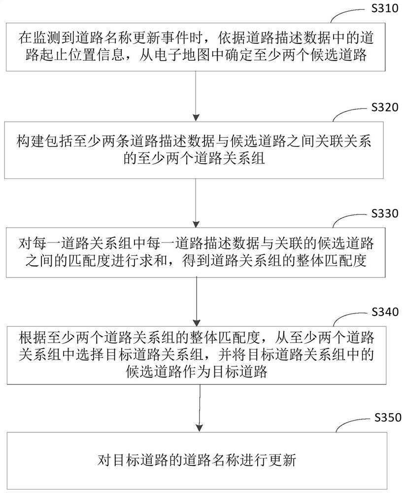
[0083] image 3 It is a flow chart of a road data processing method according to the third embodiment of the present application. This embodiment provides an optional solution for determining a target road on the basis of the above embodiments. like image 3 As shown, the road data processing method provided in this embodiment may include:
[0084] S310. When a road name update event is detected, determine at least two candidate roads from the electronic map according to the road start and end position information in the road description data.
[0085] S320. Construct at least two road relationship groups including at least two association relationships between road description data and candidate roads.
[0086] Since there may be two or more roads with relatively close starting points and very similar direction information, length information, and road grade information in the electronic map, the road name of each road in this case is described based on multiple road descri...
PUM
 Abstract
Description
Claims
Application Information
 - Generate Ideas
- Intellectual Property
- Life Sciences
- Materials
- Tech Scout
- Unparalleled Data Quality
- Higher Quality Content
- 60% Fewer Hallucinations
Browse by: Latest US Patents, China's latest patents, Technical Efficacy Thesaurus, Application Domain, Technology Topic, Popular Technical Reports.
© 2025 PatSnap. All rights reserved.Legal|Privacy policy|Modern Slavery Act Transparency Statement|Sitemap|About US| Contact US: help@patsnap.com


