Vector information assisted remote sensing image road information automatic extraction method

A remote sensing image and road information technology, applied in image enhancement, image analysis, image data processing, etc., can solve the problems of low degree of automation and high degree of manual intervention

Active Publication Date: 2021-02-23
自然资源部国土卫星遥感应用中心
View PDF9 Cites 7 Cited by
  • Summary
  • Abstract
  • Description
  • Claims
  • Application Information

AI Technical Summary

Problems solved by technology

However, the degree of automation in this way is still very low and the degree of human intervention is high

Method used


Image

  • Vector information assisted remote sensing image road information automatic extraction method
  • Vector information assisted remote sensing image road information automatic extraction method
  • Vector information assisted remote sensing image road information automatic extraction method

Examples


Embodiment 1

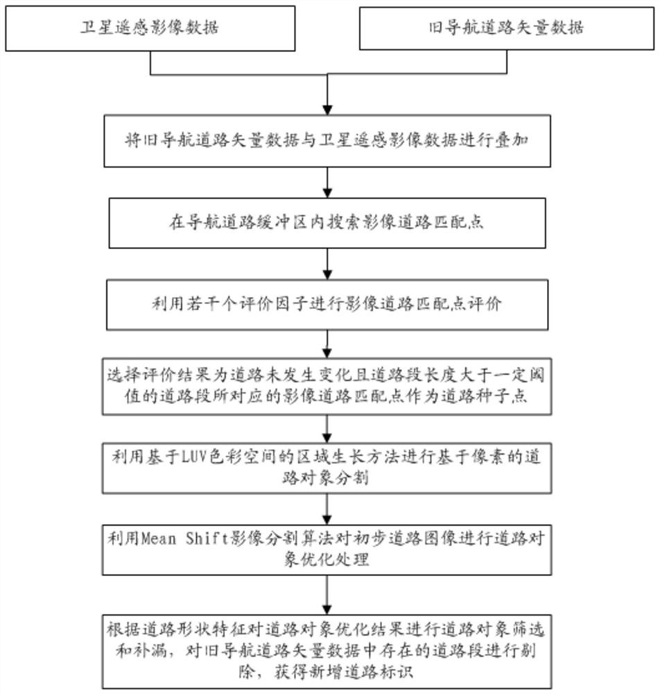
[0071] Embodiment 1, a method for automatically extracting road information from remote sensing images assisted by vector information, such as figure 1 shown, including the following steps:

[0072] S1) Obtaining satellite remote sensing image data and old navigation road vector data, superimposing the old navigation road vector data and satellite remote sensing image data to obtain a vector superimposed image, the vector superimposed image including the old navigation road vector and navigation road nodes;

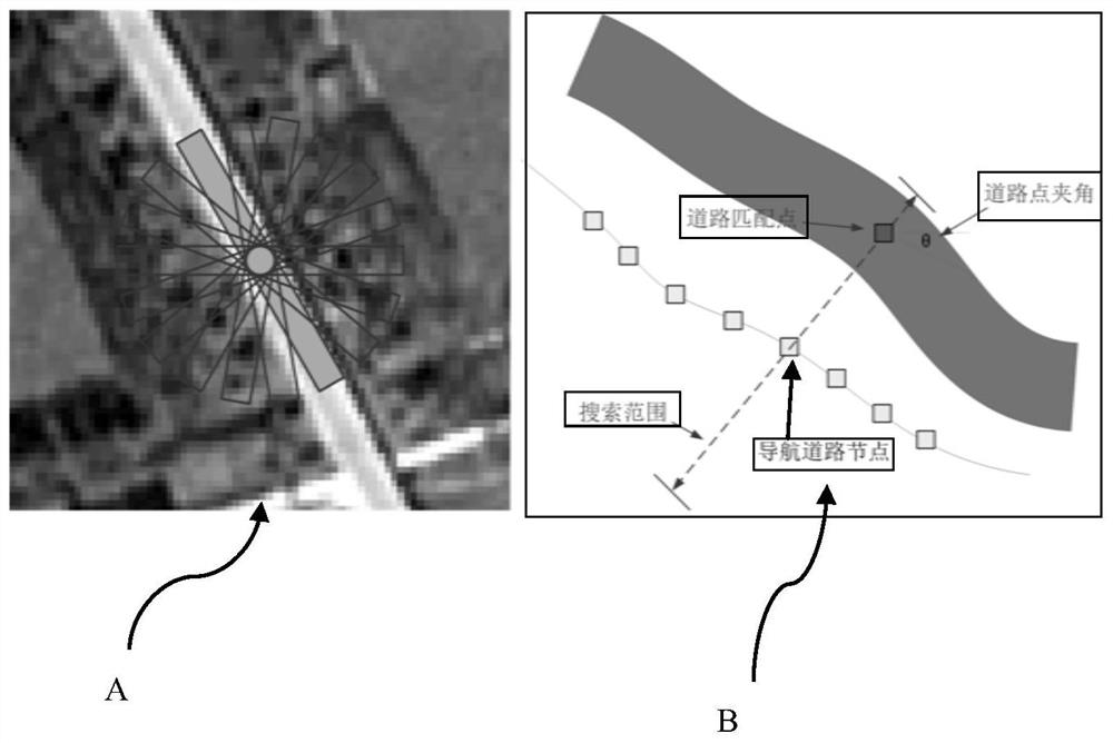
[0073] S3) take the old navigation road vector as the center line, generate a navigation road buffer within a preset range to both sides of the center line, and search for image road matching points in the navigation road buffer, including the following steps:

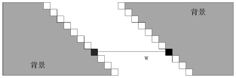
[0074] S31) Utilize anti-parallel midline extraction algorithm to obtain the width of all roads, road edge points and road center points in the vector superimposed image, including the following steps:

[0075] S...


PUM


Abstract

The invention relates to the field of remote sensing image road extraction, and discloses a vector information assisted remote sensing image road information automatic extraction method, which comprises the steps of obtaining satellite remote sensing image data and old navigation road vector data, and superposing the old navigation road vector data and the satellite remote sensing image data; taking the old navigation road vector as a center line, generating navigation road buffer areas in a preset range towards two sides of the center line, and searching image road matching points in the navigation road buffer areas; evaluating the image road matching points by utilizing the evaluation factors; performing pixel-based road object segmentation by using an LUV color space-based region growing method; and performing road object optimization processing by using a Mean Shift image segmentation algorithm to obtain a road object optimization result. According to the invention, road current situation detection is realized, automatic extraction of a changed road or a newly added road under less manual intervention is realized, and the bottleneck problems of long period, low speed, poor appearance and the like of the road in the updating process are solved.

Description

technical field [0001] The invention relates to the field of remote sensing image road extraction, in particular to an automatic extraction method of remote sensing image road information assisted by vector information. Background technique [0002] Road data is an important part of basic geographic data. Navigation electronic maps supported by road data have been more and more widely used in vehicle-mounted moving target monitoring, management and service systems, and have penetrated into the daily lives of ordinary people. At present, the road data update method belongs to the version-based update production, that is, data production based on all elements, regardless of whether the road changes or not, it participates in the collection and editing, and the final data is submitted at one time, which is easy to cause duplication of work and makes the data production task become Heavy and long update cycle. Although today's navigation electronic map manufacturers generally u...

Claims


Application Information

Patent Timeline
IPC IPC(8): G06T7/11G06T7/13G06T7/136G06T7/187G06T5/00
CPCG06T7/13G06T7/136G06T7/11G06T7/187G06T2207/10032G06T5/70
Inventor 王光辉刘慧杰刘宇张涛王更张伟郑利娟魏海
Owner 自然资源部国土卫星遥感应用中心
Why Eureka
Try Eureka