A vector information-assisted automatic extraction method of remote sensing image road information
A remote sensing image and road information technology, applied in image analysis, image enhancement, image data processing, etc., can solve the problems of low degree of automation and high degree of manual intervention, and achieve the effect of long solution period
- Summary
- Abstract
- Description
- Claims
- Application Information
AI Technical Summary
Problems solved by technology
Method used
Image
Examples
Embodiment 1
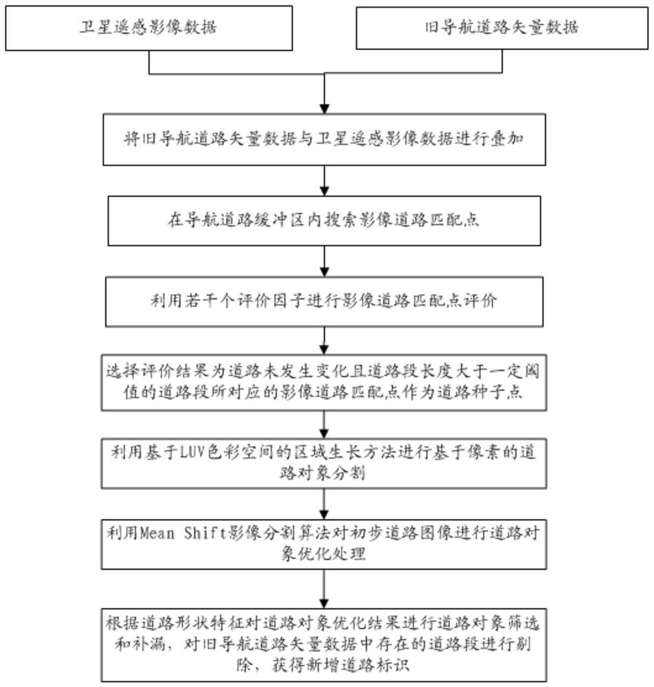
[0071]Embodiment 1, a vector information assisted remote sensing image road information automatic extraction method, such asfigure 1 As shown, including the following steps:
[0072]S1) Get the satellite remote sensing image data and the old navigation road vector data, superimpose the old navigation road vector data with satellite remote sensing image data, and the vector superimposed image, the vector superimposed image includes the old navigation road vector and the navigation road node;
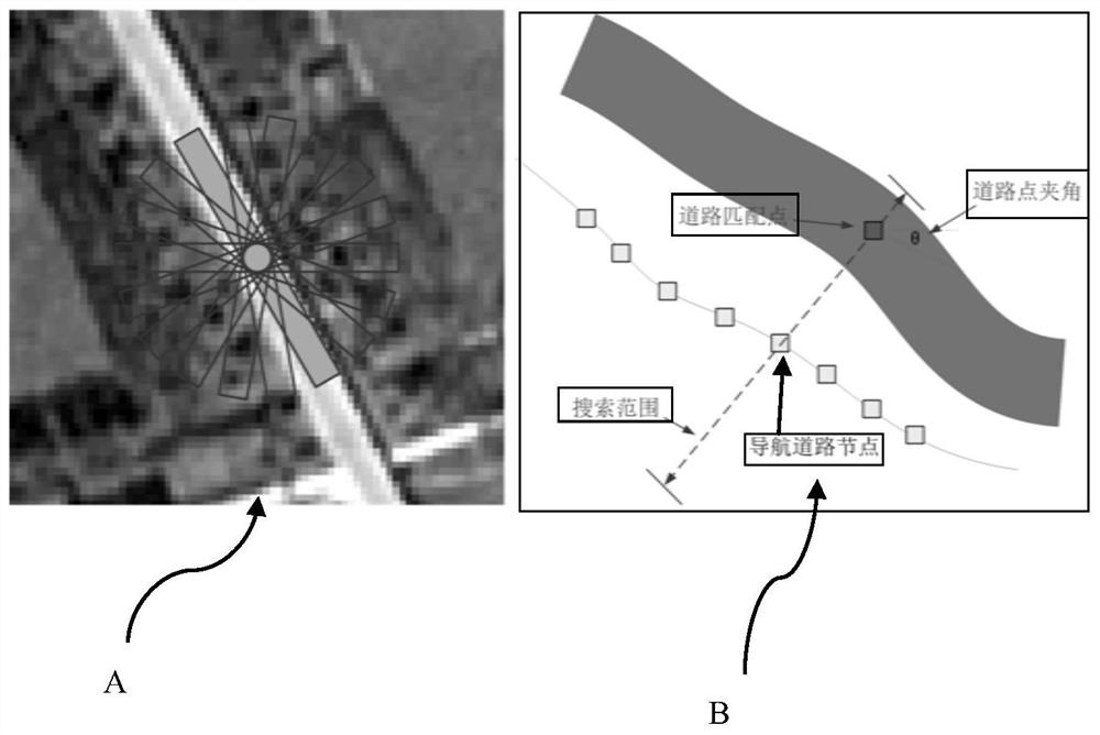
[0073]S3) The navigation road buffer within the preset range is generated in both sides of the old navigation road vector, and search for image road matching points in the navigation road buffer, including the following steps:
[0074]S31) Using the anti-parallel midline extraction algorithm to obtain the width, road edge points, and the center point position of the road point of the road in the vector superimposed image, including the following steps:
[0075]S311) The grayscale image obtained from the tw...
PUM
 Abstract
Description
Claims
Application Information
 - R&D Engineer
- R&D Manager
- IP Professional
- Industry Leading Data Capabilities
- Powerful AI technology
- Patent DNA Extraction
Browse by: Latest US Patents, China's latest patents, Technical Efficacy Thesaurus, Application Domain, Technology Topic, Popular Technical Reports.
© 2024 PatSnap. All rights reserved.Legal|Privacy policy|Modern Slavery Act Transparency Statement|Sitemap|About US| Contact US: help@patsnap.com


