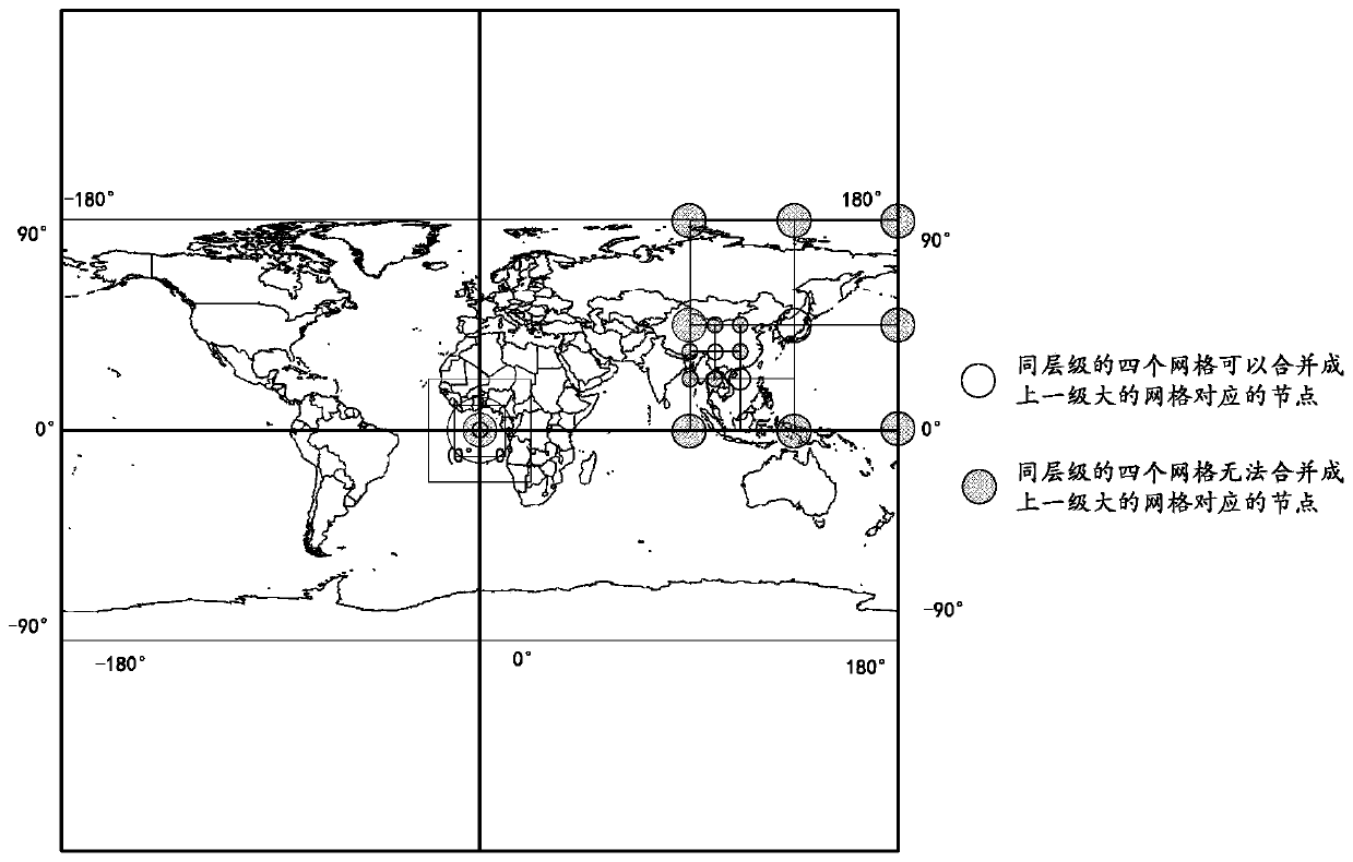
Non-rigid grid coding method and device, spatial object unique identification method and device and query method and device
A technology of spatial objects and coding methods, which is applied in the field of data processing, can solve problems that cannot fully satisfy the organization and management of spatial data, and achieve the effects of improving query efficiency and query accuracy, strong correlation, and good spatial computing capabilities
- Summary
- Abstract
- Description
- Claims
- Application Information
AI Technical Summary
Problems solved by technology
Method used
Image
Examples
Embodiment 1
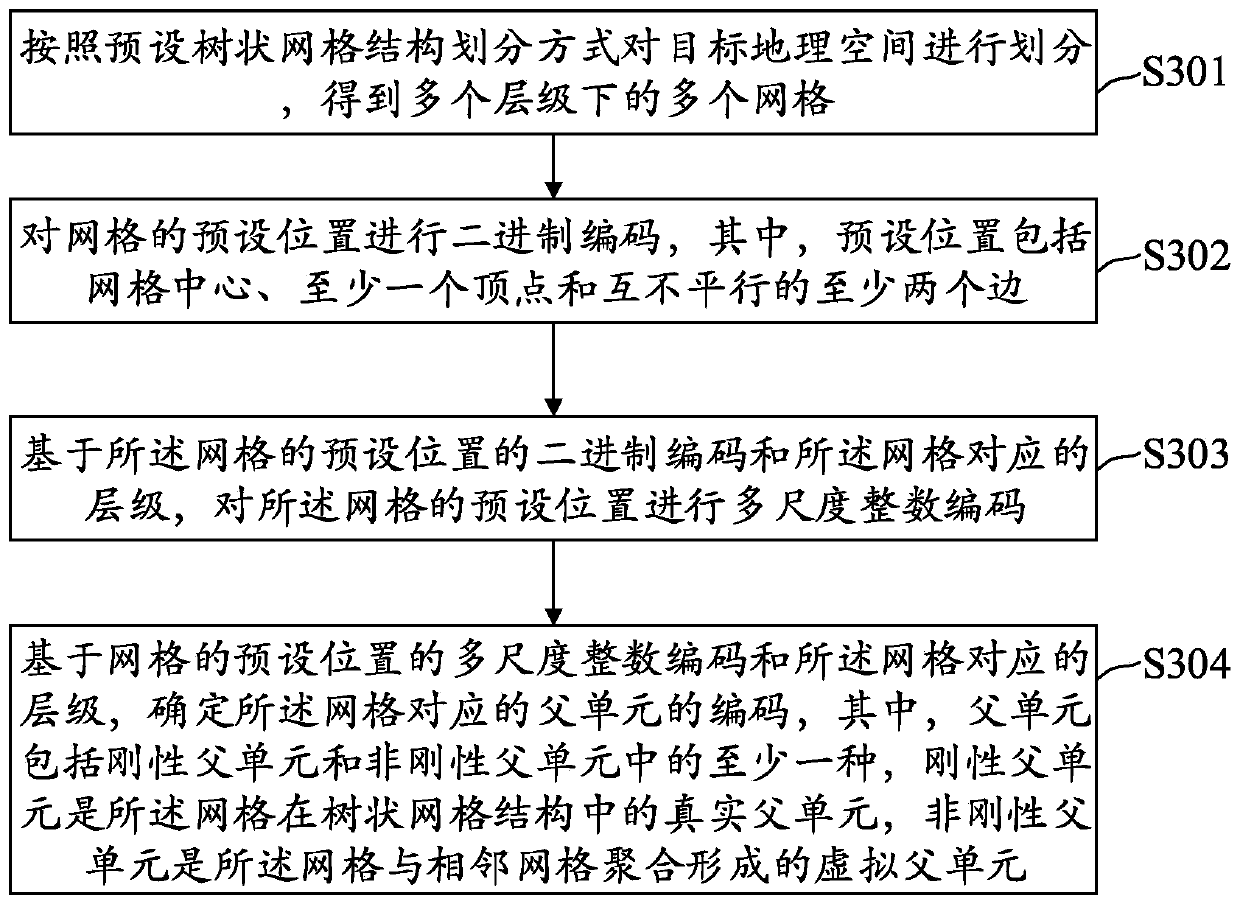
[0080] Such as image 3 As shown, a non-rigid spatial grid coding method provided by the embodiment of this specification may include:
[0081] Step 301: Divide the target geographical space according to the preset tree grid structure division method to obtain multiple grids at multiple levels.
[0082] Among them, the scales of grids at different levels are different. When performing tree grid division, the maximum number of levels can be determined according to the actual situation. For example, the maximum number of levels can be determined to be 30. Assume that N is used to represent the level. At this time, the value of N is an integer between [0, 30].
[0083] In this embodiment, the preset tree-like grid structure may include but not limited to one of a triangular tree-like grid structure, a quadrilateral tree-like grid structure and a hexagonal tree-like grid structure, wherein the triangular tree-like grid structure The grid structure includes but not limited to qua...
Embodiment 2
[0216] On the basis of Embodiment 1, the embodiment of this application also provides a method for uniquely identifying a spatial object, such as Figure 10 As shown, the method may include the following steps:
[0217] Step 1001. Determine the smallest enclosing rectangle of the spatial object in the target geographic space, wherein the target geographic space is divided into multiple grids at multiple levels according to a preset tree-like grid structure division method.
[0218] As described in the previous embodiment, the target geographic space can be any two-dimensional geographic space to be managed, and the target geographic space can be represented by an electronic map of the geographic space. Geospatial electronic maps are meshed. The spatial objects in the target geographic space can be objects such as buildings, schools, hospitals, vehicles, roads, and cameras included in the electronic map, or they can be related data collected from the target geographic space, s...
Embodiment 3
[0272] Generally speaking, there are four main spatial relationships between the spatial object and the region to be queried: separation, intersection, the query region contains the object, and the object contains the query region. Therefore, the identification method of the above-mentioned spatial object adopts virtual grid + real grid for identification, which will make the identification grid of the spatial object and the grid of the area to be queried (query grid for short) have four kinds of spatial relationships (such as Figure 13 shown): the identification grid intersects with the query grid, the identification grid is separated from the query grid, the identification grid is the parent unit of the query grid, and the identification grid is the query grid or its child units.
[0273] However, in the traditional grid query method, the identification grid of the spatial object and the query grid are only included or included, and the grids are seamless and non-overlapping...
PUM
 Abstract
Description
Claims
Application Information
 - R&D
- Intellectual Property
- Life Sciences
- Materials
- Tech Scout
- Unparalleled Data Quality
- Higher Quality Content
- 60% Fewer Hallucinations
Browse by: Latest US Patents, China's latest patents, Technical Efficacy Thesaurus, Application Domain, Technology Topic, Popular Technical Reports.
© 2025 PatSnap. All rights reserved.Legal|Privacy policy|Modern Slavery Act Transparency Statement|Sitemap|About US| Contact US: help@patsnap.com


