Laser SLAM adaptive resolution raster map construction method

A construction method and grid map technology, which can be used in the re-radiation of electromagnetic waves, the use of re-radiation, measurement devices, etc., and can solve problems such as the same resolution

Active Publication Date: 2020-07-07
TIANJIN UNIV
View PDF6 Cites 8 Cited by
  • Summary
  • Abstract
  • Description
  • Claims
  • Application Information

AI Technical Summary

Problems solved by technology

[0007] The purpose of the present invention is to solve the above-mentioned problems caused by the same resolution of the grid map, and propose a laser SLAM adaptive resolution grid map construction method, which can make the accuracy of some areas of the map higher and occupy less resources as a whole , and can be better used in large-scale scenes

Method used


Image

  • Laser SLAM adaptive resolution raster map construction method
  • Laser SLAM adaptive resolution raster map construction method
  • Laser SLAM adaptive resolution raster map construction method

Examples


Embodiment Construction

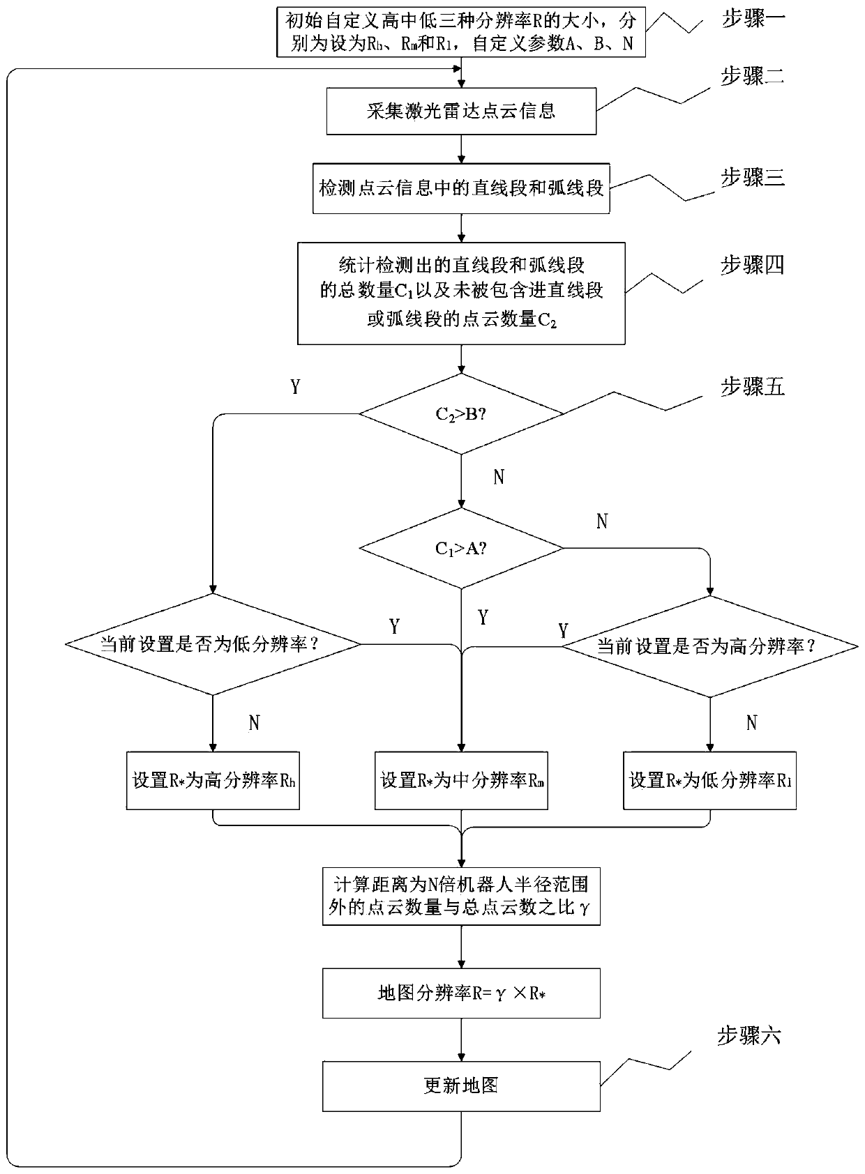
[0034] Embodiment of the present invention is described in detail below in conjunction with accompanying drawing and embodiment, but the present invention is not limited to following embodiment, any researcher who is familiar with this technical field is within the disclosed scope of patent of the present invention, without departing from this invention Various changes made under the premise of the purpose of the invention all belong to the protection scope of the patent of the invention.

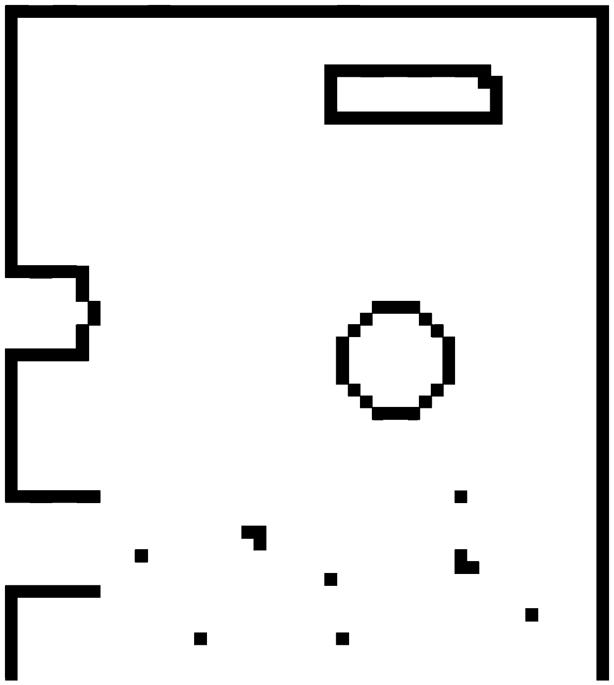
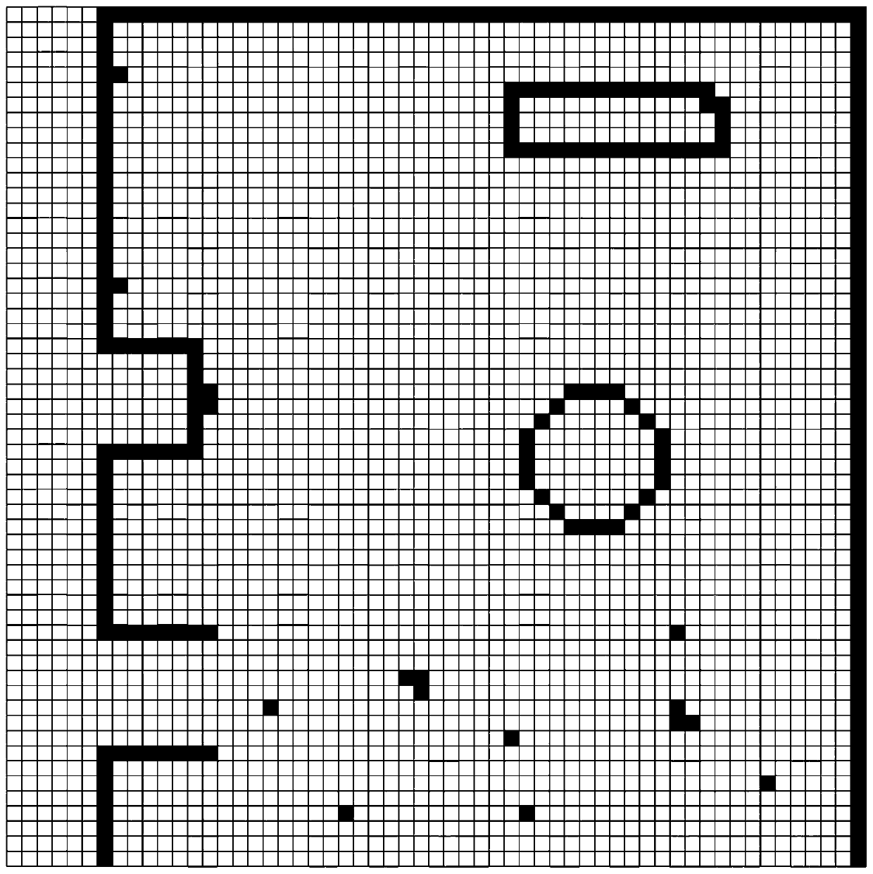
[0035] To create a map in a large-scale environment, the map of most scenes does not need a high resolution, otherwise it will waste storage space and computing resources. To construct a map in a scene with many obstacles (such as tables and chairs in the office), you need Higher resolution, otherwise some smaller objects will be missed. The present invention proposes a solution to the above problems, and constructs a grid map whose resolution is determined by the distribution of objects in...


PUM


Abstract

The invention discloses a laser SLAM adaptive resolution raster map construction method, and the method comprises the following steps: initially customizing the sizes of high, medium and low resolutions, respectively setting the three resolutions as Rh, Rm and R1, and customizing parameters A, B and N; collecting laser radar point cloud information; detecting a straight line segment and an arc line segment in the point cloud information; counting the total number C1 of the detected straight line segments and arc line segments and the number C2 of point clouds which are not included in the straight line segments and arc line segments; automatically setting a map resolution R* according to the values of C1 and C2, and adjusting according to the point cloud distance information to obtain themap resolution R; and updating maps. According to the method, the precision of partial regions of the map can be higher, the occupied resources are few, and the method can be better used in a large-scale scene.

Description

technical field [0001] The invention belongs to the technical field of automatic control and robot navigation, and more specifically relates to a laser SLAM self-adaptive resolution grid map construction method. Background technique [0002] A robot is a multidisciplinary integration of machinery, electronic information, communication, computer, and artificial intelligence. It is an automated device that can perform specific tasks or have certain functions (such as decision-making ability, perception ability, and movement ability). Autonomous mobile robots have the capabilities of environment detection, positioning and navigation, path planning, and autonomous movement, and can perform complex tasks in unknown terrain. Obtaining accurate position and attitude (pose) information through accurate perception of the surrounding environment is a prerequisite for realizing complex functions. The robot perceives its own state and surrounding environment information through its own...

Claims


Application Information

Patent Timeline
Patent Type & Authority Applications(China)
IPC IPC(8): G01S17/89
CPCG01S17/89Y02A90/10
Inventor 孟庆浩李鸿彬靳荔成
Owner TIANJIN UNIV
Why Eureka
Try Eureka