Tree detection method employing unmanned aerial vehicle for shooting
A detection method and technology of unmanned aerial vehicle, applied in the direction of measurement device, optical device, instrument, etc., can solve the problems of endangering the personal safety of staff, inaccurate measurement data, influence of the use of infrared rangefinder, etc., and achieve the improvement of terrain restrictions. , the effect of reducing security risks
- Summary
- Abstract
- Description
- Claims
- Application Information
AI Technical Summary
Problems solved by technology
Method used
Image
Examples
Embodiment 1
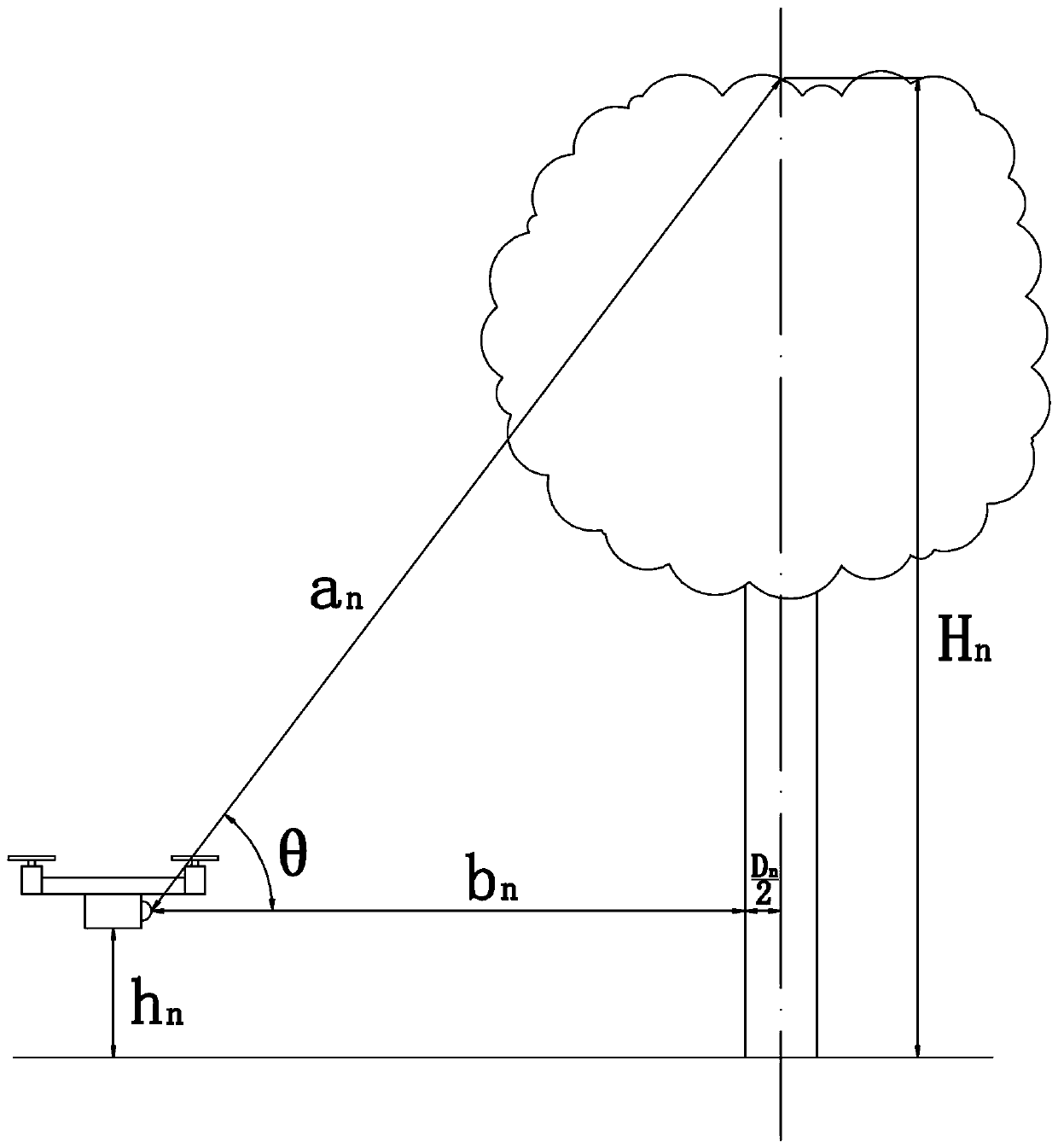
[0025] see figure 1 As shown, in the present embodiment, the tree detection method that applies unmanned aerial vehicle photographing, comprises the following steps:
[0026] a. Use the drone to fly to the periphery of the target tree.
[0027] b. Keep the current altitude of the drone at h n , while measuring the straight-line distance a between the UAV and the tree top of the target tree using infrared ranging equipment n And record the elevation angle θ between the UAV and the top of the target tree n , in this embodiment, the angle of the infrared range-finding device of the UAV is adjustable and its adjustment angle can be controlled by remote control so that the infrared range-finding device can aim at the treetop of the target tree, and the adjustment angle of the infrared range-finding device can be recorded at the same time Obtain the elevation angle θ n value.
[0028] c. Take a photo of the target tree to obtain the original image.
[0029] d. Move the positio...
Embodiment 2
[0038] see figure 1 As shown, in the present embodiment, the tree detection method that applies unmanned aerial vehicle photographing, comprises the following steps:
[0039] a. Use the drone to fly to the periphery of the target tree.
[0040] b. Keep the current altitude of the drone at h n , in this example h n It is equal to the breast height of the target tree (that is, 1.3m), and at the same time, use infrared ranging equipment to measure the straight-line distance between the UAV and the top of the target tree a n , the current horizontal distance b between the UAV and the target tree n And record the elevation angle θ between the UAV and the top of the target tree n . In this embodiment, the angle of the infrared range-finding device of the drone is adjustable, and its adjustment angle can be remotely controlled so that the infrared range-finding device can aim at the top of the target tree, and at the same time, the adjustment angle of the infrared range-finding ...
PUM
 Abstract
Description
Claims
Application Information
 - Generate Ideas
- Intellectual Property
- Life Sciences
- Materials
- Tech Scout
- Unparalleled Data Quality
- Higher Quality Content
- 60% Fewer Hallucinations
Browse by: Latest US Patents, China's latest patents, Technical Efficacy Thesaurus, Application Domain, Technology Topic, Popular Technical Reports.
© 2025 PatSnap. All rights reserved.Legal|Privacy policy|Modern Slavery Act Transparency Statement|Sitemap|About US| Contact US: help@patsnap.com

