
Survey management and data intelligent analysis system and method based on GIS

A technology of intelligent analysis and data, applied in the field of survey and design, can solve problems such as inability to fully reflect the knowledge value of engineering data, lack of systematization, and low work efficiency, and achieve the effects of saving manpower and material resources, improving work efficiency, and saving resources

Active Publication Date: 2020-02-18
SHANDONG ELECTRIC POWER ENG CONSULTING INST CORP
View PDF12 Cites 8 Cited by
  • Summary
  • Abstract
  • Description
  • Claims
  • Application Information

AI Technical Summary

Problems solved by technology

[0004]1. The early stage of the project is generally completed by visiting the site and collecting data. How to collect the early data efficiently and accurately is very important. The personal work experience, work ability and cognitive influence of personnel, the subjectivity of on-site surveys are quite different, and the degree of data collection is uneven.
[0005]2. The amount of survey data is large and the classification and storage are complex, and the retrieval and query of data is mainly manual, which is not systematic and inefficient
Taking Shandong Electric Power Engineering Consulting Institute as an example, since the establishment of Shandong Electric Power Engineering Consulting Institute, it has completed nearly 3,000 various construction projects and more than 20,000 various drilling holes, but most of the engineering survey results (before 2006) are based on paper. High-quality documents are stored in the archives, and the retrieval and query of materials all rely on manual file checking, and the work efficiency is very low
[0006]3. The traditional management methods are powerless for more and more data, and cannot fully reflect the knowledge value of engineering data, especially for the synthesis of large-scale areas The integrated analysis of survey information is even more difficult to obtain
[0007]4. The utilization rate of the existing geological survey-related data is low, the professional barriers are relatively large, the forms are scattered, and there is no unified classification and storage method. Engineering design and survey provide little guidance and reference value, and the advantages of big data have not yet been explored, and cannot provide a strong and reliable basis for regional geological characteristics and empirical formulas

Method used


Image

  • Survey management and data intelligent analysis system and method based on GIS
  • Survey management and data intelligent analysis system and method based on GIS
  • Survey management and data intelligent analysis system and method based on GIS

Examples


Embodiment Construction

[0052] It should be noted that the following detailed description is exemplary and intended to provide further explanation of the present disclosure. Unless defined otherwise, all technical and scientific terms used herein have the same meaning as commonly understood by one of ordinary skill in the art to which this disclosure belongs.

[0053]It should be noted that the terminology used herein is only for describing specific embodiments, and is not intended to limit the exemplary embodiments according to the present disclosure. As used herein, unless the context clearly dictates otherwise, the singular is intended to include the plural, and it should also be understood that when the terms "comprising" and / or "comprising" are used in this specification, they mean There are features, steps, operations, means, components and / or combinations thereof.

[0054] Implementation example one

[0055] This implementation example discloses a GIS-based survey management and data intelli...


PUM


Abstract

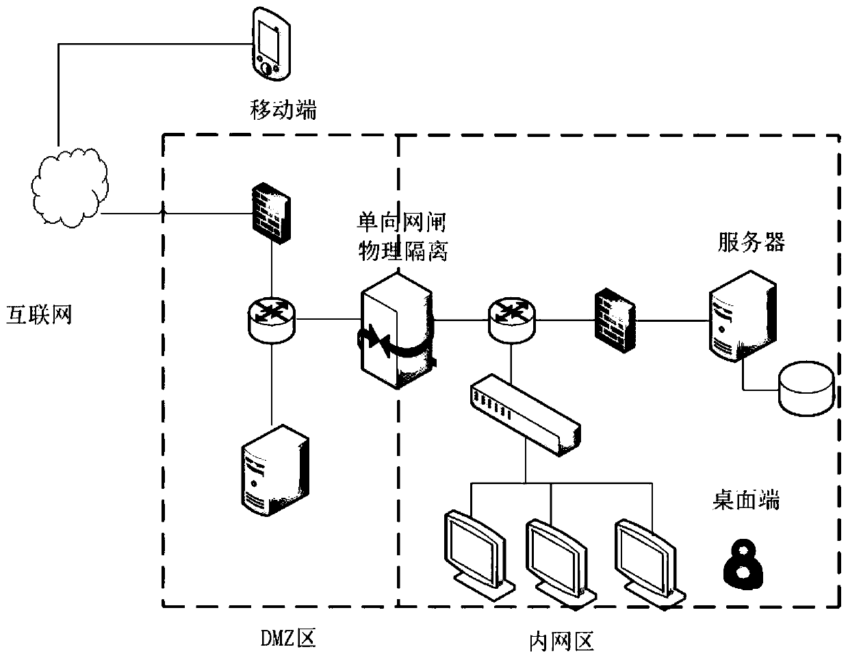
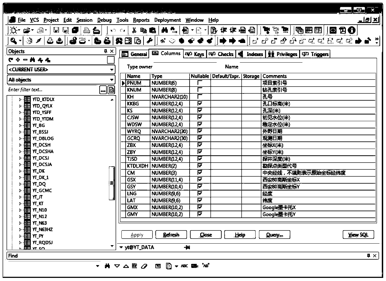
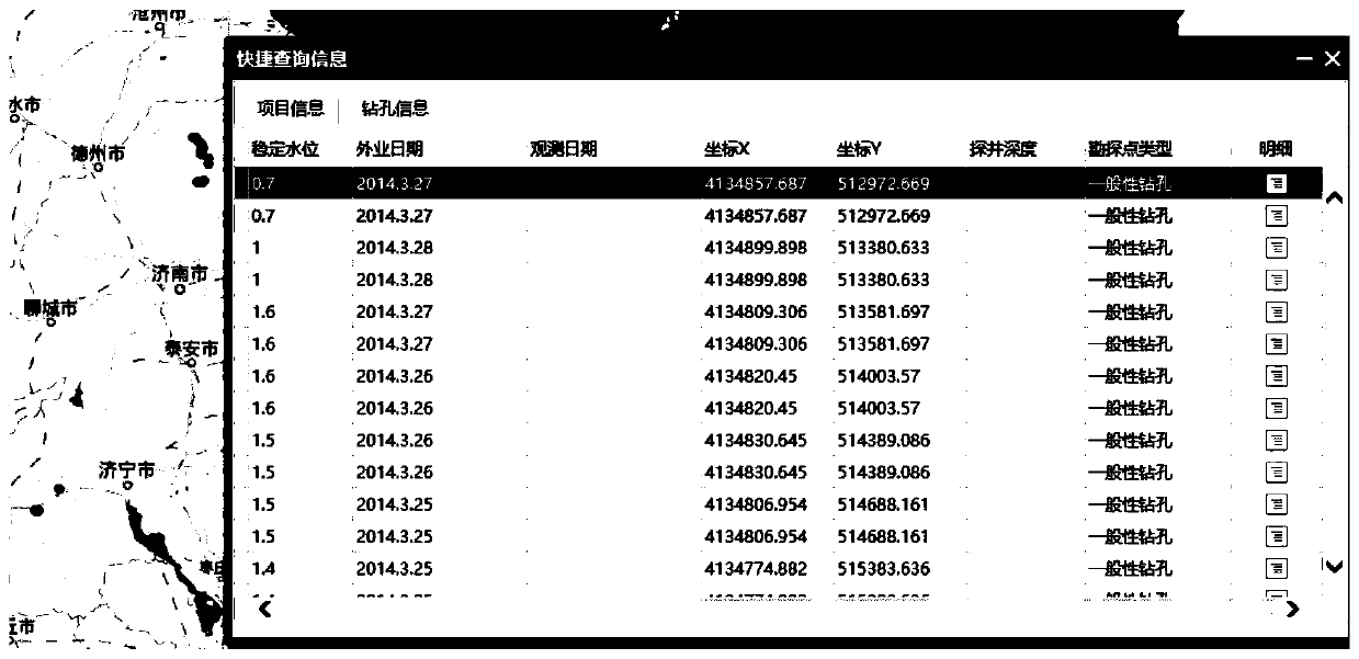
The invention provides a GIS-based survey management and data intelligent analysis system and method. The system comprises a data management end which imports the latest geotechnical engineering survey data into a database; the server communicates with the database, and the server enables the massive geological information to form a two-dimensional graph; wherein the data management end constructsa database, analyzes a data file format of geotechnical investigation data, realizes inspection and data import of the geotechnical investigation data, and imports the geotechnical investigation datainto the database in batches; and the Web desktop end is deployed on the server in a B / S mode, and inquires, retrieves and counts the geotechnical engineering investigation data stored in the serverin various forms through a browser. The latest engineering investigation data is imported into the system database regularly, so that normal updating of the data in the system is guaranteed, and all personnel can see the latest achievements in time conveniently.

Description

technical field [0001] The disclosure relates to the technical field of survey design, in particular to a GIS-based survey management and data intelligent analysis system and method. Background technique [0002] The GIS-based survey management and data intelligent analysis system uses GIS technology to establish an open and dynamic geological information platform on the basis of professionals collecting and organizing existing geotechnical engineering survey data inside and outside the province, sorting out existing survey data, and establishing a unified Geotechnical engineering survey database specification, gradually complete the database construction of previous geological survey results, realize the standardized design of spatial database, and complete data storage, query, and some basic analysis functions, process management, etc. on this basis. [0003] The current geological survey related data has the following technical problems in use: [0004] 1. The early stag...

Claims


Application Information

Patent Timeline
Patent Type & Authority Applications(China)
IPC IPC(8): G06F16/21G06F16/2458G06F16/25G06F16/29
CPCG06F16/2462G06F16/211G06F16/29G06F16/25
Inventor 王强恒孙旭刘浩王基文卢晓东杨庆义蔡伟于天文刘灿范沛军高鹏李仁杰张勇贾东亮任传健
Owner SHANDONG ELECTRIC POWER ENG CONSULTING INST CORP
Learn More