
A three-dimensional roughness description method of rock mass structural surface based on drilling camera technology

A technology of structural surface and roughness, applied in the field of three-dimensional roughness description of rock mass structural surface, can solve problems such as inaccuracy, and achieve the effect of ensuring authenticity and real and reliable sampling data

Active Publication Date: 2020-08-11
INST OF ROCK & SOIL MECHANICS CHINESE ACAD OF SCI
View PDF8 Cites 0 Cited by
  • Summary
  • Abstract
  • Description
  • Claims
  • Application Information

AI Technical Summary

Problems solved by technology

It can be seen from this that it is not accurate enough to use core data as the source of rock mass structural plane information. Therefore, it is necessary to propose an in-situ measurement technology to directly measure the structural plane on the borehole wall to obtain the Structural information

Method used


Image

  • A three-dimensional roughness description method of rock mass structural surface based on drilling camera technology
  • A three-dimensional roughness description method of rock mass structural surface based on drilling camera technology
  • A three-dimensional roughness description method of rock mass structural surface based on drilling camera technology

Examples


Embodiment 1

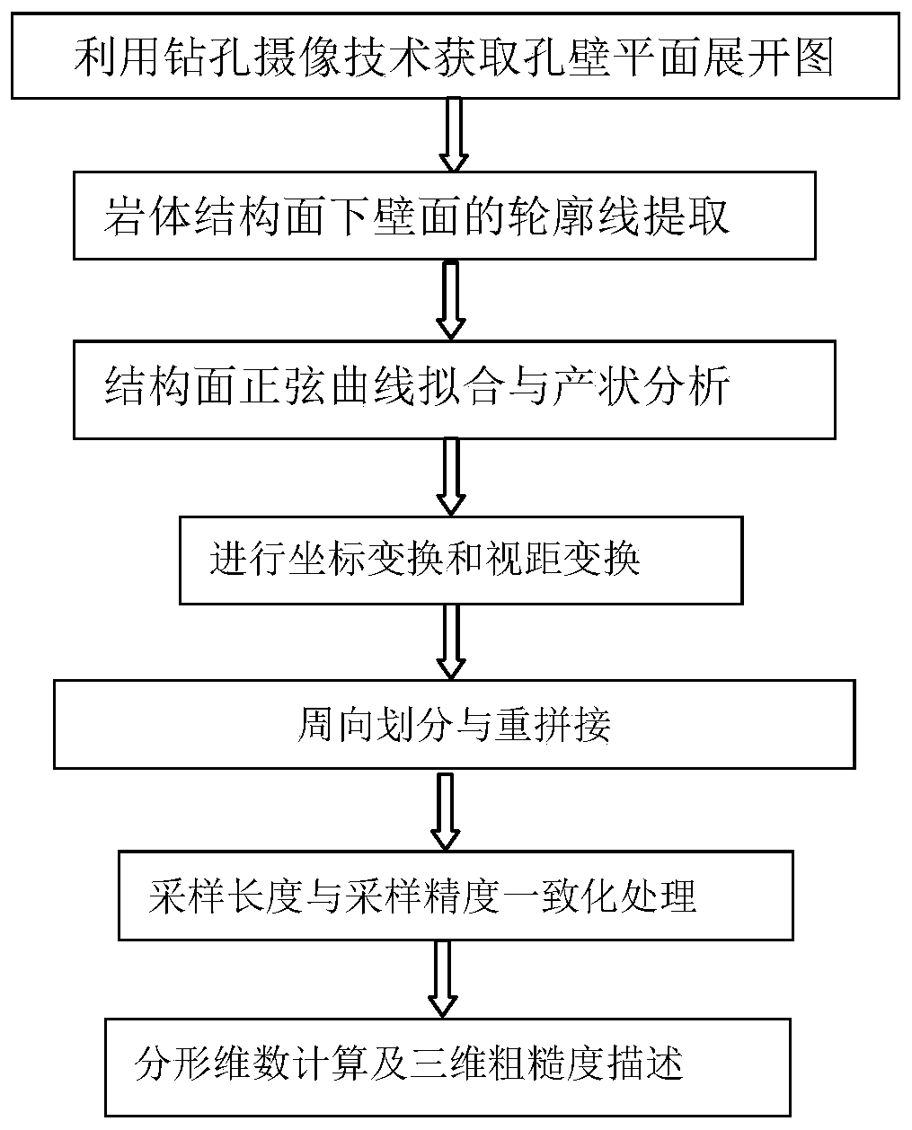
[0052] A method for describing the three-dimensional roughness of the rock mass structural surface based on the drilling camera technology. The specific steps are as follows on the premise that the drilling image has been obtained, and the actual measurement of the drilling image data is used as an example for detailed description.

[0053] A method for describing three-dimensional roughness of rock mass structural surface based on drilling camera technology, the steps are:

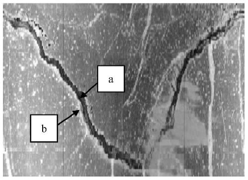
[0054] Step 1. Use a digital drilling camera system to obtain a panoramic view of the hole wall;

[0055] The digital drilling camera system is a new set of advanced and intelligent exploration equipment. The digital borehole camera system integrates electronic technology, video technology, digital technology and computer technology. It records and analyzes the hole wall without disturbance in situ from a panoramic angle. By directly studying the hole wall, the disturbing influence of core drilling is avoided, ...

Embodiment 2

[0118] In the following, general application situations are taken as an example to further illustrate the present invention.

[0119] A method for describing the three-dimensional roughness of rock mass structural surfaces based on drilling camera technology, including the following steps:

[0120] Step 1. Use a digital drilling camera system to obtain a panoramic view of the hole wall;


PUM


Abstract

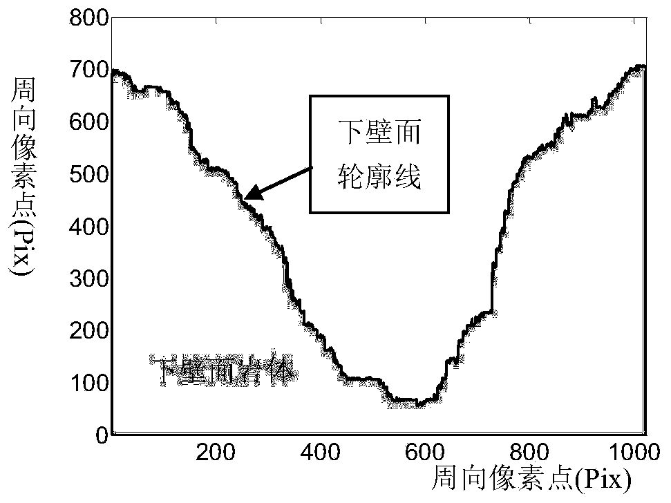
The invention discloses a three-dimensional roughness description method for a rock mass structural surface based on borehole camera technology. The method comprises the steps of obtaining a hole walldeveloped panoramic view; obtaining the contour line of the lower wall surface of the rock mass structural surface; fitting a structural surface fitted line, and obtaining the reference plane of thelower wall surface of the rock mass structural surface, and the inclination orientation and the inclination angle of the rock mass structural surface; acquiring a contour line developed curve; acquiring a spliced contour line; obtaining the reference contour line of the set sampling length and the set sampling precision; according to the fractal dimension of each reference contour line segment, forming a structural surface roughness coefficient rose diagram and describing the three-dimensional roughness of the rock mass structural surface based on the same. The method can well describe the three-dimensional roughness information of the rock mass structural surface, and solves the problem that the three-dimensional roughness information of a deep rock mass structural surface is difficult toobtain.

Description

Technical field [0001] The invention belongs to the technical field of rock mass engineering and image recognition, and specifically relates to a method for acquiring an image of a rock mass structure surface of a hole wall by using a drilling camera technology and describing the three-dimensional roughness of the rock mass structure surface. This method can describe the three-dimensional roughness information of the rock mass structural surface well, and solves the difficult problem of obtaining the three-dimensional roughness information of the deep rock mass structural surface. Background technique [0002] With the rapid development of economic construction, the traditional living space on the earth can no longer meet the needs of human activities, and seeking development and living space in the deep part of the earth has become a common trend in geotechnical engineering construction and development worldwide. In recent years, the state has gradually paid attention to the use...

Claims


Application Information

Patent Timeline
Patent Type & Authority Patents(China)
IPC IPC(8): G01B11/30G01B11/24
CPCG01B11/24G01B11/30
Inventor 邹先坚王川婴王益腾
Owner INST OF ROCK & SOIL MECHANICS CHINESE ACAD OF SCI
Learn More