A method for determining the amount and location of shared bicycles connected to rail stations
A technology for sharing bicycles and determining methods, applied in character and pattern recognition, data processing applications, instruments, etc., can solve problems such as poor accessibility, lack of understanding of dynamic needs, disrupting normal traffic order, etc., to achieve good promotion value and universality. good effect
- Summary
- Abstract
- Description
- Claims
- Application Information
AI Technical Summary
Problems solved by technology
Method used
Image
Examples
Embodiment 1
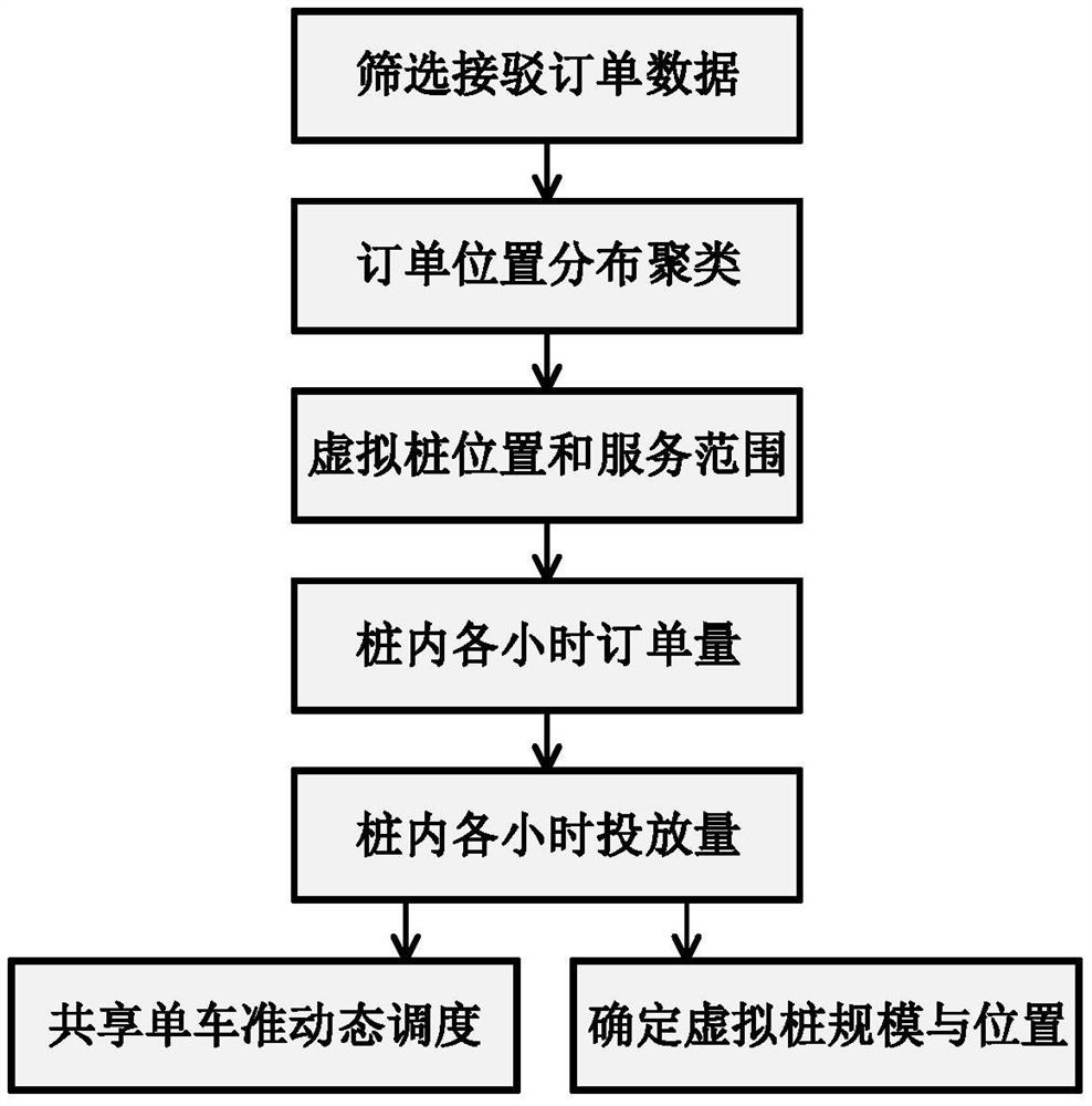
[0041] like figure 1 , figure 2 A method for determining the amount and location of shared bicycles connected to a track site is shown, including the following steps:
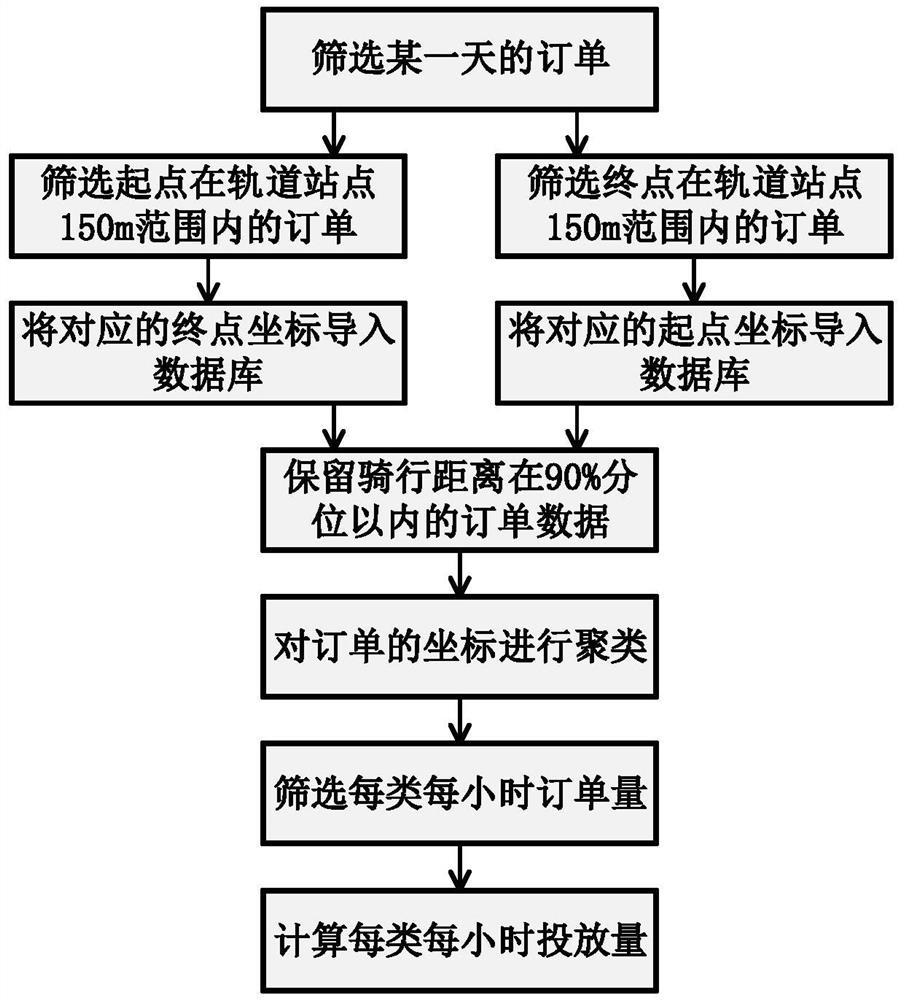
[0042]1) Select the shared bicycle order data within a distance of 150m between the starting point (or ending point) and the rail transit station in a day, and perform spatial clustering on the corresponding ending point (or starting point) to obtain the gathering position of shared bicycles, as the virtual pile of shared bicycles ; The shared bicycle order data includes: order ID, user ID, vehicle ID, ride start time, start longitude, start latitude, ride end time, end longitude, end latitude, ride date. If there is some null data in the shared bicycle order data, delete this part of data during data preprocessing; the rail transit site data includes: site ID, site name, site line, site longitude, and site latitude. The spatial clustering of shared bicycles uses the K-Means clustering method, which clusters...
Embodiment 2
[0058] Taking Fuqiao Station of Nanjing Metro Line 3 as an example, the flow chart of the method is as follows figure 1 As shown, the data processing flow chart of the shared bicycle order is as follows: figure 2 As shown, the specific implementation steps are as follows:
[0059] S1. From the shared bicycle order database, filter the order data of the shared bicycles on a fine working day, the distance between the starting point (or end point) and the pontoon station is not more than 150m. Among them, the distance between the shared bicycle and the pontoon station can be calculated using the corresponding latitude and longitude coordinates, and the calculation formula is as follows:
[0060]
[0061] Among them, D 3 Indicates the distance between shared bicycles and rail transit stations; lon R Indicates the station longitude in the rail transit station data; lon B Indicates the end longitude (or start longitude) in the shared bicycle order data; lat R Indicates the ...
PUM
 Abstract
Description
Claims
Application Information
 - R&D
- Intellectual Property
- Life Sciences
- Materials
- Tech Scout
- Unparalleled Data Quality
- Higher Quality Content
- 60% Fewer Hallucinations
Browse by: Latest US Patents, China's latest patents, Technical Efficacy Thesaurus, Application Domain, Technology Topic, Popular Technical Reports.
© 2025 PatSnap. All rights reserved.Legal|Privacy policy|Modern Slavery Act Transparency Statement|Sitemap|About US| Contact US: help@patsnap.com


