
Taxi track data-based travel time-space mode identification method and system

A trajectory data and pattern recognition technology, applied in character and pattern recognition, structured data retrieval, geographic information database, etc., can solve the problem of insufficient combination of time features, lack of measurement methods for taxi travel pattern recognition and extraction, and inability to take into account the taxi It can reduce the time complexity, high time complexity and improve efficiency

Inactive Publication Date: 2019-08-30
南京图申图信息科技有限公司
View PDF2 Cites 10 Cited by
  • Summary
  • Abstract
  • Description
  • Claims
  • Application Information

AI Technical Summary

Problems solved by technology

[0003] However, existing studies focus on analyzing the spatial distribution characteristics of travel behavior under time slices and statistical characteristics such as frequency, distance, and direction, which reflect the travel pattern of a specific time period, that is, dynamics, but it is not combined with time characteristics, and it is difficult to intuitively reflect it. Travel behavior changes periodically over time, and it is necessary to explore an analysis model that can express the temporal and spatial characteristics of travel behavior
Moreover, there is a lack of measurement methods suitable for taxi travel pattern recognition and extraction in existing research.
Some existing studies introduce time series clustering to analyze the travel patterns of the crowd, and express the spatio-temporal characteristics of travel behavior in a unified way through the "research unit-time series" aggregation model, which has a good application in data with station attributes (bus, subway) , but is not directly applicable to the taxi data
The existing research unit division methods (regular grid, traffic area, etc.) cannot take into account the spatial location characteristics of taxis and road network morphological characteristics, and the time series proximity measurement method is based on the proximity of values, which is difficult to reflect the trend of time series changes. similarity

Method used


Image

  • Taxi track data-based travel time-space mode identification method and system
  • Taxi track data-based travel time-space mode identification method and system
  • Taxi track data-based travel time-space mode identification method and system

Examples


Embodiment Construction

[0036] Below in conjunction with specific embodiment, further illustrate the present invention, should be understood that these embodiments are only used to illustrate the present invention and are not intended to limit the scope of the present invention, after having read the present invention, those skilled in the art will understand various equivalent forms of the present invention All modifications fall within the scope defined by the appended claims of the present application.

[0037] The embodiment of the present invention discloses a travel time-space pattern recognition method based on taxi track data, which mainly includes the following steps:

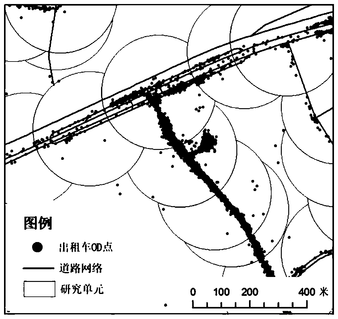
[0038] S1: Take the road intersection as the center and set the length as the radius of the circular area as the research unit to collect and process the taxi OD data points to obtain the taxi travel time series data set. The core of this step is the division of research units taking into account the road network constraints....


PUM


Abstract

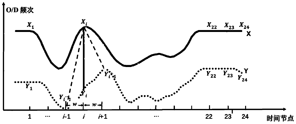
The invention discloses a taxi track data-based travel space-time mode identification method and system. The method comprises the following steps of carrying out the collective counting processing onthe taxi OD data points by taking a road intersection point as a center and a circular area with a set length as a radius as a research unit; clustering the taxi travel time sequence data set by adopting a density-based clustering algorithm, and adjusting the clustering parameters according to an evaluation index to obtain an optimal clustering result, wherein a product obtained by adding a time window constraint condition to the DTW and adjusting a metric value of a first-order time correlation coefficient adaptive dissimilarity index through an adjustment function is used as a final time sequence similarity measurement function; and superposing the spatial distribution of the clustering result by combining the research area base map to obtain a travel mode spatial distribution map. According to the present invention, the results of the research unit division method and the time sequence clustering method are more consistent with the general cognition of the taxi mode, and better applicability is shown for the taxi data.

Description

technical field [0001] The invention relates to the fields of urban geography and spatio-temporal data mining, in particular to a travel spatio-temporal pattern recognition method and system based on time series clustering for mining crowd movement rules through urban taxi travel trajectory data. Background technique [0002] A city is the result of long-term interaction between crowd activities and urban spatial structure, and the travel needs of the crowd are closely related to the characteristics of the urban spatial structure. Therefore, understanding the correlation between the spatial-temporal patterns of urban population travel and urban spatial structure has important and practical significance for urban planning, traffic management, and emergency response. Researchers have studied the relationship between crowd travel behavior and urban form from different aspects, such as analyzing the mixed scale of land use types and occupation and residence, and trying to evalua...

Claims


Application Information

Patent Timeline
IPC IPC(8): G06K9/62G06F16/29
CPCG06F16/29G06F18/22G06F18/23213
Inventor 王磊孙毅中杨静尚博文
Owner 南京图申图信息科技有限公司
Learn More