
Software system for making three-dimensional city map

A software system and two-dimensional map technology, which is applied in image data processing, 3D modeling, instruments, etc., can solve the problems that three-dimensional maps take a lot of time and effort, and the production of three-dimensional maps is complicated, so as to achieve comprehensive observation, simplified information and easy use Effect

Inactive Publication Date: 2019-07-05
杭州易明远科技有限公司
View PDF0 Cites 0 Cited by
  • Summary
  • Abstract
  • Description
  • Claims
  • Application Information

AI Technical Summary

Problems solved by technology

[0004] Aiming at the deficiencies of the prior art, the present invention provides a software system for making three-dimensional city maps, which solves the problem that the making of three-dimensional maps is relatively complicated, and each three-dimensional map needs to spend a lot of time and energy, which is the need of the prior art. Problems Overcoming Major Difficulties

Method used


Image

  • Software system for making three-dimensional city map
  • Software system for making three-dimensional city map
  • Software system for making three-dimensional city map

Examples


Embodiment Construction

[0021] The following will clearly and completely describe the technical solutions in the embodiments of the present invention with reference to the accompanying drawings in the embodiments of the present invention. Obviously, the described embodiments are only some, not all, embodiments of the present invention. Based on the embodiments of the present invention, all other embodiments obtained by persons of ordinary skill in the art without making creative efforts belong to the protection scope of the present invention.

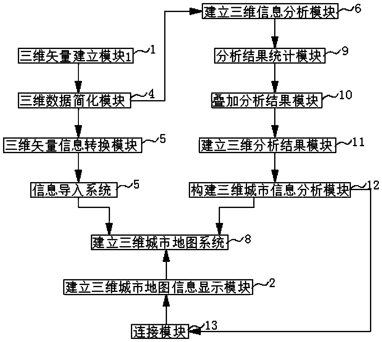
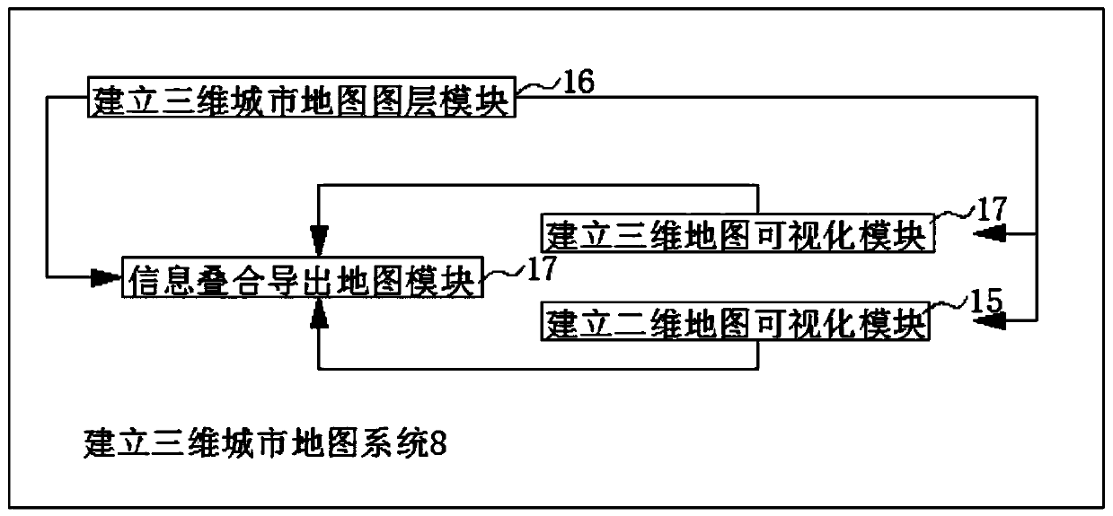
[0022] see Figure 1-3 , the present invention provides a technical solution: a software system for making a three-dimensional city map, including a three-dimensional vector building module 1, a three-dimensional city map information display module 2 and a data update module 3, using the three-dimensional vector building module 1 to construct a three-dimensional The cooperation between the city information analysis module 12 and the establishment of the three-...


PUM


Abstract

The invention discloses a software system for making a three-dimensional city map. The system comprises a three-dimensional vector establishment module, a three-dimensional city map establishment information display module and a data updating module. The output end of the three-dimensional vector establishment module is connected with the input end of the three-dimensional data simplification module. The output end of the three-dimensional data simplification module is connected with the input end of the three-dimensional vector information conversion module and the input end of the three-dimensional information establishment analysis module, and the output end of the three-dimensional vector information conversion module is connected with the input end of the information import system. The invention discloses a software system for manufacturing a three-dimensional city map. The three-dimensional map can be automatically established through cooperation of the three-dimensional vector establishment module, the three-dimensional city information analysis module and the three-dimensional city map establishment information display module, the problem that the three-dimensional map is difficult to establish is solved, the three-dimensional maps can be established in batches, and workers can plan cities conveniently.

Description

technical field [0001] The invention relates to the technical field of three-dimensional electronic maps, in particular to a software system for making three-dimensional city maps. Background technique [0002] A three-dimensional electronic map, or 3D electronic map, is a three-dimensional, abstract description of one or more aspects of the real world or a part of it based on a three-dimensional electronic map database. The network 3D electronic map not only provides users with map retrieval functions such as map query and travel navigation through the intuitive representation of geographical real scene simulation, but also integrates a series of services such as life information, e-government, e-commerce, virtual community, and travel navigation. While bringing convenience to people, the three-dimensional electronic map of the network also brings threats to national security, social stability and people's privacy. As a form of graphic language for recording geographic inf...

Claims


Application Information

Patent Timeline
Patent Type & Authority Applications(China)
IPC IPC(8): G06T17/05
CPCG06T17/05
Inventor 李明江李爱丹刘晓峰魏平
Owner 杭州易明远科技有限公司
Learn More