
A distributed watershed hydrological simulation method based on irregular plot units

A technology of plot unit and simulation method, which is applied in the fields of instruments, data processing applications, prediction, etc., to achieve the effect of broad application prospects

Inactive Publication Date: 2019-05-28
南京泛在地理信息产业研究院有限公司 +1
View PDF4 Cites 4 Cited by
  • Summary
  • Abstract
  • Description
  • Claims
  • Application Information

AI Technical Summary

Problems solved by technology

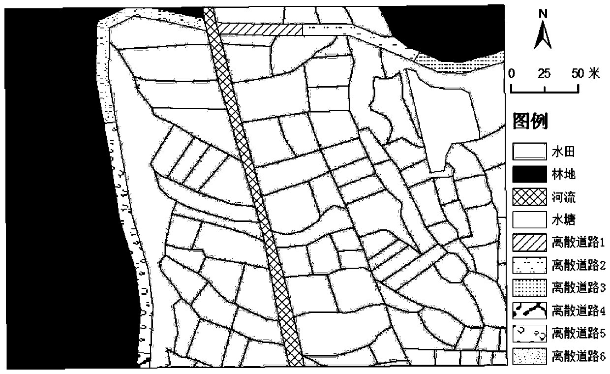
In the existing distributed hydrological models, the spatial discretization is mostly based on raster data models, but it is difficult to accurately express irregular ground objects such as rice terraces and ponds only based on raster data.

Method used


Image

  • A distributed watershed hydrological simulation method based on irregular plot units
  • A distributed watershed hydrological simulation method based on irregular plot units
  • A distributed watershed hydrological simulation method based on irregular plot units

Examples


Embodiment Construction

[0041] The technical solution of the present invention will be described in detail below in conjunction with the accompanying drawings and specific embodiments.

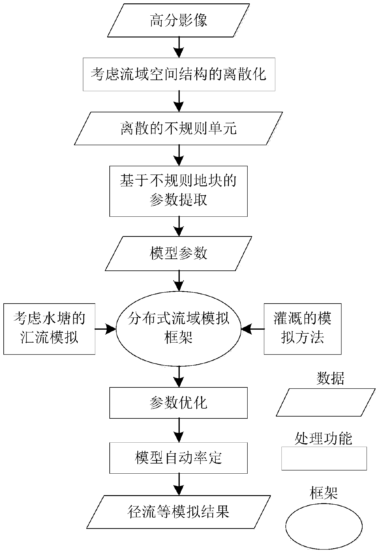
[0042] Such as figure 1 As shown, a distributed watershed hydrological simulation method based on irregular plots, taking the distributed hydrological simulation of irregular plot units in the Tianshe watershed in the hilly area of ​​the Taihu Lake Basin as an example, includes the following steps:

[0043] (1) Discretize the watershed by using irregular units, among which paddy fields, ponds and roads are discretized in the form of irregular polygons, and woodlands, grasslands, river beaches and building land are discretized in the form of regular grid units change.

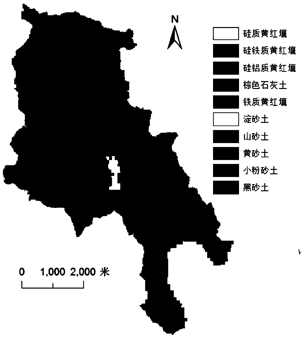
[0044] In this example, the Zhongtianshe River Basin, a typical low mountain and hilly watershed in the Taihu Lake Basin, is selected as the research area. This watershed is located in the drinking water source of Liyang City, Jiangsu Province. The main...


PUM


Abstract

The invention discloses a distributed watershed hydrological simulation method based on irregular plot units. The method comprises the following steps of carrying out partition discretization on a watershed by adopting the irregular units; designing a data structure supporting irregular plot units; extracting model parameters corresponding to the irregular plot units; designing a distributed basinsimulation framework; improving the slope confluence module, so that the influence of irrigation and drainage activities of paddy fields and ponds on the confluence process can be considered; carrying out parameter optimization; and obtaining an optimized parameter combination and an optimized simulation result according to the obtained parameter range. According to the invention, the distributedwatershed hydrological simulation based on irregular plot units is supported, and the confluence relationship between units is displayed and simulated, and compared with traditional distributed hydrological simulation based on spatial discrete units such as a grid / hydrological response unit, the method has a better practical situation and has a wide application prospect in the fields of drainagebasin scientific management, water pollution treatment and the like in areas with severe agricultural activity influence.

Description

technical field [0001] The invention relates to watershed scientific management and water pollution control, in particular to a distributed watershed hydrological simulation method based on irregular plot units. Background technique [0002] Water is an irreplaceable resource that supports the sustainable development of society and economy. However, under the complex influence of economic development, global climate change and human activities, ecological and environmental problems such as water resource shortage and water pollution have appeared in many areas, which seriously restrict the sustainable development of the country and the region. There is an urgent need for scientific watershed management and governance. As a flexible and effective auxiliary decision-making method, watershed process simulation has been widely used in watershed scientific management. [0003] Hydrological processes in different regions often have different characteristics due to their unique n...

Claims


Application Information

Patent Timeline
Patent Type & Authority Applications(China)
IPC IPC(8): G06Q10/04G06Q50/02G06Q50/06
Inventor 刘军志刘章聪朱阿兴朱良君沈芳江净超邓永翠
Owner 南京泛在地理信息产业研究院有限公司
Learn More