
A Saddle Point Extraction Method Based on Contour Model

An extraction method and contour line technology, applied in the application field of geographic information technology, can solve the problems of difficult data processing, easy generation of false saddle points, etc., and achieve the effect of improving the extraction accuracy

Active Publication Date: 2020-10-16
南京泛在地理信息产业研究院有限公司 +1
View PDF6 Cites 0 Cited by
  • Summary
  • Abstract
  • Description
  • Claims
  • Application Information

AI Technical Summary

Problems solved by technology

[0004] Purpose of the invention: In view of the difficulties in data processing and the easy generation of false saddle points when using DEM data to extract saddle points, the present invention provides a method of using contour data and using the morphological characteristics of saddle points in real terrain to perform saddle method of point extraction

Method used


Image

  • A Saddle Point Extraction Method Based on Contour Model
  • A Saddle Point Extraction Method Based on Contour Model
  • A Saddle Point Extraction Method Based on Contour Model

Examples


Embodiment Construction

[0030] The present invention will be further explained below in conjunction with the accompanying drawings and specific embodiments.

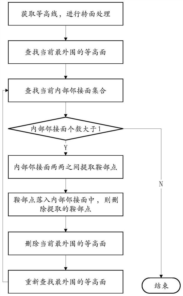
[0031] Such as figure 1 As shown, a saddle point extraction method based on the contour model includes the following steps:

[0032] Step 1. Obtain the contour line data of the area to be processed, and convert the acquired contour line data into a line-to-surface process to obtain the surface set S after all contour lines are converted to a surface; clear the saddle point set U s ;

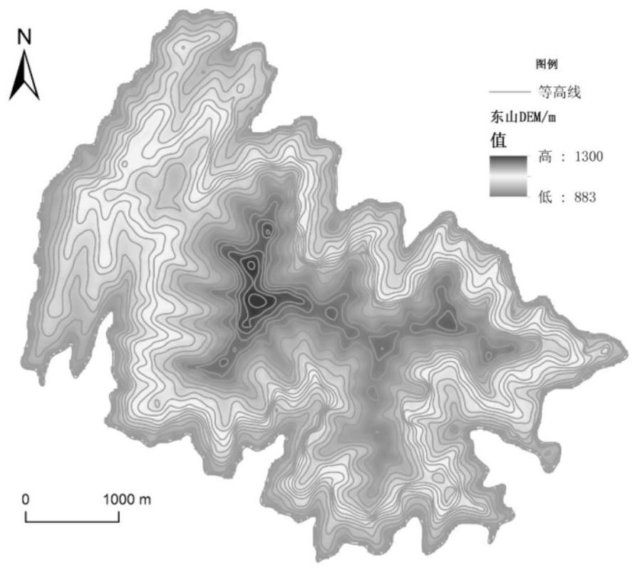
[0033] In this embodiment, Dongshan Mountain in Licheng County, Changzhi City, Shanxi Province, which has a relatively high topographical undulation in the Loess Plateau area, is selected as the experimental sample area. The contour lines of the sample area are as follows: figure 2 As shown, the contour distance is 5m; Dongshan is located in the north-central area of ​​Licheng County, and is dominated by moderately eroded mountains. The terrain in the area is r...


PUM


Abstract

The invention discloses a contour line model-based saddle point extraction method, which comprises the following steps of: 1, acquiring contour line data and carrying out line-to-surface processing toobtain a surface set S; 2, finding the outermost equal-height surface s from the S; 3, traversing the set S, finding out all faces which are located in an area surrounded by the faces s and are adjacent to the faces s, and forming an internal adjacent face set T; wherein the internal adjacent surfaces with the elevation values greater than the elevation values of the surfaces s in the set T forma set W; 4, extracting saddle points between every two internal adjacent surfaces in the set W to form a set U; Adding a saddle point which is not located in any internal adjacent surface in the set Uinto the set Us; 5, deleting the surface s from the surface set S, and repeating the steps 2-5; and 4, the number of the internal adjacent surfaces in the current outermost contour surface is smallerthan 2. According to the method, the topographic characteristics of the saddle points and the spatial characteristics of the saddle points in the contour line are fully utilized, the problem that pseudo saddle points are generated in the traditional saddle point extraction process is solved, and the extraction precision of the saddle points is improved.

Description

technical field [0001] The invention belongs to the application field of geographic information technology, and in particular relates to a saddle point extraction method based on a contour line model. Background technique [0002] The saddle refers to the saddle-shaped depression located between two adjacent hills. The saddle points, mountain tops, runoff nodes, ditch head points, erosion reference points, and trace erosion crack points together constitute a topographic feature point cluster that plays an important role in controlling the topographical undulation characteristics. Among them, the elevation difference between the saddle point and the adjacent mountain top is often used as an important index to distinguish the positive terrain relief characteristics of the ground, and it becomes one of the basis for the recognition of topographical patterns based on topographic feature point clusters. [0003] The automatic and efficient identification and extraction of saddle...

Claims


Application Information

Patent Timeline
Patent Type & Authority Patents(China)
IPC IPC(8): G06F16/29
Inventor 刘海龙刘海鹏余锦慧杨昕代文程益涵
Owner 南京泛在地理信息产业研究院有限公司
Learn More