
A total station and its star map identification method

A star map recognition and total station technology, applied in the directions of instruments, measuring instruments, navigation, etc., can solve the problem of low efficiency of star map recognition

Active Publication Date: 2021-09-03
PLA STRATEGIC SUPPORT FORCE INFORMATION ENG UNIV PLA SSF IEU
View PDF5 Cites 0 Cited by
  • Summary
  • Abstract
  • Description
  • Claims
  • Application Information

AI Technical Summary

Problems solved by technology

[0006] The purpose of the present invention is to provide a total station and its star map recognition method to solve the problem of low star map recognition efficiency caused by astronomical survey operators relying on the approximate coordinates of the survey station and professional star knowledge

Method used


Image

  • A total station and its star map identification method
  • A total station and its star map identification method
  • A total station and its star map identification method

Examples


Embodiment Construction

[0042]The specific embodiments of the present invention will be further described below in conjunction with the accompanying drawings.

[0043] Embodiment of the star map recognition method based on the total station:

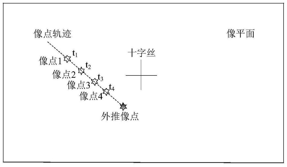
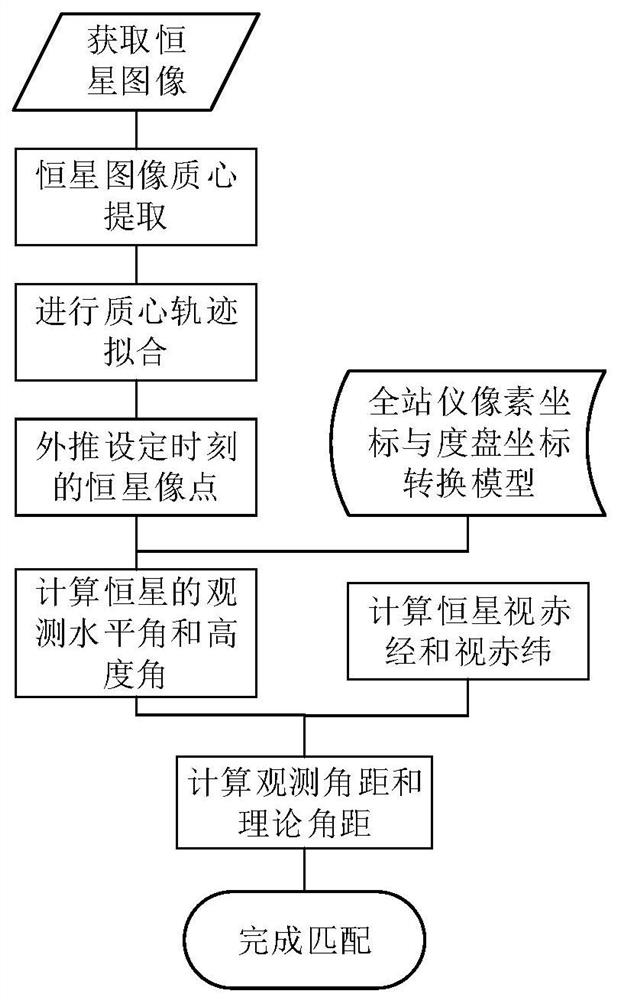
[0044] A total station-based star map recognition method of the present invention extracts the centroids of continuous stellar images at different times, and fits the trajectory of star image points according to the centroids extracted at each time, and then can be set The image point coordinates of the stars at the moment, and in conjunction with the pixel coordinates of the total station and the dial coordinate conversion model, calculate the observation horizontal angle and altitude angle of the stars at the set moment; wherein, in the present invention, at least three stars need to be calculated respectively The observed horizontal angle and altitude angle at the set time; then, according to the obtained observed horizontal angle and altitude angle of at le...


PUM


Abstract

The invention relates to a total station and its star map identification method; the total station continuously takes pictures of the stars, obtains the trajectory of the star on the image plane, and uses a polynomial to fit the trajectory; according to the fitted trajectory model, extrapolates At the time of setting the image point coordinates of the stars, and using the image coordinates of the total station and the coordinate conversion model of the dial to obtain the observation horizontal angle and altitude angle of at least three stars; calculate the angular distance information between any two stars, and Taking the angular distance information as the matching condition, set a reasonable threshold, complete the matching, and identify the stars in the star map. The invention can realize the star map recognition without the total station instrument of the general position of the survey station, so that the astronomical survey operators can recognize the star map without professional knowledge of star recognition.

Description

technical field [0001] The invention belongs to the field of astronomical image processing, and in particular relates to a total station and a star map recognition method thereof. Background technique [0002] Astronomical measurement is a technology that relies on natural celestial bodies such as stars, planets, the sun, and the moon to achieve precise positioning and orientation. It has strong autonomy and anti-interference, and can be used as an important backup method for satellite navigation systems. [0003] At present, the classic star map identification requires a star map to contain multiple star points, and the angular distance information between stars is used for identification, but astronomical survey operators need to conduct star map The recognition of the star map is relatively low. [0004] With the increasing maturity of image total station technology, its automatic camera function can replace the human naked eye to realize automatic observation of natural...

Claims


Application Information

Patent Timeline
Patent Type & Authority Patents(China)
IPC IPC(8): G01C15/00G01C21/02
CPCG01C15/00G01C21/025
Inventor 詹银虎郑勇张超李崇辉叶凯米科峰
Owner PLA STRATEGIC SUPPORT FORCE INFORMATION ENG UNIV PLA SSF IEU
Learn More