SINS (Ship's Inertial Navigation System)/GPS (Global Position System) high-precision gravity disturbance method based on system states estimation
A technology of gravity disturbance and system state, which is applied in the field of navigation and can solve problems such as limited accuracy of gravity disturbance measurement values
- Summary
- Abstract
- Description
- Claims
- Application Information
AI Technical Summary
Problems solved by technology
Method used
Image
Examples
Embodiment 1
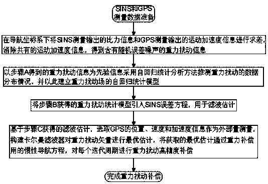
[0015] Embodiment 1. A kind of SINS / GPS high precision gravitational disturbance compensation method based on system state estimation, this method it comprises the following steps:
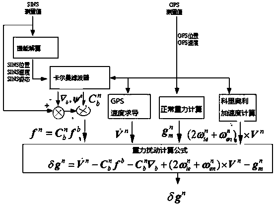
[0016] Step A: Under the navigation coordinate system, the specific force information of the SINS measurement output and the motion acceleration information of the GPS measurement output are calculated for difference, and the common motion acceleration information is eliminated to obtain the gravitational disturbance information containing random error noise;
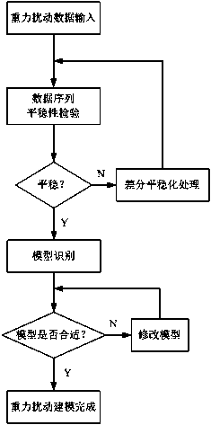
[0017] Step B: using the gravitational disturbance information obtained in step A as prior information, using the autoregressive statistical analysis method to infer the data distribution of the gravitational disturbance, and establishing an autoregressive statistical model of the gravitational disturbance field;
[0018] Step C: introducing the gravitational disturbance statistical model obtained in step B into the SINS error equation for f...
PUM
 Abstract
Description
Claims
Application Information
 - R&D Engineer
- R&D Manager
- IP Professional
- Industry Leading Data Capabilities
- Powerful AI technology
- Patent DNA Extraction
Browse by: Latest US Patents, China's latest patents, Technical Efficacy Thesaurus, Application Domain, Technology Topic, Popular Technical Reports.
© 2024 PatSnap. All rights reserved.Legal|Privacy policy|Modern Slavery Act Transparency Statement|Sitemap|About US| Contact US: help@patsnap.com


