Gravity pipeline pumping station water collection range analysis method and device
A range analysis and pipeline technology, applied in the field of big data analysis, can solve the problems of difficult to fully grasp the water collection area of the pumping station, and the inability to schedule the adjustment of the pumping station.
- Summary
- Abstract
- Description
- Claims
- Application Information
AI Technical Summary
Problems solved by technology
Method used
Image
Examples
Embodiment 1
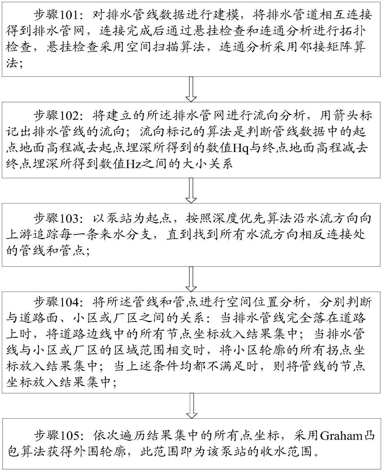
[0048] Such as figure 1 As shown, this embodiment provides a method for analyzing the water collection range of a power pipeline pumping station, and the specific steps are as follows:
[0049] Step 101: Modeling the drainage pipeline data, connecting the drainage pipes to each other to obtain a drainage pipe network, performing topology inspection through suspension inspection and connectivity analysis after the connection is completed, the suspension inspection adopts a space scanning algorithm, and the connectivity analysis adopts an adjacency matrix algorithm;
[0050] Step 102: Analyze the flow direction of the established drainage pipe network, and mark the flow direction of the drainage pipeline with arrows; the algorithm of flow direction marking is to judge the value Hq obtained by subtracting the starting point ground elevation from the starting point buried depth from the pipeline data and the ending point ground The magnitude relationship between the value Hz obtai...
Embodiment 2
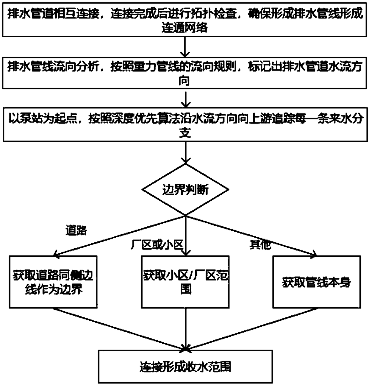
[0058] On the basis of Embodiment 1, this embodiment provides a method for analyzing the water collection range of the power pipeline pumping station, and the specific steps are as follows:
[0059] Step 201: Modeling the drainage pipeline data, connecting the drainage pipes to each other to obtain a drainage pipe network, performing topology inspection through suspension inspection and connectivity analysis after the connection is completed, the suspension inspection adopts a space scanning algorithm, and the connectivity analysis adopts an adjacency matrix algorithm;
[0060] The suspension inspection described in this step adopts the spatial scanning algorithm to scan the gravity pipe network data one by one, and judges whether the end point of each pipeline intersects with the pipe point during the scanning process, and whether each pipe point is covered by the pipeline end point. If there is no intersection with the pipe point, the pipe line is marked as a dangling line, a...
Embodiment 3
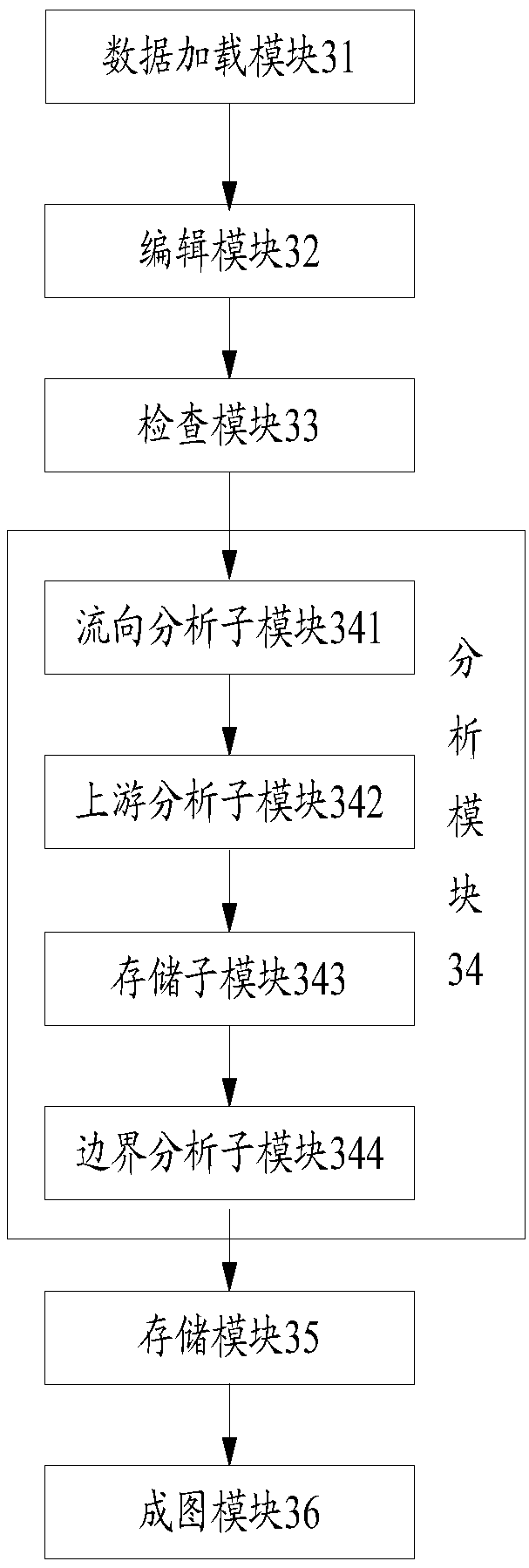
[0071] Such as figure 2 As shown, the present embodiment provides a gravity pipeline pump station water collection range analysis device, including: data loading module 31, editing module 32, checking module 33, analysis module 34, storage module 35, drawing module 36, wherein,
[0072] The data loading module 31 is coupled with the editing module 32, and is used to load the spatial data of the drainage pipeline, display the positional relationship of the pipeline in a graphical manner, and send it to the editing module 32;
[0073] The editing module 32 is respectively coupled with the data loading module 31 and the checking module 33, and is used to connect the drainage pipeline space data of the data loading module 31 according to the actual situation, so that the drainage pipeline forms a drainage pipe network and then sends To the inspection module 33, the editing module 32 is used to draw pipelines, connect pipelines, break pipelines, connect pipelines, and delete pipel...
PUM
 Abstract
Description
Claims
Application Information
 - R&D Engineer
- R&D Manager
- IP Professional
- Industry Leading Data Capabilities
- Powerful AI technology
- Patent DNA Extraction
Browse by: Latest US Patents, China's latest patents, Technical Efficacy Thesaurus, Application Domain, Technology Topic, Popular Technical Reports.
© 2024 PatSnap. All rights reserved.Legal|Privacy policy|Modern Slavery Act Transparency Statement|Sitemap|About US| Contact US: help@patsnap.com


