
A Path Planning Method for Unmanned Aerial Vehicle Based on Situation Space

An unmanned aerial vehicle and path planning technology, applied in the field of three-dimensional path planning, can solve problems such as limitations and achieve excellent time efficiency

Active Publication Date: 2020-12-04
HARBIN ENG UNIV
View PDF3 Cites 0 Cited by
  • Summary
  • Abstract
  • Description
  • Claims
  • Application Information

AI Technical Summary

Problems solved by technology

However, the targets and threats tracked by UAVs are usually flexible in three-dimensional (3D) high-altitude flight paths, and the motion control of UAVs is limited by some performance parameters, so online search for locally optimal or even feasible routes is important to UCAV is a big challenge

Method used


Image

  • A Path Planning Method for Unmanned Aerial Vehicle Based on Situation Space
  • A Path Planning Method for Unmanned Aerial Vehicle Based on Situation Space
  • A Path Planning Method for Unmanned Aerial Vehicle Based on Situation Space

Examples


Embodiment Construction

[0044] The following examples describe the present invention in more detail.

[0045] The invention provides a new method for improving the performance of the tracking algorithm by reasonably determining the initial filtering value in the process of tracking the maneuvering target by using the passive detection technology. Due to the lack of research on this problem in the past, whether the initial value of the filter is determined properly in practical engineering applications has a greater impact on the convergence speed of the filter, and may even lead to the algorithm approaching divergence under the premise of large measurement errors. . Therefore, the invention can improve the convergence speed of the filtering algorithm, and at the same time, some test schemes and data result analysis are given.

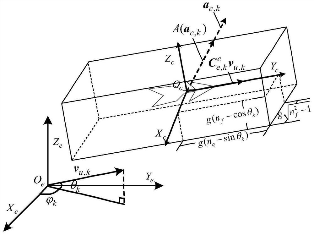
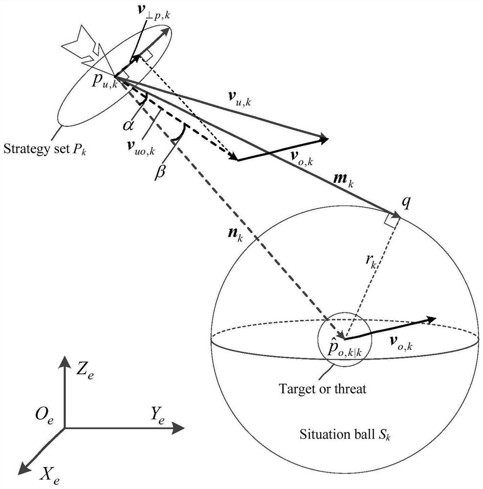
[0046]The present invention focuses on the path planning of the line-of-sight unmanned aerial vehicle in a dynamic environment. That is, a simple three-dimensional path plan...


PUM


Abstract

The invention provides a situational space based route planning method for an unmanned aerial vehicle. The method comprises 1, using the unmanned aerial vehicle to detect the surrounding environment information in real time, extracting state information of a detected moving object; 2, resolving the situational space of each moving object according to the state information, analyzing the physical constraint of the unmanned aerial vehicle, giving a constraint space in an airborne coordinate system; 3, acquiring a tracking strategy according to the revenue function of the moving object; 4, acquiring a conflict avoidance strategy for avoiding the moving threat according to the situational space; 5, fusing the strategic accelerations in the step 3 and the step 4, generating a new control acceleration, correcting according to the upper limit of the speed, and then obtaining a new plan position according to a destination point generation method. The method provides an effective conflict-freepath for a UCAV (Unmanned Combat Air Vehicle) having a maneuvering characteristic to tract a target in the high-altitude sparse space. The planned path not only meets the practical physical demands, and effectively keeps a safe flying distance with the tracked target.

Description

technical field [0001] The invention relates to a three-dimensional path planning method. Specifically, it is a three-dimensional path planning method for unmanned aerial vehicles. Background technique [0002] Object tracking and collision avoidance are critical to the success of unmanned aerial vehicle (UCAV) missions. In order to improve the autonomy level of unmanned vehicles and ensure the feasibility and safety of planned routes, the development of related navigation and control strategies is rapidly increasing. These devices have attracted a lot of attention in many applications. Traditional two-dimensional (2D) path planning is mainly used to find the globally optimal path offline in a known or static environment. However, the targets and threats tracked by UAVs are usually flexible in three-dimensional (3D) high-altitude flight paths, and the motion control of UAVs is limited by some performance parameters, so online search for locally optimal or even feasible ro...

Claims


Application Information

Patent Timeline
Patent Type & Authority Patents(China)
IPC IPC(8): G01C21/20
CPCG01C21/20
Inventor 郜丽鹏游世勋刁鸣朱嘉颖马星星
Owner HARBIN ENG UNIV
Learn More