A centimeter-level satellite positioning intelligent unmanned agricultural machinery control system and method
A satellite positioning and agricultural machinery technology, applied in control/adjustment systems, three-dimensional position/channel control, vehicle position/route/altitude control, etc., can solve the problems of low positioning accuracy, complicated operation, and high investment cost
- Summary
- Abstract
- Description
- Claims
- Application Information
AI Technical Summary
Problems solved by technology
Method used
Image
Examples
Embodiment approach
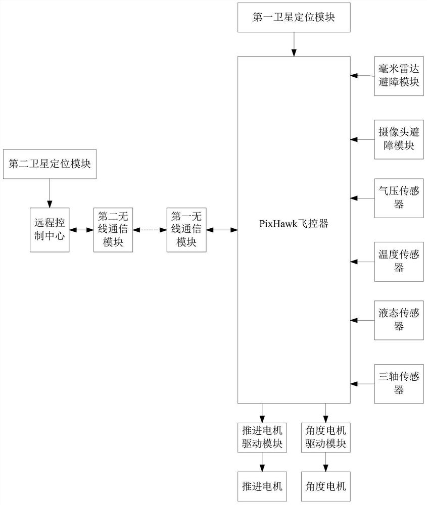
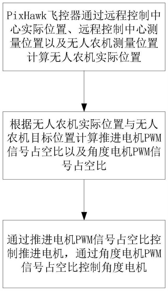
[0048] Combine below figure 1 as well as figure 2 The specific method steps of the embodiments of the present invention are introduced. The embodiment of the present invention comprises the following steps:
[0049] Step 1: The PixHawk flight controller calculates the actual position of the unmanned agricultural machine through the actual position of the remote control center, the measured position of the remote control center and the measured position of the unmanned agricultural machine;
[0050] The actual position of the remote control center described in step 1 is the actual calibration position of the remote control center on the motion plane of the unmanned agricultural machinery:
[0051] (X 0 ,Y 0 )
[0052] Among them, X 0 is the actual position coordinates of the remote control center on the X-axis on the unmanned agricultural machinery movement plane, Y 0 is the actual position coordinates of the remote control center on the Y-axis on the unmanned agricultu...
PUM
 Abstract
Description
Claims
Application Information
 - Generate Ideas
- Intellectual Property
- Life Sciences
- Materials
- Tech Scout
- Unparalleled Data Quality
- Higher Quality Content
- 60% Fewer Hallucinations
Browse by: Latest US Patents, China's latest patents, Technical Efficacy Thesaurus, Application Domain, Technology Topic, Popular Technical Reports.
© 2025 PatSnap. All rights reserved.Legal|Privacy policy|Modern Slavery Act Transparency Statement|Sitemap|About US| Contact US: help@patsnap.com


