GIS-based pedestrian flow density monitoring method

A technology of people flow density and number of people, applied in the field of people flow density monitoring based on GIS, can solve the problem of time-consuming and laborious, unable to accurately and intuitively obtain people flow density, etc., to achieve the effect of convenient use and improvement of construction level

Inactive Publication Date: 2018-05-15
ANHUI SUN CREATE ELECTRONICS
View PDF5 Cites 10 Cited by
  • Summary
  • Abstract
  • Description
  • Claims
  • Application Information

AI Technical Summary

Problems solved by technology

[0003] Nowadays, there are also some methods of monitoring the flow density of people. Generally, the flow density of people is monitored by cameras, which requires artificial judgment on the flow of people.

Method used


Image

  • GIS-based pedestrian flow density monitoring method
  • GIS-based pedestrian flow density monitoring method
  • GIS-based pedestrian flow density monitoring method

Examples


Embodiment Construction

[0028] The following will clearly and completely describe the technical solutions in the embodiments of the present invention with reference to the accompanying drawings in the embodiments of the present invention. Obviously, the described embodiments are only some, not all, embodiments of the present invention. Based on the embodiments of the present invention, all other embodiments obtained by persons of ordinary skill in the art without making creative efforts belong to the protection scope of the present invention.

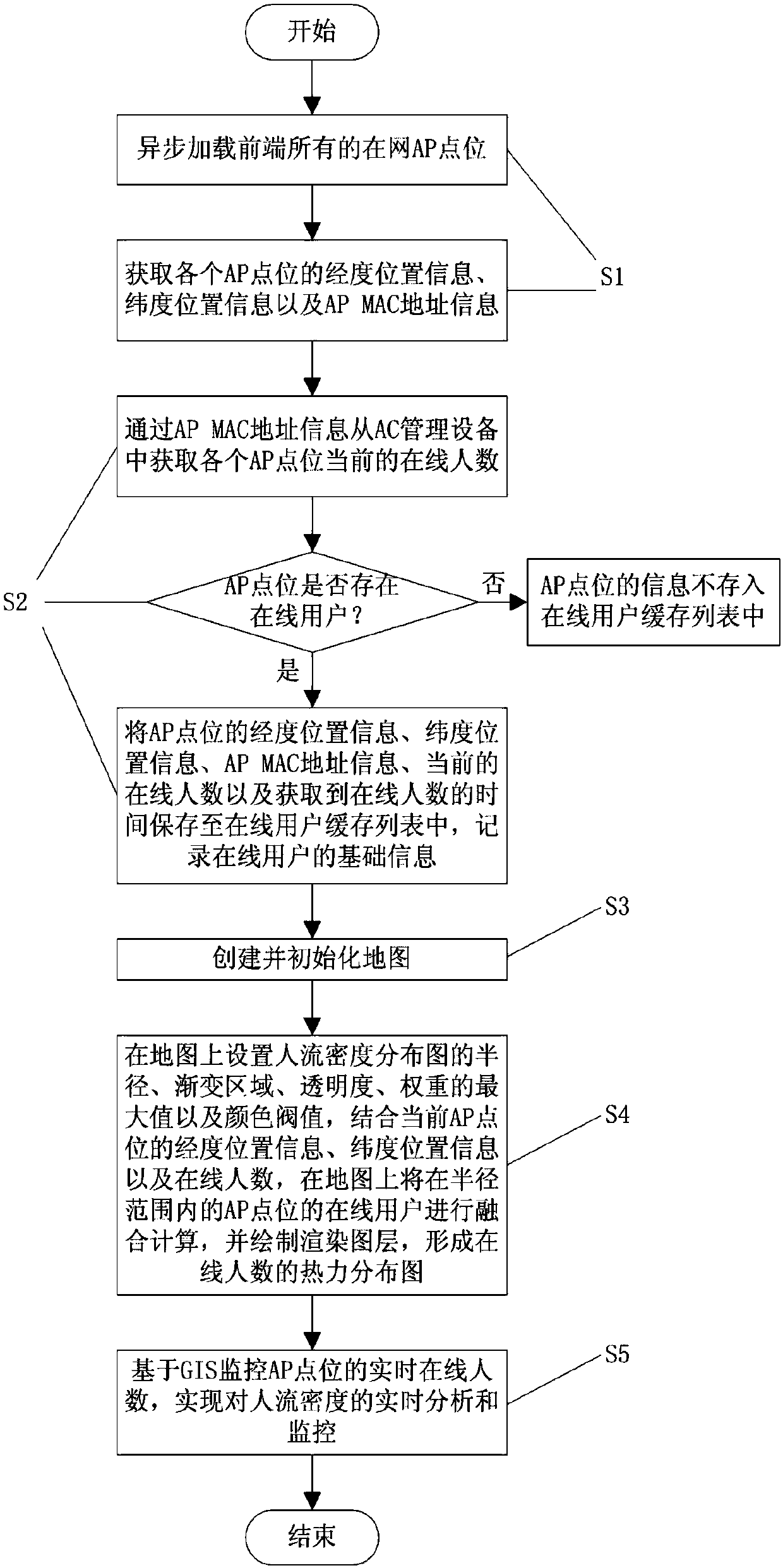
[0029] Such as figure 1 As shown, a GIS-based crowd density monitoring method includes the following steps:

[0030] S1. Asynchronously load all the AP points on the network at the front end, and obtain the longitude location information, latitude location information and AP MAC address information of each AP point;

[0031] Asynchronously load all the AP points on the network at the front end, and other work can be performed during the loading work, which gr...


PUM


Abstract

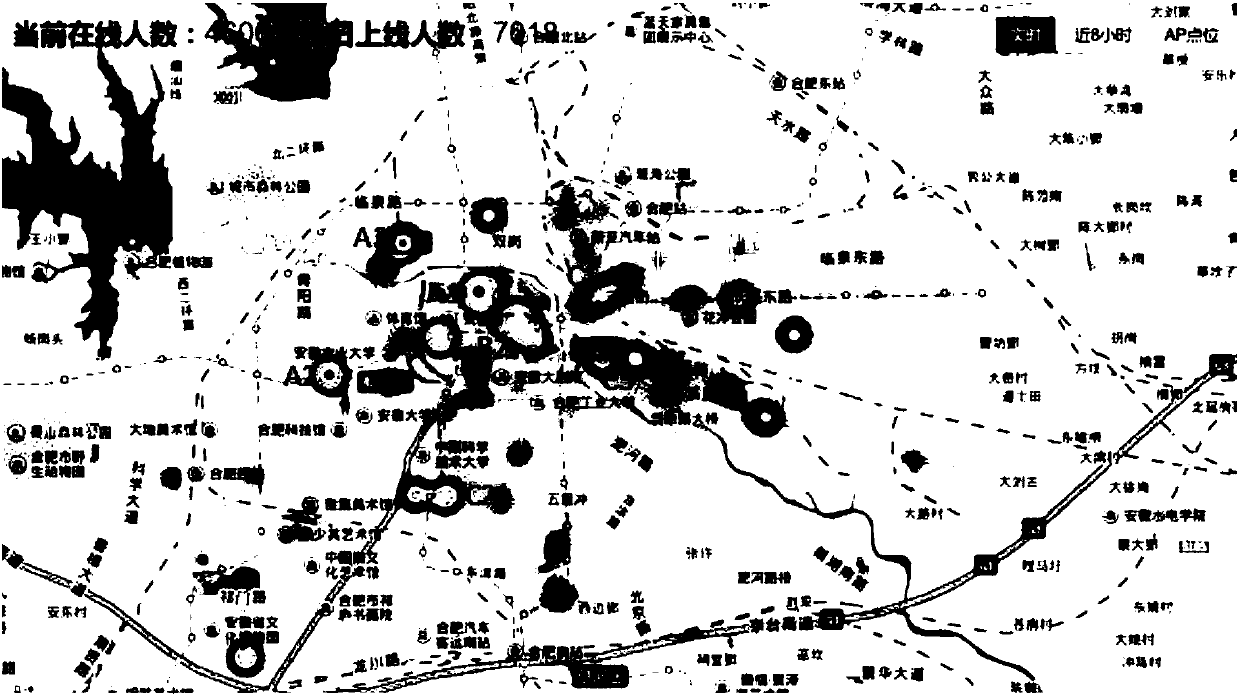
The invention relates to a pedestrian flow density monitoring method, in particular to a GIS-based pedestrian flow density monitoring method. According to online AP point locations, the longitude position information, latitude location information and APMAC address information of each AP point location are obtained, the number of the current online people of each AP point location is obtained fromAC management equipment, and the APMAC address information, the longitude position information, the latitude location information, the number of the current online people and the time for obtaining the number of the current online people are obtained through statistics. According to the number, obtained by wireless sensing, of the current online people of the AP point locations, through the combination of the GIS technology, a pattern layer is drawn and rendered, and a thermal distribution map of the number of the online people is formed. The method can accurately and intuitively judge the pedestrian flow density, real-time analysis and monitoring of the pedestrian flow density are achieved, and data support is provided, so that public welfare information related to urban construction andmanagement is pushed, the pedestrian flow density monitoring ability of government management departments in major events, activities and other places is improved, and security and evacuation preparation work is timely done.

Description

technical field [0001] The invention relates to a method for monitoring the density of people, in particular to a method for monitoring the density of people based on GIS. Background technique [0002] At present, all parts of the country are vigorously promoting the construction of wireless local area networks in public places, which is of great significance to improving urban functions and meeting the growing demands of citizens for information consumption. In the past few years, with the continuous development of wireless network technology, the construction level of "wireless city" based on wireless broadband network has been continuously improved. What wireless broadband brings to the society is not only the longing for a rich and colorful network life in the future, but more importantly, it brings a strong new driving force for social development. Therefore, "wireless city" has become the development direction of the future information city. [0003] Nowadays, there a...

Claims


Application Information

Patent Timeline
Patent Type & Authority Applications(China)
IPC IPC(8): G06F17/30H04W4/02H04W48/16
CPCG06F16/29H04W4/02H04W48/16
Inventor 莫申林王卫何丹娜翟佩璇徐龙汪彬彬产文涛张凡
Owner ANHUI SUN CREATE ELECTRONICS
Why Eureka
Try Eureka