
Transponder Satellite Communication Navigation and Positioning System

A satellite communication, navigation and positioning technology, applied in the field of satellite communication, navigation and positioning technology, to achieve the effects of easy replacement, low investment, and convenient maintenance and use

Active Publication Date: 2009-07-29
NAT ASTRONOMICAL OBSERVATORIES CHINESE ACAD OF SCI +1
View PDF0 Cites 32 Cited by
  • Summary
  • Abstract
  • Description
  • Claims
  • Application Information

AI Technical Summary

Problems solved by technology

Features such as flexible and convenient composition

Method used


Image

  • Transponder Satellite Communication Navigation and Positioning System
  • Transponder Satellite Communication Navigation and Positioning System
  • Transponder Satellite Communication Navigation and Positioning System

Examples


Embodiment Construction

[0043] Constellation geometric position configuration is very important, and it will obviously affect the navigation and positioning accuracy of the wide end. So the satellite's

[0049] Several constellation schemes can be formed from the above-mentioned ranging sources.

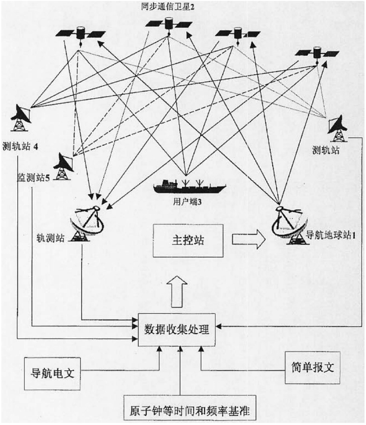
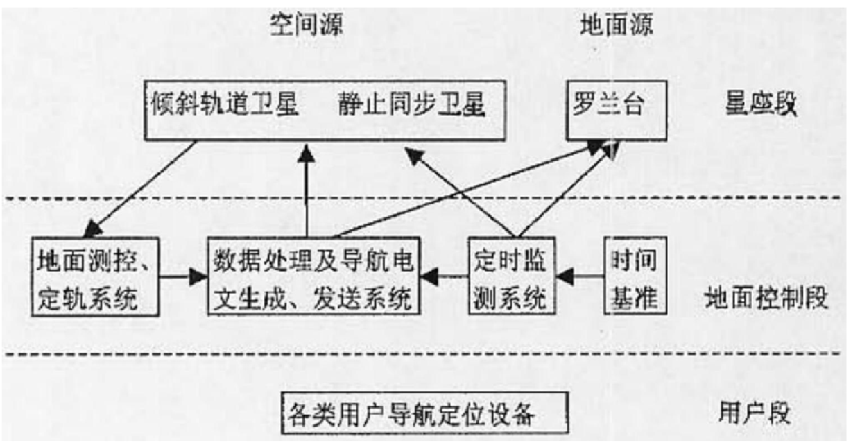
[0050] The satellite of this system does not have an atomic clock, and the satellite broadcasts navigation information in a transponder forwarding mode. Constellation Configuration Scheme

[0051] Constitute a regional navigation positioning system.

[0055] Compared with only using geostationary communication satellites to form a constellation, without launching satellites in inclined synchronous orbit

[0058] Constitute a regional navigation positioning system.

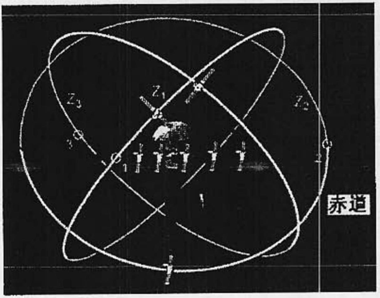
[0060] The period of the inclined synchronous orbit satellite is 24 hours, and the orbital inclination can be optimized.

[0062] For the situation of four inclined orbit satellites, the right ascension interval of the ascending node of the four sa...


PUM


Abstract

A transponder satellite communication navigation positioning system relates to the field of space technology. The system is equipped with a high-precision atomic clock at a ground communication navigation reference station, and the satellite orbit data is given by the satellite orbit determination system; the satellite integrity is given by the monitoring system The data forms the navigation message, and the ranging code composed of pseudo-random codes forms an integrated baseband signal, which is modulated by spread spectrum to form a navigation signal carrier, which is transmitted through the antenna and forwarded by 3 to 9 satellites in a certain geometric distribution in space The device converts the frequency and forwards the downlink, and broadcasts the signal to the coverage area; the ground user terminal receiving device receives the navigation signal carrier, and despreads and demodulates it to obtain the navigation data, thereby determining the position, speed and time of the user terminal receiving device. The invention has the advantages of low investment, guaranteed accuracy, convenient and flexible system maintenance and management, and dual functions of navigation and communication, so that the navigation and positioning accuracy can reach meter-level precision or be better than meter-level precision.

Description

Transponder satellite communication navigation and positioning system technical field [0001] The present invention relates to the field of space technology, particularly a satellite communication navigation positioning technology. Background technique Satellite navigation begins in the seventies in 20th century, and typical system has the Global Positioning System (GPS) that U.S. develops, former Soviet Union The global satellite radio navigation system (GLONASS) developed by the United States, etc., but there is no navigation and positioning system developed by my country. system. Contents of the invention The object of the present invention is to provide a kind of all-weather continuous use on the surface of the earth and in the air, precise positioning and navigation and timing of the new communication navigation positioning system. It is suitable for my country's national conditions, and has the advantages of less investment, high precision, short development cy...

Claims


Application Information

Patent Timeline
Patent Type & Authority Patents(China)
IPC IPC(8): G01C21/00H04B7/19G01S5/14
Inventor 艾国祥施浒立吴海涛颜毅华边玉敬胡永辉李志刚郭际蔡贤德
Owner NAT ASTRONOMICAL OBSERVATORIES CHINESE ACAD OF SCI
Learn More