
Traffic travel origin and destination identification method based on space-time clustering analysis algorithm

A cluster analysis, traffic travel technology, applied in the direction of road vehicle traffic control system, traffic flow detection, traffic control system, etc., can solve the problems of difficult organization, data quality cannot be reliably guaranteed, and strong randomness.

Inactive Publication Date: 2017-04-26
SOUTHWEST JIAOTONG UNIV
View PDF4 Cites 33 Cited by
  • Summary
  • Abstract
  • Description
  • Claims
  • Application Information

AI Technical Summary

Problems solved by technology

Its main disadvantages are as follows: 1. Respondents are unwilling to participate in the survey or the survey is too random, subjective memory bias and errors are common, and a lot of short-distance or short-term travel information is often missed, and the data quality cannot be reliably guaranteed; 2. The investigation process is cumbersome and difficult to organize. Usually, the traffic bureau, public security bureau, and sub-district office are required to coordinate and complete the survey of residents’ travel. The survey organization is difficult, and the questionnaire design, investigator training, Personnel organization and division of labor are cumbersome and require a lot of manpower and material resources
However, the corresponding threshold setting and rule setting of this type of method are mainly based on subjective experience and lack of corresponding data support. At the same time, this type of method does not consider the spatial distribution information of GPS track points, and the technical application range has certain limitations.

Method used


Image

  • Traffic travel origin and destination identification method based on space-time clustering analysis algorithm
  • Traffic travel origin and destination identification method based on space-time clustering analysis algorithm
  • Traffic travel origin and destination identification method based on space-time clustering analysis algorithm

Examples


specific Embodiment approach

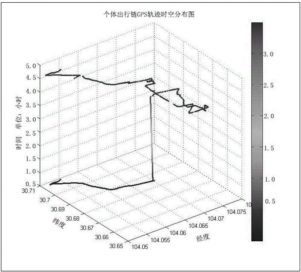
[0045] Specific embodiments: we have carried out data collection and algorithm application test in Chengdu, how to operate the present invention in detail.

[0046] Step 1: Mobile phone GPS positioning data collection and database creation

[0047] 1) Data collection: 30 volunteers in Chengdu installed mobile phone GPS collection software, traveled according to the designed travel route and collected data. In order to ensure the diversity and rationality of the data samples, the travel routes include daily commuting travel, non-commuting travel (including daily life, cultural entertainment and leisure, pick-up and drop-off, medical treatment, business, etc.), travel to and from school, etc. A total of 200 complete travel chain data were collected in the test, and volunteers recorded corresponding travel logs for later verification.

[0048] When collecting data, the user should turn on the data collection software to warm up 2-3 minutes before leaving home for a day, and ensu...


PUM


Abstract

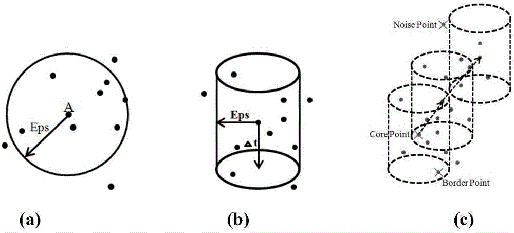
The invention discloses a traffic travel origin and destination identification method based on a space-time clustering analysis algorithm. A mobile phone GPS positioning instrument is used to collect the complete travel space-time positioning data of a resident in a day. The collected data is subjected to preprocessing, abnormal data is removed, and missing data is repaired. The space-time clustering analysis algorithm based on density is used to identify traffic travel origin and destination. A final traffic travel origin and destination identification result is formed according to different user and user travel time sequence statistics. The characteristics of high precision and continuous tracking of a travel path of mobile phone GPS positioning technology is fully utilized, the identification advantage of the space-time clustering analysis algorithm based on density is developed, the disadvantage of a traditional space-time clustering algorithm in identifying an actual travel endpoint is solved, and the resident traffic travel origin and destination information intelligent identification with the use of mobile phone positioning data is realized. The method can be used for large-scale automated resident traffic travel origin and destination information collection.

Description

technical field [0001] The invention belongs to the field of travel investigation of residents in traffic data collection, and in particular relates to a process for analyzing and processing mobile phone GPS positioning data by using a density-based spatio-temporal clustering analysis algorithm, so as to identify the spatio-temporal position information of the origin and destination of traffic trips in individual traffic trips with method. Background technique [0002] With the continuous development of social economy, the types and frequency of daily traffic trips of residents are increasing. What follows is that the traffic congestion in major cities is becoming more and more serious, which directly affects the social and economic development and the quality of residents' traffic travel. The acquisition of information on the origin and destination of residents’ traffic travel (that is, where residents go to) can provide an important basis for the analysis of the current s...

Claims


Application Information

Patent Timeline
IPC IPC(8): G08G1/01
CPCG08G1/0104
Inventor 杨飞周建尧戴露
Owner SOUTHWEST JIAOTONG UNIV
Learn More