
System for measuring inertial navigation by using big dipper and method for installing included angle by tachymeter

An inertial navigation system and a technology for an integrated navigation system, applied in the field of integrated navigation, can solve the problems that GPS signals cannot be blocked, it is difficult to use an inertial navigation system, and navigation errors accumulate.

Active Publication Date: 2017-01-11
CSSC MARINE TECH CO LTD
View PDF5 Cites 2 Cited by
  • Summary
  • Abstract
  • Description
  • Claims
  • Application Information

AI Technical Summary

Problems solved by technology

The downside is that an inertial navigation system is essentially a dead reckoning system, and navigation errors accumulate over time
[0006] The shortcoming of the first method is that it needs the assistance of landmark points, which limits the application scope of the integrated navigation system, and the calculated installation angle is a fixed value, and needs to be re-measured when the included angle changes; the shortcoming of the second method is that When installing angle estimation, the GPS signal cannot be blocked, which puts higher requirements on the driving environment of the vehicle, and the estimation time is longer; the third method requires the inertial navigation system to have high precision, which is difficult to use for low-to-medium precision inertial navigation in the system

Method used

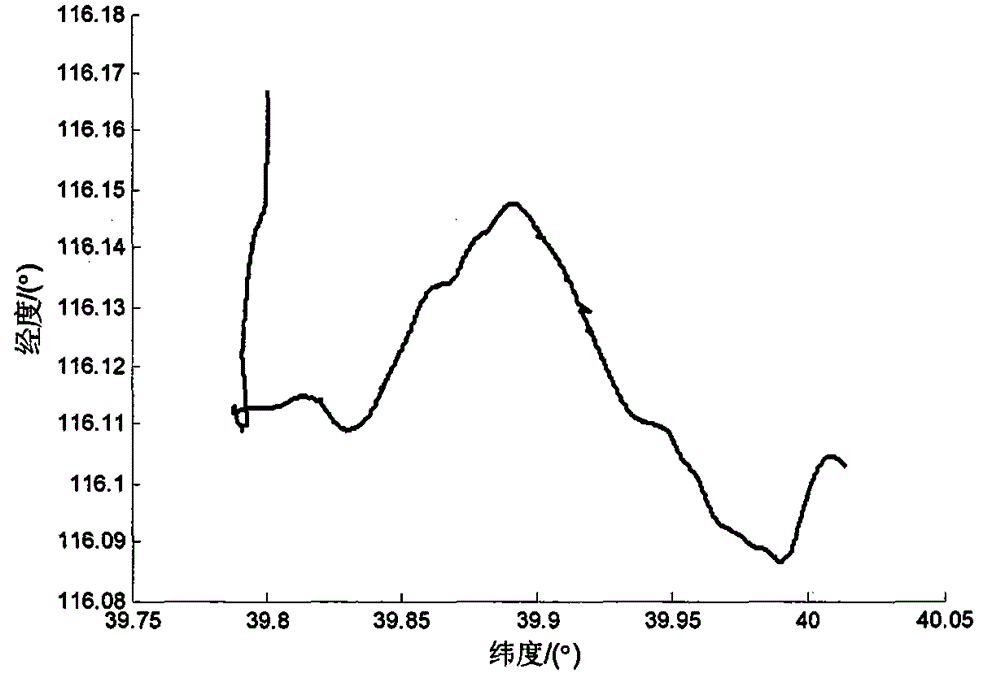
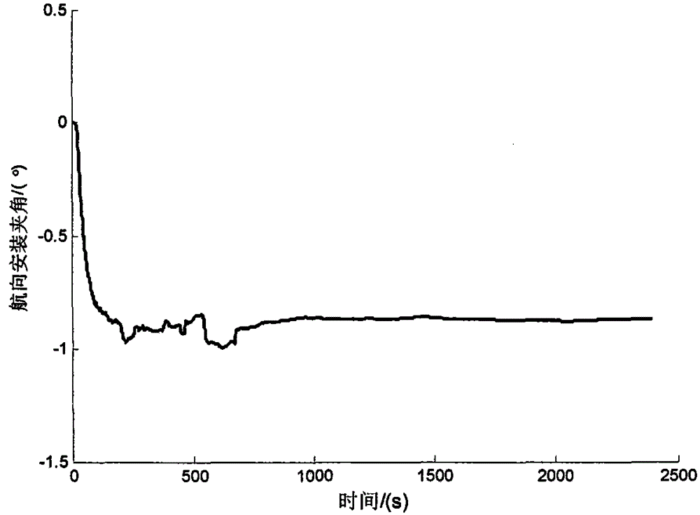
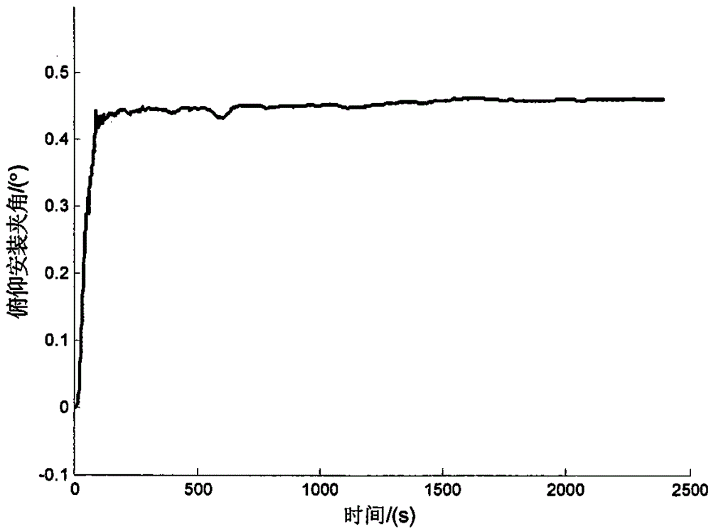

Image

  • System for measuring inertial navigation by using big dipper and method for installing included angle by tachymeter
  • System for measuring inertial navigation by using big dipper and method for installing included angle by tachymeter
  • System for measuring inertial navigation by using big dipper and method for installing included angle by tachymeter

Examples


Embodiment Construction

[0078] The technical key points of the present invention are: ① establish the relationship model between the installation angle error and the distance incremental error of the speedometer, and accurately model the observation matrix; ② calculate the carrier position increment according to the speed output of the Beidou receiver, and use The observation value is used to construct the integrated navigation system; ③A closed-loop feedback update method is used to realize the fast and accurate estimation of the installation angle between the inertial navigation system and the speedometer.

[0079] A method for measuring the installation angle between an inertial navigation system and a speedometer by using Beidou. The inertial navigation system is installed in the vehicle compartment, the Beidou receiver is installed on the roof of the vehicle, the speedometer is connected to the drive wheel bearing through a flexible shaft, and the inertial navigation system After the initial alig...


PUM


Abstract

The invention relates to a system for measuring inertial navigation by using a big dipper and a method for installing an included angle by a tachymeter, which are suitable for a combination navigation system formed by a big dipper receiver, an inertial navigation system and the tachymeter, and belong to the technical field of combination navigation. The technical key points are characterized in that 1) establishing a relation model of installation included angle and the tachymeter path increment error, accurately modeling an observation matrix; 2) according to the speed output of the big dipper receiver, calculating the carrier position increment which is used for constructing the observed value of the combination navigation system; and 3) employing a closed loop feedback updating mode, and realizing the rapid and accurate estimation of the inertial navigation system and the tachymeter installation included angle. By combining the big dipper receiver and the inertial navigation system information, compared with the single usage of the big dipper receiver or the inertial navigation system, the output information with higher precision can be obtained, so that the measurement of the installation included angle can be rapidly and accurately measured.

Description

technical field [0001] The invention relates to a method for measuring the installation angle between an inertial navigation system and a speedometer by using a Beidou, which is suitable for a combined navigation system composed of a Beidou receiver, an inertial navigation system and a speedometer, and belongs to the technical field of combined navigation. Background technique [0002] The inertial navigation system uses Newton's second law to perceive the angular motion and linear motion of the object through the measurement of the gravitational field and inertial force without relying on information such as external light, electromagnetic waves, sound waves, and magnetic fields, so as to realize the control of the carrier. navigation. Its advantages include comprehensive output information, independent work and strong anti-interference ability, etc. It has been widely used in land, sea, air and space fields. The downside is that an inertial navigation system is essentiall...

Claims


Application Information

Patent Timeline
IPC IPC(8): G01C1/00G01C21/16G01S19/45G01S19/47
CPCG01C1/00G01C21/165G01S19/45G01S19/47
Inventor 王清哲赵甲文白晓勇王宇王玉玺
Owner CSSC MARINE TECH CO LTD
Learn More