Real-time traffic monitoring method and system
A technology of real-time road conditions and users, applied in the field of communication, can solve the problems that users cannot actively choose to receive interested road sections, users cannot monitor road conditions in real time, users cannot intuitively understand real-time road conditions, etc., and achieve the effect of cheap technical means
- Summary
- Abstract
- Description
- Claims
- Application Information
AI Technical Summary
Problems solved by technology
Method used
Image
Examples
Embodiment 1
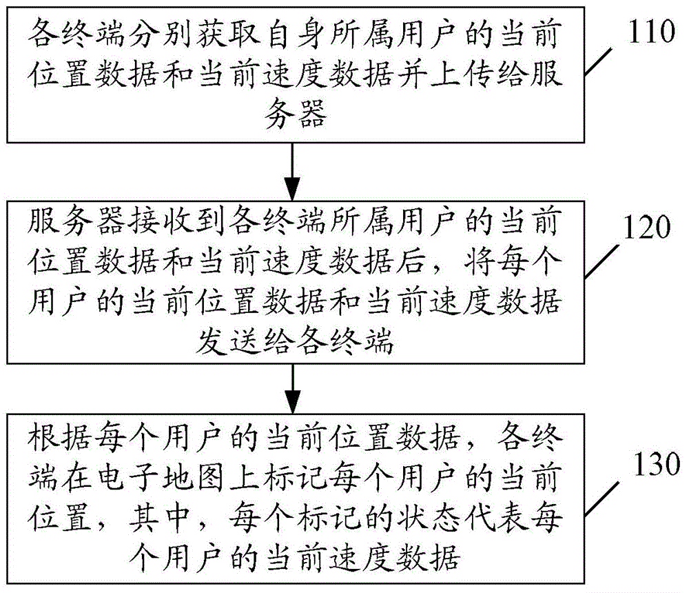
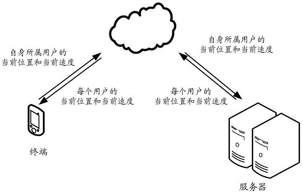
[0028] figure 1 and figure 2 A schematic diagram of the implementation flow of the real-time road condition monitoring method provided by Embodiment 1 of the present invention, as figure 1 As shown, the method includes:
[0029] Step 110: each terminal obtains the current location data and current speed data of its own user respectively and uploads them to the server.
[0030] Before step 110, the user to which each terminal belongs opens the electronic map on the terminal.
[0031] In step 110, each terminal acquires current location data and current speed data of its own user through a Global Positioning System (GPS, Global Positioning System).
[0032] Such as figure 2 As shown, each terminal uploads the current location data and current speed data of the user to which it belongs to the server through the network.
[0033] Step 120: After receiving the current location data and current speed data of the users to which each terminal belongs, the server sends the curre...
Embodiment 2
[0044] image 3 A schematic diagram of the composition and structure of the real-time road condition monitoring system provided by Embodiment 2 of the present invention, as image 3 As shown, the system includes:
[0045] The terminal 210 is used to obtain the current location data and current speed data of the user it belongs to and uploads to the server; it is also used to mark the current location of each user on the electronic map according to the current location data of each user, Wherein, the state of each mark represents the current speed data of each user. The terminal 210 is also used to obtain the current location data and current speed data of the user it belongs to through GPS.
[0046] The server 220 is configured to send the current position data and current speed data of each user to each terminal after receiving the current position data and current speed data of the users to which each terminal belongs.
[0047] Here, the mark is a dot. It should be noted...
PUM
 Abstract
Description
Claims
Application Information
 - Generate Ideas
- Intellectual Property
- Life Sciences
- Materials
- Tech Scout
- Unparalleled Data Quality
- Higher Quality Content
- 60% Fewer Hallucinations
Browse by: Latest US Patents, China's latest patents, Technical Efficacy Thesaurus, Application Domain, Technology Topic, Popular Technical Reports.
© 2025 PatSnap. All rights reserved.Legal|Privacy policy|Modern Slavery Act Transparency Statement|Sitemap|About US| Contact US: help@patsnap.com


