Method and device for acquiring undulating surface sugarcane acreage based on remote sensing image
A technology of undulating ground and remote sensing images, applied in measurement devices, optical devices, instruments, etc., can solve problems such as result error and low efficiency, and achieve the effect of fast fitting calculation and accurate data support
- Summary
- Abstract
- Description
- Claims
- Application Information
AI Technical Summary
Problems solved by technology
Method used
Image
Examples
Embodiment Construction
[0040] The specific embodiments of the present invention will be described in detail below in conjunction with the accompanying drawings, but it should be understood that the protection scope of the present invention is not limited by the specific embodiments.
[0041] Throughout the specification and claims, unless expressly stated otherwise, the term "comprise" or variations thereof such as "includes" or "includes" and the like will be understood to include stated elements and not to exclude other components.
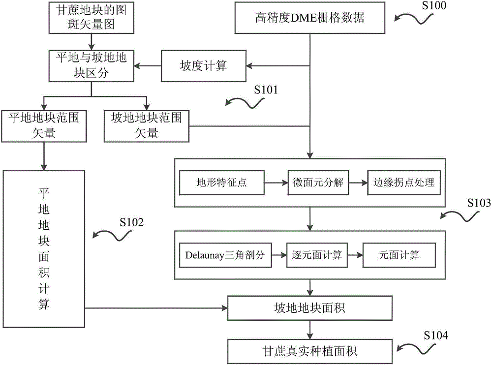
[0042] This embodiment proposes a method for calculating the real planting area of sugarcane that takes into account topographic features. According to the plane range vector obtained by remote sensing, combined with a high-precision digital elevation model (DEM), the terrain of sugarcane plots is judged, and through the important terrain and boundary features. Extraction to realize fast fitting calculation of real planting area of sugarcane.
[0043] figure 1 A...
PUM
 Abstract
Description
Claims
Application Information
 - Generate Ideas
- Intellectual Property
- Life Sciences
- Materials
- Tech Scout
- Unparalleled Data Quality
- Higher Quality Content
- 60% Fewer Hallucinations
Browse by: Latest US Patents, China's latest patents, Technical Efficacy Thesaurus, Application Domain, Technology Topic, Popular Technical Reports.
© 2025 PatSnap. All rights reserved.Legal|Privacy policy|Modern Slavery Act Transparency Statement|Sitemap|About US| Contact US: help@patsnap.com


