Oblique modeling data based two and three dimensional integration method and system
A modeling data, three-dimensional technology, applied in the field of geographic information systems, can solve the problems of inability to separate multiple scenes, application limitations, and independent models.
- Summary
- Abstract
- Description
- Claims
- Application Information
AI Technical Summary
Problems solved by technology
Method used
Image
Examples
Embodiment Construction
[0054] In order to make the above objects, features and advantages of the present application more obvious and comprehensible, the present application will be further described in detail below in conjunction with the accompanying drawings and specific implementation methods.
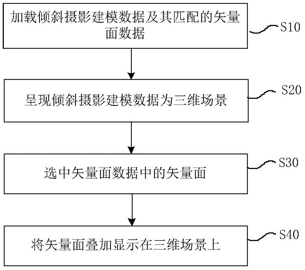
[0055] figure 1 It is a flow chart of an embodiment of the 2D and 3D integration method based on inclined modeling data of the present application, and the method includes:
[0056] In step S10, load oblique photographic modeling data and its matching vector surface data;
[0057] Oblique photography refers to images acquired by aerial cameras with a certain inclination angle. Oblique photography technology is a high-tech developed in the field of international surveying, mapping and remote sensing in recent years. By carrying multiple sensors on the same flight platform and collecting images from different angles such as vertical and oblique, more complete and accurate information on ground objects can...
PUM
 Abstract
Description
Claims
Application Information
 - R&D Engineer
- R&D Manager
- IP Professional
- Industry Leading Data Capabilities
- Powerful AI technology
- Patent DNA Extraction
Browse by: Latest US Patents, China's latest patents, Technical Efficacy Thesaurus, Application Domain, Technology Topic, Popular Technical Reports.
© 2024 PatSnap. All rights reserved.Legal|Privacy policy|Modern Slavery Act Transparency Statement|Sitemap|About US| Contact US: help@patsnap.com


