
Field winter wheat florescence remote sensing and yield estimating method

A technology of winter wheat and flowering period, which is applied in the field of crop growth monitoring, can solve the problems of limited sampling range and sample size, high cost of manpower and material resources, and difficulty for farmers to obtain economic benefits, so as to facilitate cognition and application, and save manpower and resources Effect of reduction in cost, actual investigation workload

Inactive Publication Date: 2014-10-29
JIANGSU ACADEMY OF AGRICULTURAL SCIENCES
View PDF3 Cites 8 Cited by
  • Summary
  • Abstract
  • Description
  • Claims
  • Application Information

AI Technical Summary

Problems solved by technology

[0004] For a long time, the traditional way of estimating winter wheat production has mainly relied on manual field sampling of wheat fields. Although it can accurately estimate winter wheat production in a small area, it is difficult to estimate winter wheat production in large areas at or above the county level. The estimation method not only requires a lot of manpower and material costs, but also because of the long sampling interval, limited sampling range and sample size, it is difficult to obtain large-scale yield data in time, which greatly affects the formulation of winter wheat management measures. Or the adjustment of grain policy, it is difficult to drive or guide farmers to obtain greater economic benefits

Method used


Image

  • Field winter wheat florescence remote sensing and yield estimating method

Examples


Embodiment Construction

[0015] Below in conjunction with accompanying drawing and embodiment example the present invention is described in further detail:

[0016] (1) During the flowering period of winter wheat in Dafeng City, query and order the environmental satellite remote sensing image of Dafeng City on April 26 (spatial resolution is 30 meters), the remote sensing image includes near-infrared band, red band, green band The four spectral bands of the blue light band and the blue light band meet the requirements of the satellite remote sensing image used in the present invention. After geometric correction and atmospheric correction preprocessing, it is ready for use;

[0017] (2) Synchronized with the satellite transit day, set up 15 ground monitoring points in Dafeng City, each ground monitoring point is positioned at the center of the winter wheat contiguous planting area greater than 100 m × 100 m, and collect the GPS information of the ground control points (for The preprocessing of remote...


PUM


Abstract

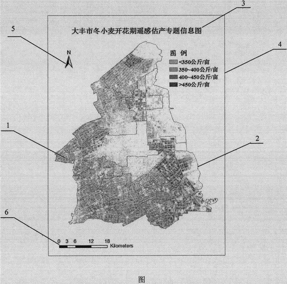
The invention discloses a field winter wheat florescence remote sensing and yield estimating method and belongs to the technical field of crop growth monitoring. The winter wheat florescence remote sensing and yield estimating method aims to solve the problems that a traditional field winter wheat yield estimating method consumes a great deal of manpower and time, the monitoring range and the sample size are limited, and forecasting information is delayed. According to the method, the yield of winter wheat can be estimated by utilizing three satellite remote sensing vegetation indexes comprising the normalization difference value vegetation index, the specific value vegetation index and the green vegetation index during the florescence of winter wheat. The method has the advantages that the satellite remote sensing data are utilized for estimating the yield of the field winter wheat, the quantitative relationship between the remote sensing spectral signature and the growth of the winter wheat is taken into consideration, and therefore the yield of the winter wheat can be estimated reasonably in time with large range and low cost, a formed winter wheat remote sensing and yield estimating thematic information map is large in information amount, visual, and easy to understand and use, and obvious reference effects of field winter wheat yield information recognizing and plantation planning are achieved.

Description

technical field [0001] The invention relates to a method for estimating the yield of field winter wheat, in particular to a method for estimating the yield of field winter wheat through remote sensing at the flowering stage, and belongs to the technical field of crop growth monitoring. Background technique [0002] Crop remote sensing yield estimation refers to the indirect estimation based on the principle of specific spectral characteristics of crops, on the basis of using remote sensing detection technology to obtain different spectral characteristics of crops at different growth stages, and based on the quantitative relationship and correlation between remote sensing spectral characteristic information and growth indicators. A range of methods for crop yields. [0003] Satellite remote sensing technology has the characteristics of fast, accurate, and low cost, and can obtain a wide range of farmland crop information in a timely manner, such as crop type, planting distrib...

Claims


Application Information

Patent Timeline
IPC IPC(8): G06F17/50
Inventor 李卫国王庆林
Owner JIANGSU ACADEMY OF AGRICULTURAL SCIENCES
Learn More