
A method for obtaining a clear scene map by combining accident close-up images and aerial images

An aerial image and scene graph technology, which is applied in the field of obtaining clear scene graphs from the fusion of accident close-up images and aerial images, can solve the problems of high shooting position, insufficient ability to distinguish information of small traces on the ground, and analysis of the causes of unfavorable accidents.

Inactive Publication Date: 2015-11-25
THE THIRD AFFILIATED HOSPITAL OF THIRD MILITARY MEDICAL UNIV OF PLA
View PDF3 Cites 0 Cited by
  • Summary
  • Abstract
  • Description
  • Claims
  • Application Information

AI Technical Summary

Problems solved by technology

[0002] Aerial images play an important role in traffic accident scene surveys. The two-dimensional equal-scale real scene map obtained through geometric correction and coordinate transformation can efficiently restore the elements of the accident scene. However, in order to obtain global information, the aerial images are often shot at a higher location. , so the ability to distinguish small traces on the ground is insufficient
In the current traffic accident scene survey, it is often necessary to photograph the details of the various elements of the accident. However, due to the arbitrary shooting angle and viewing range, the position of the photographed elements in the entire scene can only be roughly estimated by manual identification, which is not conducive to Follow-up accident analysis

Method used


Image

  • A method for obtaining a clear scene map by combining accident close-up images and aerial images
  • A method for obtaining a clear scene map by combining accident close-up images and aerial images
  • A method for obtaining a clear scene map by combining accident close-up images and aerial images

Examples


Embodiment Construction

[0035] Embodiments of the present invention are described in detail below, examples of which are shown in the drawings, wherein the same or similar reference numerals designate the same or similar elements or elements having the same or similar functions throughout. The embodiments described below by referring to the figures are exemplary only for explaining the present invention and should not be construed as limiting the present invention.

[0036] In describing the present invention, it should be understood that the terms "longitudinal", "transverse", "upper", "lower", "front", "rear", "left", "right", "vertical", The orientation or positional relationship indicated by "horizontal", "top", "bottom", "inner", "outer", etc. are based on the orientation or positional relationship shown in the drawings, and are only for the convenience of describing the present invention and simplifying the description, rather than Nothing indicating or implying that a referenced device or elem...


PUM


Abstract

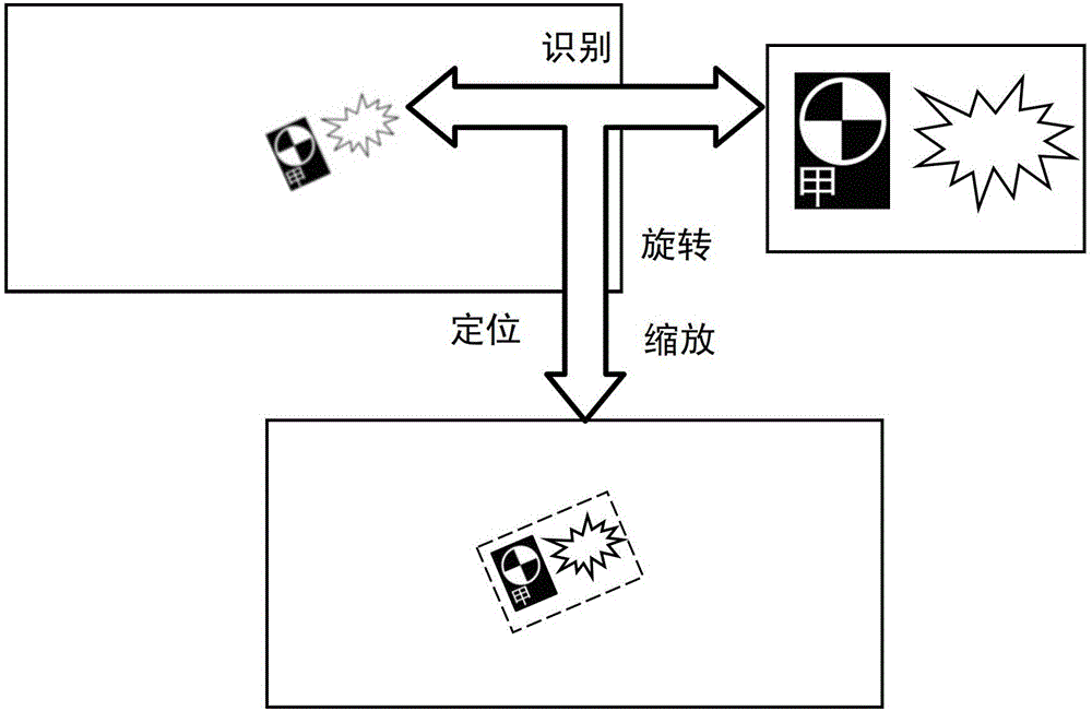
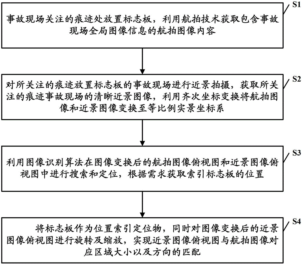
The invention provides a method for acquiring a distinct scene graph by fusing an accident close-range graph with an aerial image. The method comprises the following steps of S1, placing a marking plate at a considered trace position of an accident scene and acquiring aerial image contents containing global image information of the accident scene by using an aerial technology; S2, carrying out close-range photographing on the accident scene where the marking plate is placed at the considered trace position to acquire a distinct close-range image of the considered trace accident scene and transforming the aerial image and the close-range image to an equal-proportion live-action coordinate system by using homogeneous coordinate transformation; S3, searching and positioning in an aerial image top view and a close-range image top view which are subjected to image transformation by using an image recognition algorithm and acquiring the position of an index marking plate according to the requirement; S4, taking the marking plate as a position index positioning object, and meanwhile, rotating and zooming the close-range image top view subjected to the image transformation to realize the matching of the close-range image top view with a corresponding area of the aerial image in size and direction.

Description

technical field [0001] The invention relates to the technical field of traffic accident site information acquisition, and in particular to a method for obtaining a clear scene map by combining an accident close-up image with an aerial image. Background technique [0002] Aerial images play an important role in traffic accident scene surveys. The two-dimensional equal-scale real-scene scene map obtained through geometric correction and coordinate transformation can efficiently restore the elements of the accident scene. However, in order to obtain global information, the aerial images are often shot at a higher location. , so the ability to distinguish the finer trace information on the ground is insufficient. In the current traffic accident scene survey, it is often necessary to photograph the details of the various elements of the accident. However, due to the random shooting angle and viewing range, the position of the photographed elements in the entire scene can only be ...

Claims


Application Information

Patent Timeline
Patent Type & Authority Patents(China)
IPC IPC(8): G06T5/50G06T7/00
Inventor 尹志勇刘文君李奎王富平
Owner THE THIRD AFFILIATED HOSPITAL OF THIRD MILITARY MEDICAL UNIV OF PLA
Learn More