
Two-linear array space mapping camera and laser altimeter integral device

A laser altimeter and surveying and mapping camera technology, applied in the field of space remote sensing, can solve the problems of low surveying and mapping accuracy, large outer envelope size, etc., and achieve the effects of improving surveying and mapping accuracy, solid coordinate system relationship, and improved space utilization.

Inactive Publication Date: 2013-08-07
CHANGCHUN INST OF OPTICS FINE MECHANICS & PHYSICS CHINESE ACAD OF SCI
View PDF5 Cites 6 Cited by
  • Summary
  • Abstract
  • Description
  • Claims
  • Application Information

AI Technical Summary

Problems solved by technology

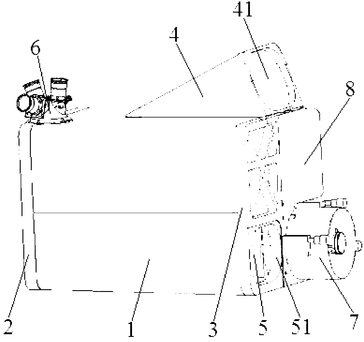
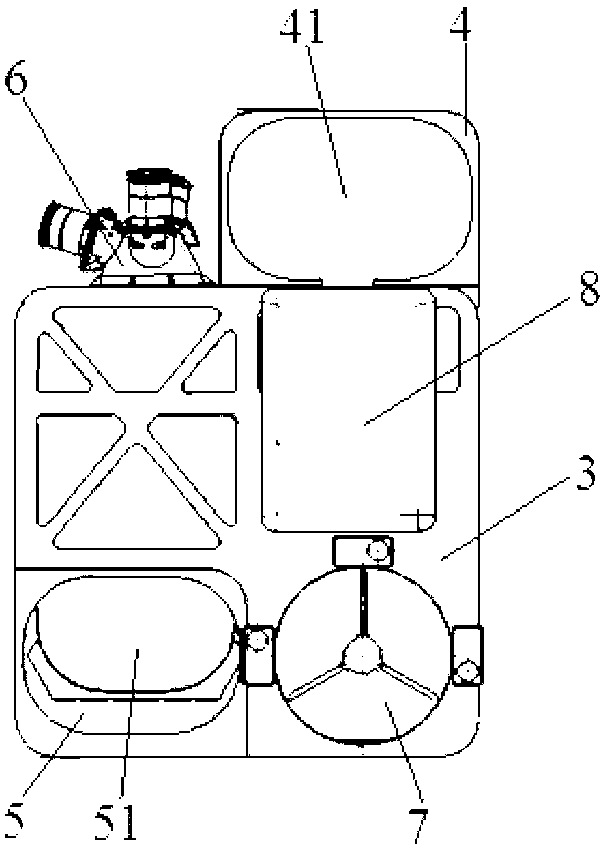
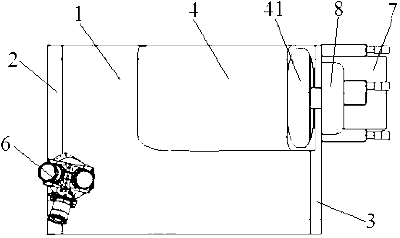
[0005] In order to solve the problems of large overall envelope size and low surveying and mapping accuracy existing in the existing split design of laser altimeter and camera, the present invention provides an integrated device of two linear array space surveying and mapping cameras and laser altimeter

Method used


Image

  • Two-linear array space mapping camera and laser altimeter integral device
  • Two-linear array space mapping camera and laser altimeter integral device
  • Two-linear array space mapping camera and laser altimeter integral device

Examples


Embodiment Construction

[0026] The present invention will be described in further detail below in conjunction with the accompanying drawings.

[0027] Such as figure 1 , figure 2 with image 3 As shown, the integrated device of two linear array space surveying and mapping cameras and a laser altimeter of the present invention is mainly composed of a housing 1, a rear substrate 2, a front substrate 3, a squint camera 4, a front camera 5, a star sensor 6, a laser Composed of an altimeter 7 and a closed cover 8, the casing 1 is a rectangular structure with openings at both ends, and the rear substrate 2 and the front substrate 3 are respectively fixed at the openings at both ends of the casing 1; the front substrate 3 is divided into four areas, which are respectively The upper left end, the lower left end, the upper right end and the lower right end, the upper left end area is provided with a lightweight hole; the main structure of the squint camera 4 is located inside the housing 1, and its main th...


PUM


Abstract

The invention discloses a two-linear array space mapping camera and laser altimeter integral device, and belongs to the field of space remote sensing. The device assists in solving the problems of large integral outer envelope size and low mapping precision of split design of a laser altimeter and a camera. The device comprises a housing, a front base plate and a back base plate respectively fixed on two ends of the housing, an oblique camera with a main body arranged in the housing, a straight camera arranged in the housing, a star sensor fixed on the outer surface of the housing and close to the edge of the back base plate, and a laser altimeter with a main body arranged in the housing. Main three lenses of the oblique camera are fixedly distributed on the right side of the back base plate, and an oblique incident hole is fixed on the outer surface of the housing and closes to the edge of the front base plate. Main three lenses of the straight camera are fixedly distributed on the left side of the back base plate, and a straight incident hole is fixed on a left-lower end of the front base plate. The part of the laser altimeter outside the housing is fixed on the right-lower end of the front base plate through screws. The integral device provided by the invention has the advantages of small outer envelope size and high mapping precision.

Description

technical field [0001] The invention relates to the technical field of space remote sensing, in particular to an integrated device of a two-line array space surveying and mapping camera and a laser altimeter. Background technique [0002] In addition to the high resolution of the space remote sensing mapping camera itself, the image positioning accuracy of the space high-precision mapping satellite is also a core element, which is mainly determined by the inner and outer orientation elements of the space remote sensing mapping camera. Although the inner azimuth elements can be obtained through ground geometric calibration, due to the influence of factors such as stress changes during launch and operation, the inner azimuth elements may change, resulting in mapping errors. [0003] The laser altimeter obtains the distance between the satellite and the ground by detecting the transit time of the laser echo, so as to complete the correction of the main distance of the camera to...

Claims


Application Information

Patent Timeline
IPC IPC(8): G01C11/02G01C5/00
Inventor 朱磊郭疆杨近松邵明东孙继明龚大鹏齐洪宇
Owner CHANGCHUN INST OF OPTICS FINE MECHANICS & PHYSICS CHINESE ACAD OF SCI
Learn More