
Method and apparatus for for analyzing tree canopies with LiDAR data

A data analysis, tree canopy technology, applied in the processing of LiDAR data to analyze the tree canopy field in the forest, can solve the problem of underestimation of the number of trees, overestimation of the number of trees, etc.

Inactive Publication Date: 2013-03-06
WEYERHAEUSER NR CO
View PDF7 Cites 3 Cited by
  • Summary
  • Abstract
  • Description
  • Claims
  • Application Information

AI Technical Summary

Problems solved by technology

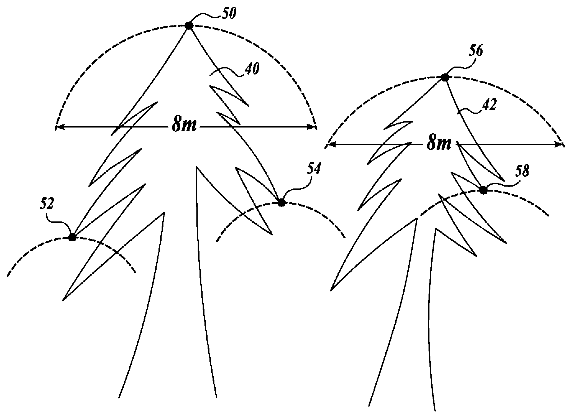
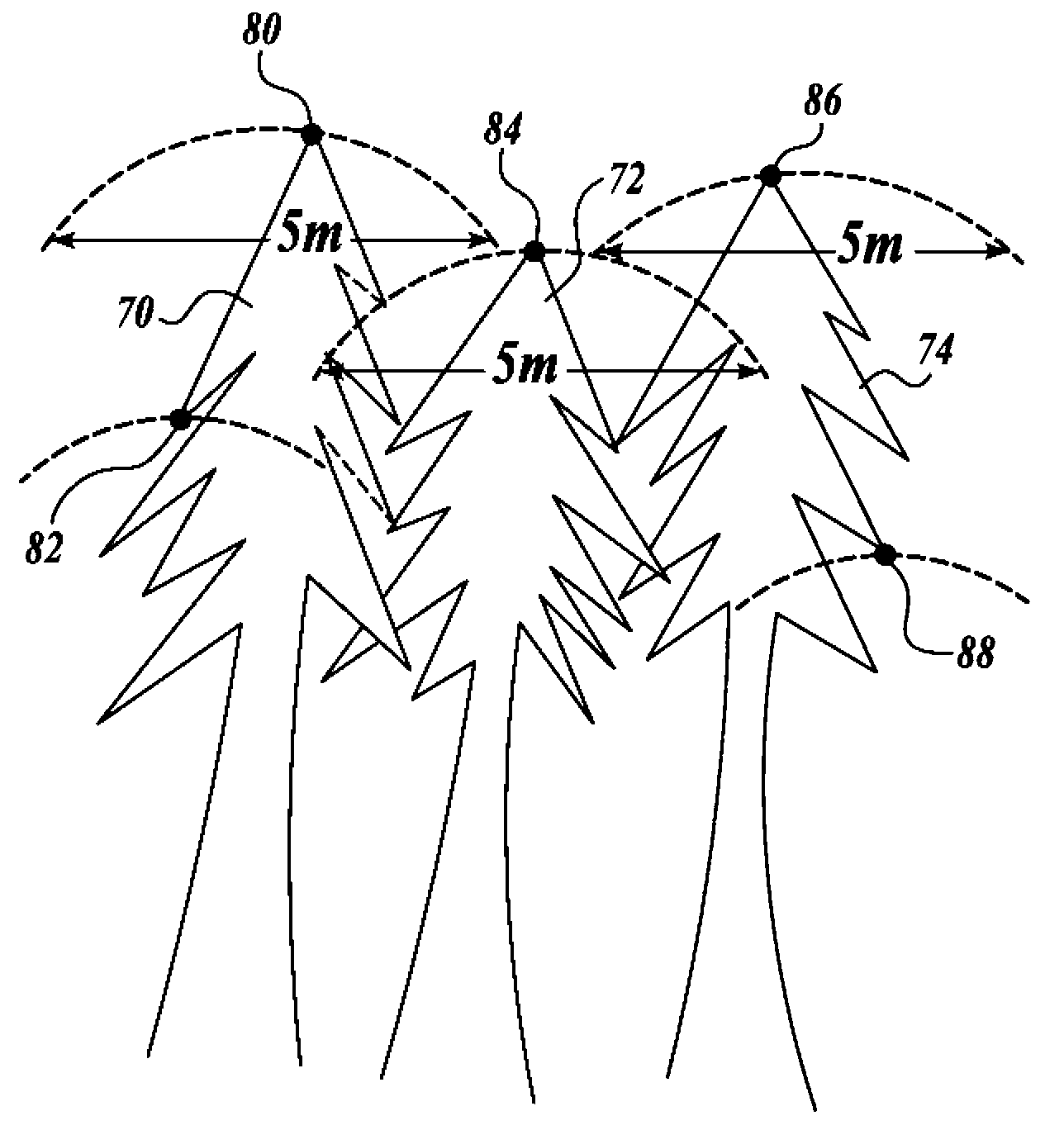
However, because tree sizes can vary significantly, it is difficult to know when a feature in the data is small enough to safely ignore
Therefore, erroneously seeing laser pulses that have reflected from the same trees may lead to an underestimation of the number of trees in the forest
Conversely, wrongly seeing laser pulses that have reflected from different trees can lead to an overestimation of the number of trees in the forest

Method used


Image

  • Method and apparatus for for analyzing tree canopies with LiDAR data
  • Method and apparatus for for analyzing tree canopies with LiDAR data
  • Method and apparatus for for analyzing tree canopies with LiDAR data

Examples


Embodiment Construction

[0019] As will be appreciated by those skilled in the art of remote sensing, LiDAR data is typically obtained by flying an aircraft, such as an airplane, helicopter, etc., in a series of parallel paths over a geographic area. The aircraft carries a LiDAR emission and detection unit that emits a series of laser pulses in a repeating back and forth scanning pattern. Some of the laser pulses are reflected back to the LiDAR detection unit in the vehicle. By knowing the position, altitude and velocity of the aircraft as well as the time between transmission and detection of the laser pulse and the angle at which the pulse was detected, the three-dimensional coordinates for each detected laser pulse can be determined and stored in a computer accessible read memory. In some cases, the intensity of each reflected laser pulse is also detected and stored. The three-dimensional coordinates of the reflected laser pulses form LiDAR data that is analyzed to determine information related t...


PUM


Abstract

A system and method for analyzing a canopy of a forest by analyzing the spatial uniformity of LiDAR data point heights in a number of areas surrounding a tree top, where the areas are smaller than the expected size of the crown of the tree. In one embodiment, the spatial uniformity is quantified as a canopy closure vector based on an analysis of the LiDAR data point heights in a frequency domain. In one particular embodiment, the standard deviation of the frequency components in the cells of a number of rings centered around the average value in an FFT output matrix is used to quantify the spatial uniformity.

Description

technical field [0001] The techniques disclosed herein relate to LiDAR data processing, and in particular to techniques for processing LiDAR data to analyze tree canopy in forests. Background technique [0002] One of the tasks of a forester or forest manager is to be able to accurately estimate the volume in the forest. In the past, volume estimation has been done by sending survey teams into the forest to obtain a sampling of tree measurements including tree height, diameter, spacing, and the like. Volume estimates are then made by extrapolating the collected sampling data to the size of the forest. While sampling-based volume estimates are generally accurate when the forest is relatively homogeneous, increasingly expensive and / or logistically limited sending survey teams to a sufficient number of sampled areas in large forests to obtain accurate data. [0003] To address this problem, remote sensing is being used as an alternative technique for obtaining sampled data fr...

Claims


Application Information

Patent Timeline
IPC IPC(8): G01B5/18G01S17/00G01S17/89
CPCG06K9/0063G01B5/0035G01S17/00G01S17/89A01G23/00G01S17/88G01B11/24G06V20/13
Inventor 杰弗里·J·韦尔蒂
Owner WEYERHAEUSER NR CO
Learn More