
Method for improving GPS (Global Positioning System) positioning precision on the basis of local positioning information

A technology of GPS positioning and positioning information, which is applied in the field of improving GPS positioning accuracy based on local positioning information, and can solve problems such as lack of global coordinates

Active Publication Date: 2013-02-13
WUXI TSINGHUA NAT LAB FOR INFORMATIONSCI & TECH INTERNET OF THINGS TECH CENT
View PDF2 Cites 24 Cited by
  • Summary
  • Abstract
  • Description
  • Claims
  • Application Information

AI Technical Summary

Problems solved by technology

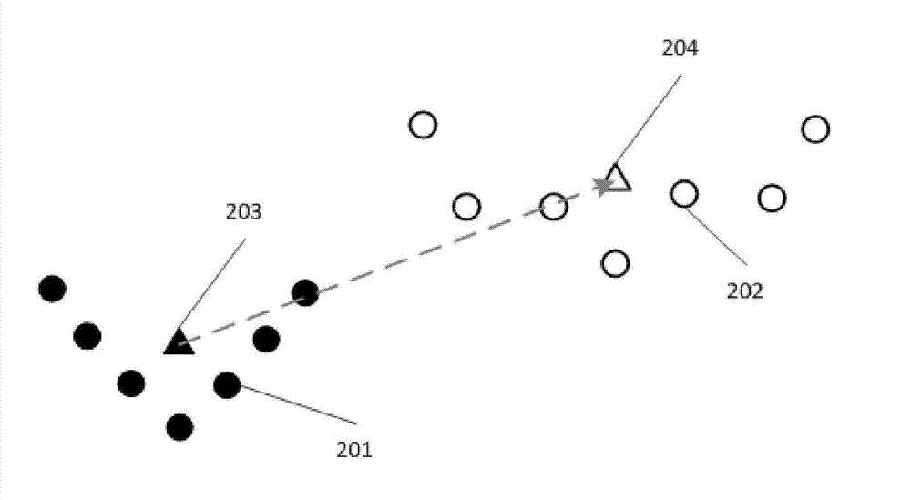
Inertial navigation technology captures the actions of smartphone users, calculates their displacement and direction, and thus calculates their position coordinates during their movement. It also provides relatively high-precision relative positioning information, but it does not have the meaning of global coordinates.

Method used


Image

  • Method for improving GPS (Global Positioning System) positioning precision on the basis of local positioning information
  • Method for improving GPS (Global Positioning System) positioning precision on the basis of local positioning information
  • Method for improving GPS (Global Positioning System) positioning precision on the basis of local positioning information

Examples


Embodiment Construction

[0039] In order to make the purpose, technical solution and advantages of the present invention clearer, the present invention will be further described below in conjunction with the accompanying drawings and embodiments.

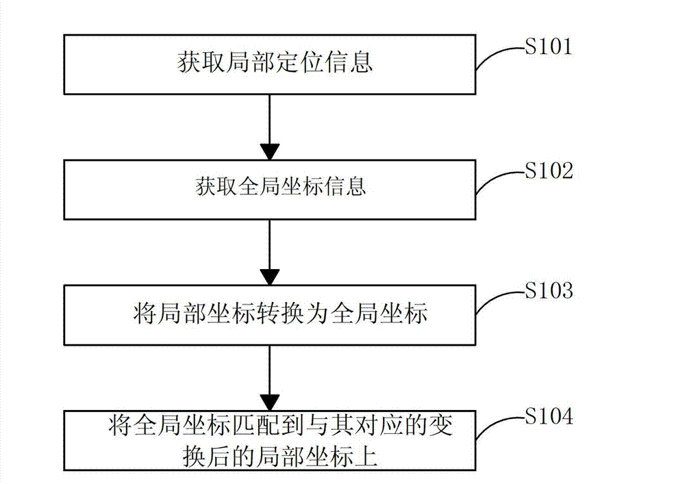
[0040] Please refer to figure 1 as shown, figure 1 It is a flowchart of a method for improving GPS positioning accuracy based on local positioning information provided by an embodiment of the present invention.

[0041] The method for improving GPS positioning accuracy based on local positioning information in this embodiment includes the following steps:

[0042] Step S101. Obtain local positioning information, which includes local positioning information of n nodes L={w 1 ,w 2 ,w 3 ,...,w n}, local coordinates w j =(u j ,v j ), n is a positive integer, and j is an integer between 1 and n.

[0043] Local positioning information can be measured by mobile phone inertial navigation technology, and can also be obtained through wireless ad hoc networks...


PUM


Abstract

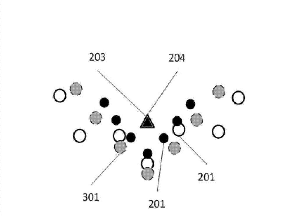
The invention discloses a method for improving GPS (Global Positioning System) positioning precision on the basis of local positioning information. The method comprises the following steps of: A, obtaining local positioning information; B, obtaining global coordinate information through a GPS unit; C, transforming local coordinates into global coordinates; and D, matching the global coordinates to the corresponding transformed local coordinates to complete the correction of the global coordinates. Compared with the traditional GPS reinforcement system, the invention has the advantages that infrastructures such as a mobile phone base station in a fixed reference point with an accurate position are not needed to be known, and special devices such as a communication network are not needed for sharing data, by means of a mobile phone inertial navigation technology or local positioning information provided by a self-organizing network, through a series of coordinate transformation, the GPS positioning precision is improved, configuration and application are easily realized, and the method can be popularized to wider applications such as indoor positioning.

Description

technical field [0001] The invention relates to the technical field of positioning, in particular to a method for improving GPS positioning accuracy based on local positioning information. Background technique [0002] Since it was put into use in 1964, the Global Positioning System (GPS) has played a pivotal role in various industries such as aerospace and navigation, road transportation, industrial production, and precision agriculture, and even promoted technological changes in many fields. Since the beginning of the 21st century, with the popularity of smart phones and the integration of GPS positioning modules in smart phones, GPS has begun to enter thousands of households, changing the working style and living habits of countless smart phone users. Location-based services, such as location check-in on social networks, location-based advertising or information push, location-based social networking, etc., have quietly penetrated into the daily lives of many ordinary cit...

Claims


Application Information

Patent Timeline
IPC IPC(8): G01S19/47
Inventor 吴陈沭杨铮刘云浩
Owner WUXI TSINGHUA NAT LAB FOR INFORMATIONSCI & TECH INTERNET OF THINGS TECH CENT
Learn More