
Multi-imaging satellite emergency task dynamic scheduling method

A dynamic scheduling and multi-imaging technology, applied in special data processing applications, instruments, electrical digital data processing, etc., can solve the problem that there is no public report on the dynamic scheduling method of multi-imaging satellite emergency tasks

Active Publication Date: 2015-05-13
NAT UNIV OF DEFENSE TECH
View PDF0 Cites 1 Cited by
  • Summary
  • Abstract
  • Description
  • Claims
  • Application Information

AI Technical Summary

Problems solved by technology

How to schedule emergency tasks under the condition of limited imaging satellite resources and maximize the satisfaction of user needs is a technical issue that technicians in the field pay great attention to. Although there are some researches on satellite task scheduling, there is no multi-imaging satellite emergency task dynamics. There are no public reports on scheduling methods, especially the method of dynamic scheduling of emergency tasks for multi-imaging satellites using task synthesis, repair and time slot construction.

Method used


Image

  • Multi-imaging satellite emergency task dynamic scheduling method
  • Multi-imaging satellite emergency task dynamic scheduling method
  • Multi-imaging satellite emergency task dynamic scheduling method

Examples


Embodiment Construction

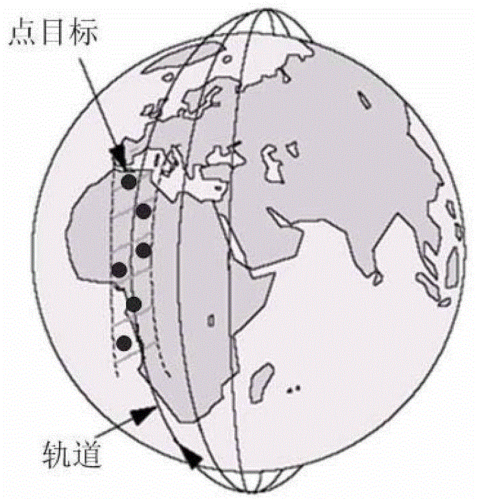
[0142] figure 1 is the schematic diagram of point target imaging. figure 1 The black dot in the middle represents the point target that can be observed within a field of view of the satellite sensor, and the dotted shaded part represents the coverage of the sensor when the side swing of the satellite is considered.

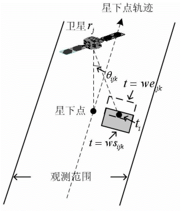
[0143] figure 2 is a schematic diagram of the imaging opportunity. The dotted line with arrow indicates the satellite resource r j The track of the sub-satellite point, the direction of the arrow indicates the direction of satellite movement; the observation range is the maximum visible range of the satellite after considering the side swing of the satellite; the sub-satellite point is the current projected position of the satellite on the earth’s surface, θ ijk is the roll angle of the satellite. The solid shaded box in the figure is the satellite sensor at t=ws ijk time, the roll angle is θ ijk Under the condition, in the field of view of the earth's surf...


PUM


Abstract

The invention discloses a multi-imaging satellite emergency task dynamic scheduling method. In order to solve the technical problem, the multi-imaging satellite emergency task dynamic scheduling method is invented to realize a scheduling target on the premise of satisfying the limitation. According to the technical scheme, the multi-imaging satellite emergency task dynamic scheduling method comprises the steps of: synthesizing adjacent target unit tasks located in one field range of a satellite sensor based on task classification; if the allocation of the synthesized tasks is failed, taking out the unit task with the maximum priority in the synthesized tasks through a restoration way for synthesis to therefore decompose the task into a synthesized task and an independent task with more imaging chances; meanwhile, establishing an available time slot in a new task insertion process; moving tasks in a waiting queue backwards; and obtaining a time slot satisfying with the implementation of newly inserted task when the waiting tasks are executable, thereby further improving a scheduling efficiency. By the adoption of the multi-imaging satellite emergency task dynamic scheduling method, tasks can be synthesized, the performing sequence and the performing time of the tasks are adjusted dynamically, imaging time of the satellite is reduced, and accomplishment rate and schedulability of the tasks are improved.

Description

technical field [0001] The invention relates to a dynamic scheduling method for multi-imaging satellite emergency tasks, in particular to a method for dynamically scheduling emergency tasks for multi-imaging satellites through task synthesis, repair and time slot construction. Background technique [0002] Imaging satellites are satellite platforms equipped with optical sensors to image specific areas of the earth's surface according to user needs. Imaging satellites have the advantages of wide coverage, long continuous monitoring time and no airspace and national boundaries. They are widely used in earth resource survey, battlefield situation reconnaissance, natural disaster monitoring and other fields. At the same time, satellite imaging has become an important means of obtaining ground information under emergency conditions. For example, when an earthquake occurs, in order to conduct disaster assessment and rescue and relief in time, users expect to obtain image data of ...

Claims


Application Information

Patent Timeline
Patent Type & Authority Patents(China)
IPC IPC(8): G06F19/00
Inventor 朱晓敏王建江马满好祝江汉邱涤珊
Owner NAT UNIV OF DEFENSE TECH
Learn More