
Navigation system, navigation method, and computer-readable storage medium

A technology of navigation system and evaluation interval, which is applied in the field of navigation system and can solve problems such as deterioration of user identification and reduction of marks at mutual intervals.

Active Publication Date: 2013-01-09
AISIN AW CO LTD
View PDF8 Cites 9 Cited by
  • Summary
  • Abstract
  • Description
  • Claims
  • Application Information

AI Technical Summary

Problems solved by technology

Therefore, when displaying a mark indicating the on / off state of the fuel economy indicator on the map to indicate the time-series change in the state of the fuel economy indicator on / off, the map The smaller the scale, that is, the wider the display area of ​​the map, the smaller the interval between the markers and the overlap between the markers, there is a possibility that the user's visibility will be deteriorated

Method used

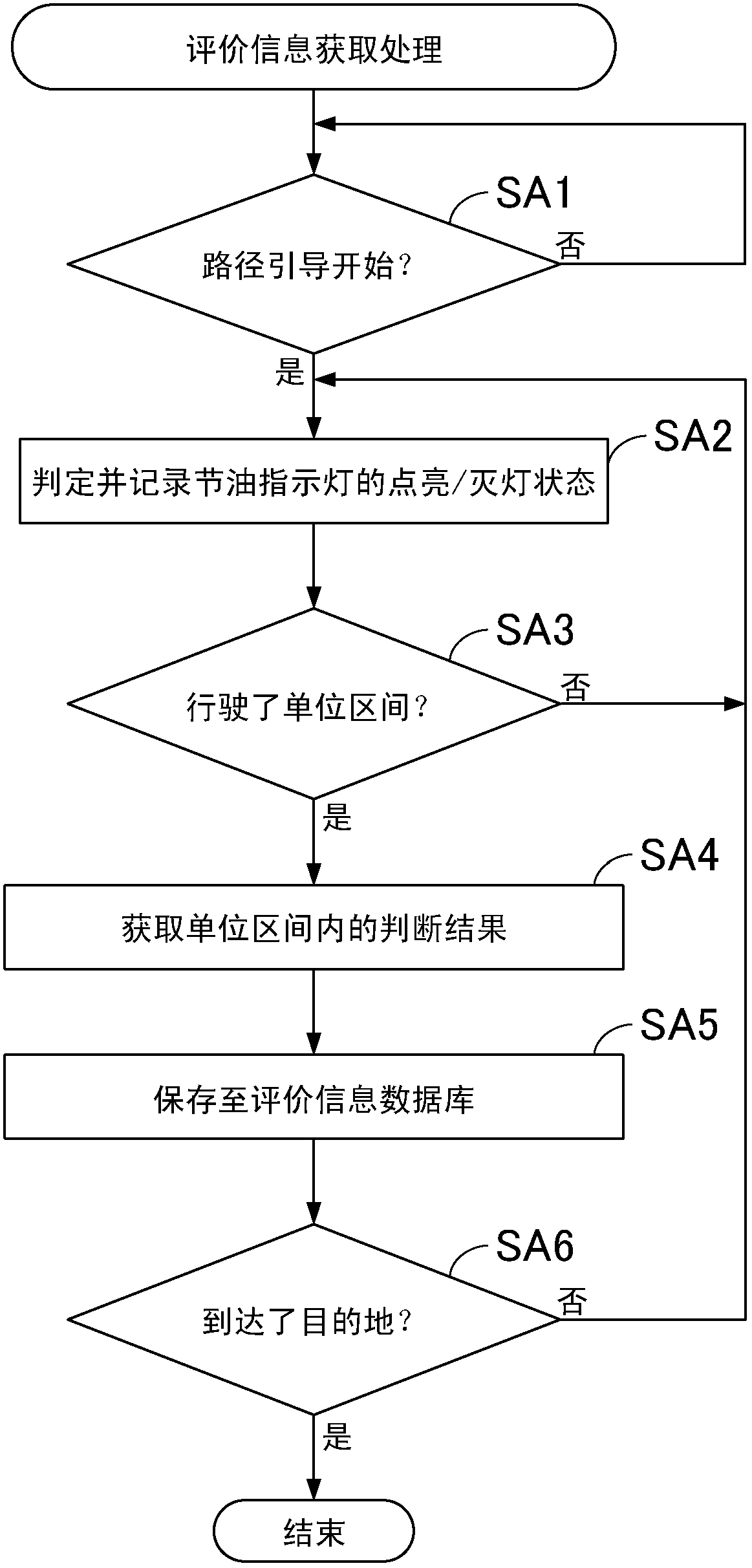
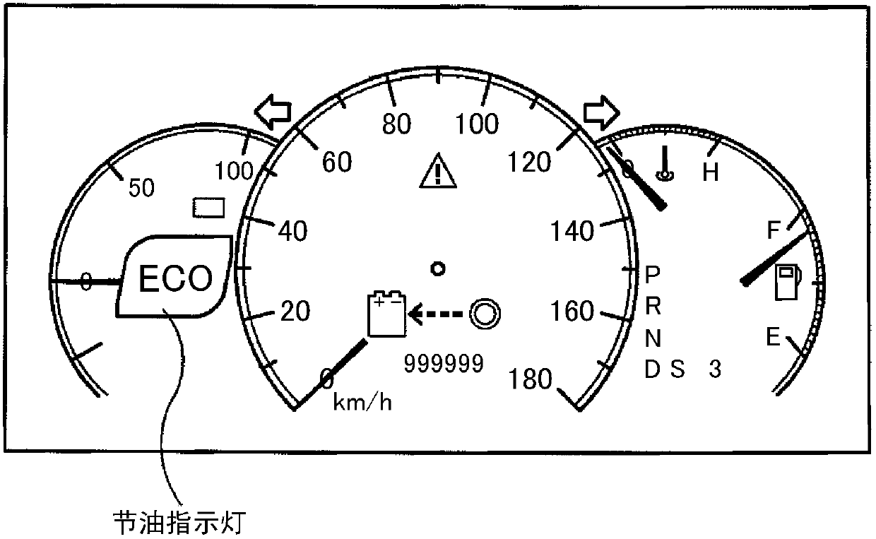

Image

  • Navigation system, navigation method, and computer-readable storage medium
  • Navigation system, navigation method, and computer-readable storage medium
  • Navigation system, navigation method, and computer-readable storage medium

Examples


Embodiment Construction

[0020] Hereinafter, embodiments of the navigation system, navigation method, and navigation program (computer-readable storage medium) of the present invention will be described in detail with reference to the accompanying drawings. However, this embodiment is not intended to limit the present invention.

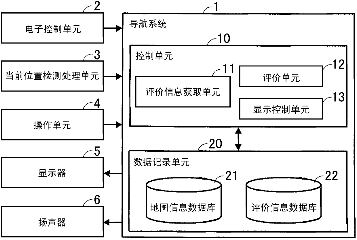
[0021] First, the configuration of the navigation system will be described. figure 1 It is a block diagram illustrating the navigation system of this embodiment. The navigation system 1 is mounted on a vehicle, for example. Such as figure 1 As shown, a navigation system 1 is connected to an ECU (Electronic Control Unit: Electronic Control Unit) 2 , a current position detection processing unit 3 , an operation unit 4 , a display 5 and a speaker 6 .

[0022] The ECU 2 monitors the status of each part of the vehicle using various sensors, and controls each part of the vehicle, such as a power system such as an engine or a motor-generator, a transmission, a drive system, and ...


PUM


Abstract

Navigation systems, methods, and programs acquire evaluation information for each unit interval having a predetermined distance, the evaluation information being an index for evaluating a driver's driving operation of a vehicle, and determine based on a first scale of a map displayed on a display unit, a first distance of an evaluation interval for evaluating the driver's driving operation. The systems, methods, and programs evaluate the driver's driving operation in the evaluation interval having the first distance based on the evaluation information for each unit interval included in the evaluation interval, and display the evaluation result at a position corresponding to the evaluation interval on the map displayed on the display unit.

Description

[0001] The entire disclosure of Japanese Patent Application No. 2011-148878 filed on Jul. 5, 2011 including specification, drawings and abstract is hereby incorporated by reference. technical field [0002] The present invention relates to a navigation system, a navigation method and a computer-readable storage medium. Background technique [0003] Conventionally, a navigation system that guides the travel route of a vehicle is used. In recent years, there has been an increasing demand for fuel-efficient travel from the standpoint of saving fuel and protecting the environment, and navigation systems that provide guidance for reducing fuel consumption during vehicle travel have also been proposed. [0004] For example, a portable device and a vehicle system have been proposed (for example, refer to Japanese Patent Application Laid-Open No. 2010-182108), in which the driving state information of the vehicle and the fuel-saving instruction in the driving state are sequentially ...

Claims


Application Information

Patent Timeline
Patent Type & Authority Applications(China)
IPC IPC(8): G01C21/34G01C21/26
CPCG01C21/3697Y02T10/84B60K35/28B60K2360/174
Inventor 三浦直树野野村纯一
Owner AISIN AW CO LTD
Learn More