Method for building CSG (Constructive Solid Geometry) model according to laser radar grid point cloud
A grid point cloud and laser radar technology, applied in the field of building CSG models, can solve the problems of large data volume of 3D models, difficult data visualization and other problems, and achieve the effect of improving efficiency
- Summary
- Abstract
- Description
- Claims
- Application Information
AI Technical Summary
Problems solved by technology
Method used
Image


Examples
Embodiment Construction
[0048] The present invention will be further described in detail below in conjunction with the accompanying drawings, so that those skilled in the art can implement it with reference to the description.
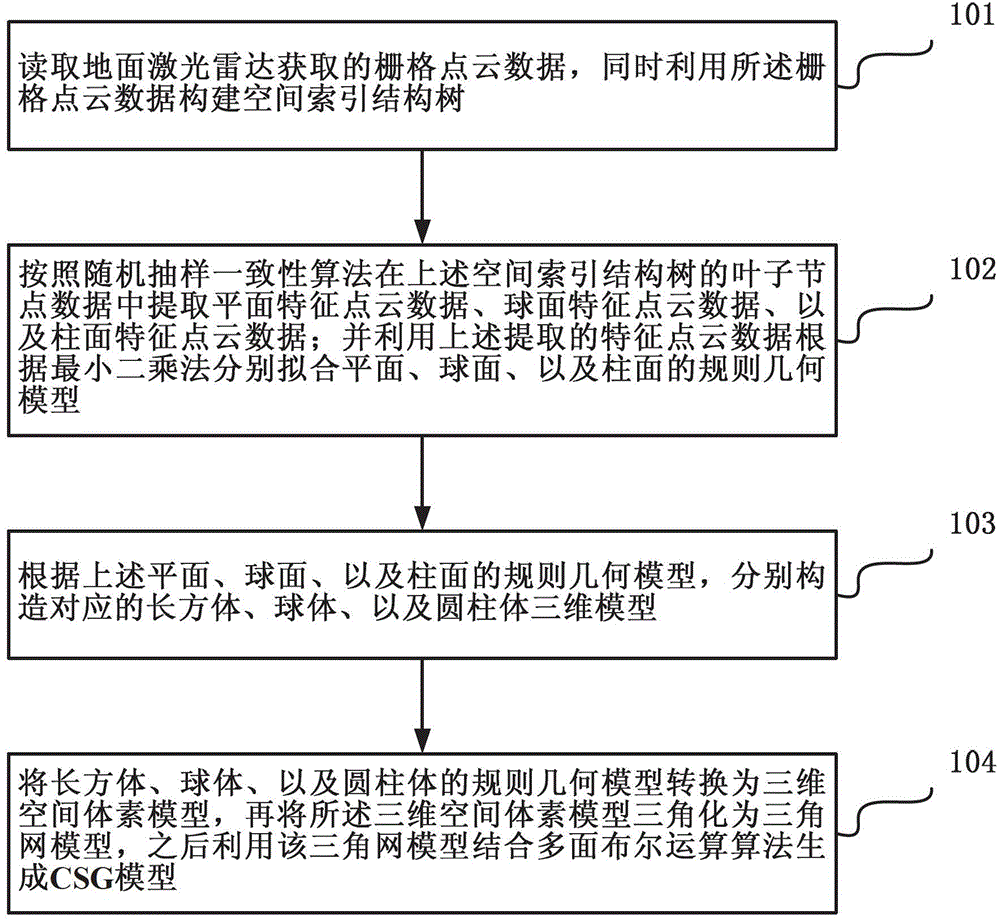
[0049] Such as figure 1 As shown, the method for constructing a CSG model according to the laser radar grid point cloud according to the present invention includes the following steps:
[0050] Step 101, read the grid point cloud data acquired by the ground laser radar, and use the grid point cloud data to construct a spatial index structure tree.
[0051] In the present invention, the data of the leaf nodes of the spatial index structure tree includes the three-dimensional minimum outer box information of the node, the two-dimensional row and column number outer rectangle information, the node name identification information, the identification information of the node storage point coordinates, and the three-dimensional coordinate offset parameter information.
[0052] In ...
PUM
 Abstract
Description
Claims
Application Information
 - R&D
- Intellectual Property
- Life Sciences
- Materials
- Tech Scout
- Unparalleled Data Quality
- Higher Quality Content
- 60% Fewer Hallucinations
Browse by: Latest US Patents, China's latest patents, Technical Efficacy Thesaurus, Application Domain, Technology Topic, Popular Technical Reports.
© 2025 PatSnap. All rights reserved.Legal|Privacy policy|Modern Slavery Act Transparency Statement|Sitemap|About US| Contact US: help@patsnap.com