Eureka AIR delivers breakthrough ideas for toughest innovation challenges, trusted by R&D personnel around the world.

3D navigation methods using nonphotorealistic (NPR) 3D maps

一种非真实感、导航地图的技术,应用在3D图像的加工、导航、测绘与导航等方向,能够解决没公开也没暗示等问题,达到减少地图更新、提高方位感、减少地图更新的需求的效果

Inactive Publication Date: 2012-08-15
ROBERT BOSCH GMBH
View PDF6 Cites 4 Cited by
  • Summary
  • Abstract
  • Description
  • Claims
  • Application Information

AI Technical Summary

Problems solved by technology

[0003] The prior art neither discloses nor suggests methods for presenting renderings of buildings, landmarks, and other 3D objects on a navigation map in a compact manner (without unnecessary detail) so that users can easily associate these renderings with others. observed real-life scenarios and require only a low level of computing resources to generate these renderings

Method used


Image

  • 3D navigation methods using nonphotorealistic (NPR) 3D maps
  • 3D navigation methods using nonphotorealistic (NPR) 3D maps
  • 3D navigation methods using nonphotorealistic (NPR) 3D maps

Examples


Embodiment Construction

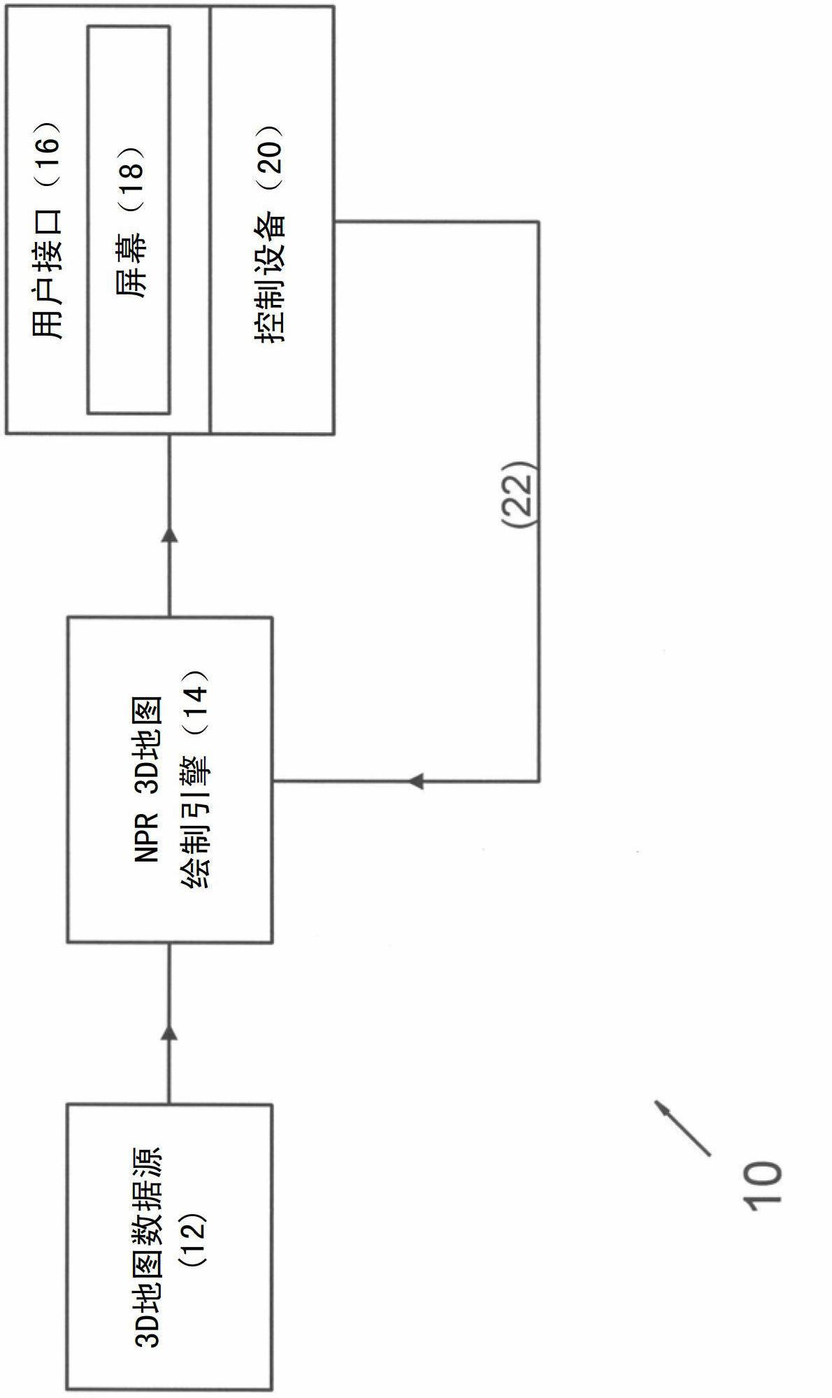
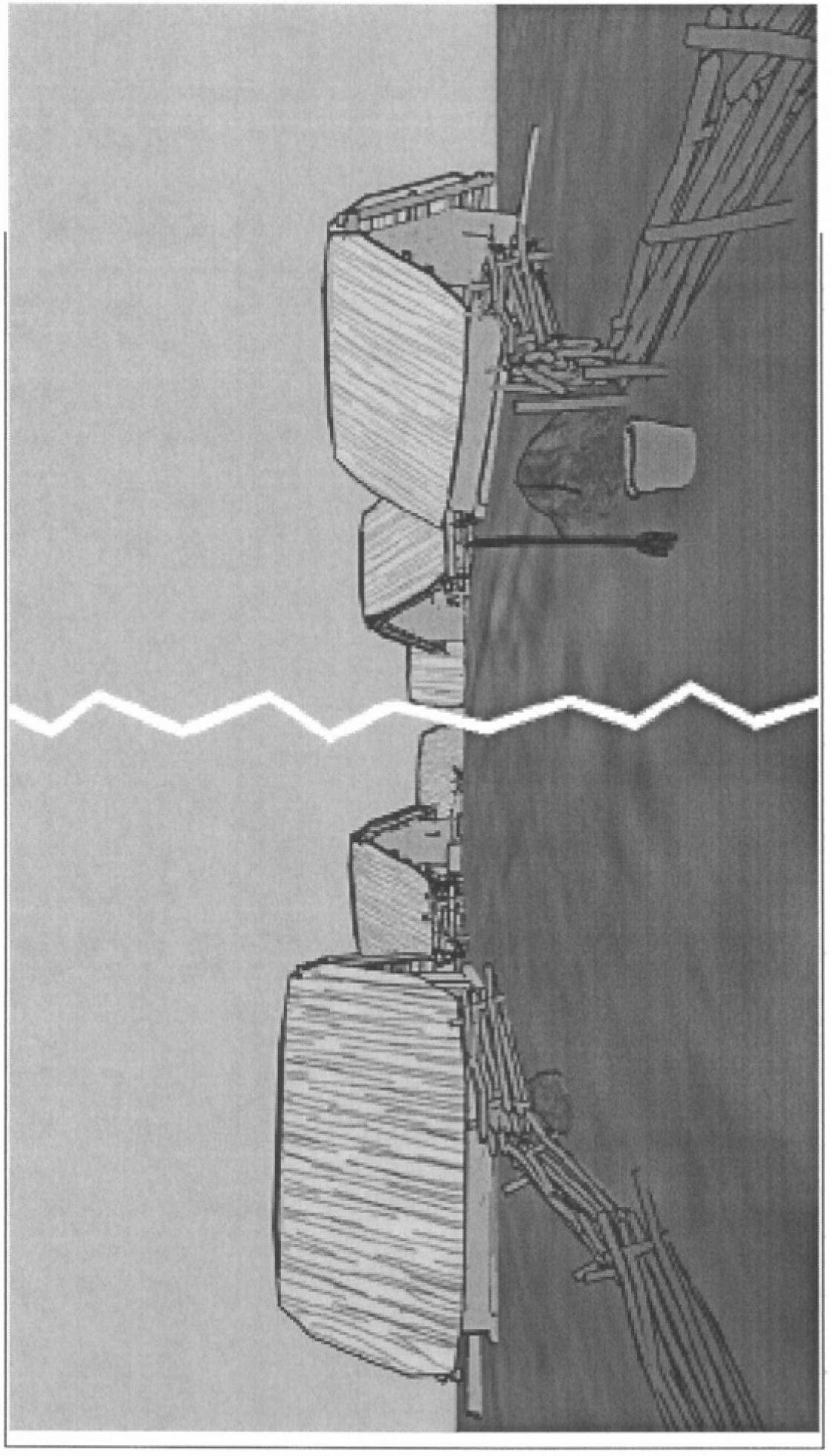
[0021] The present invention may provide a method of 3D navigation using an NPR 3D map, including stylized presentation of 3D objects in the navigation map. 3D objects displayed on the 3D navigation map may include buildings, landmarks, POIs, hazard points, and roads. The NPR 3D map can be generated based on 3D object data generated in different ways. Data providers may provide 3D data in a format suitable only for photorealistic rendering (eg, polygonal meshes with realistic textures). In this case, such data can be enhanced for NPR rendering. In addition, for stylized NPR rendering, 3D data can also be generated by reconstructing 2D data. For example, 3D building data may be generated from a 2D outline of a building without or with additional information (eg, type of building, height of building, etc.). In this process, specific rules may be applied based on the type of 3D buildings so that the styles or appearances of buildings of the same type are consistent. For examp...


PUM


Abstract

A method of displaying a navigation map includes automatically determining a location of a vehicle. Three-dimensional or 2D data associated with buildings surrounding the vehicle is identified. A nonphotorealistic image of 3D objects around the vehicle is rendered based on the data. The nonphotorealistic image is electronically displayed to a user.

Description

technical field [0001] The present invention relates to electronic navigation maps, and more particularly, the present invention relates to rendering images for use in electronic navigation maps. Background technique [0002] Because navigation maps visually mark landmarks and other points of interest (POIs) such as museums, restaurants, parks, and business districts, these maps are an important resource for travelers to unfamiliar cities. While most in-vehicle and portable navigation devices (PNDs) rely on two-dimensional (2D) navigation maps to visualize these landmarks and POIs in 2D, three-dimensional (3D) in-vehicle navigation systems are also emerging. Most of these 3D navigation systems use photorealistic rendering techniques to visualize 3D buildings, landmarks and POIs. In this rendering scheme, precise geometric models and detailed photorealistic architectural textures are required. These systems require that the rendering of these rendered 3D buildings, roads or...

Claims


Application Information

Patent Timeline
Patent Type & Authority Applications(China)
IPC IPC(8): G01C21/36G09B29/10G06T15/02
CPCG01C21/3638G06T15/02G06T19/00
Inventor 任骝
Owner ROBERT BOSCH GMBH
Why Eureka
Eureka Blog
Learn More