Satellite navigation pedometer
A satellite navigation and pedometer technology, applied in surveying and navigation, road network navigator, instrument, etc., can solve the problem of inability to accurately determine the amount of exercise
- Summary
- Abstract
- Description
- Claims
- Application Information
AI Technical Summary
Problems solved by technology
Method used
Image
Examples
Embodiment Construction
[0031] In the following, embodiments of the satellite navigation pedometer according to the present invention will be described with reference to related drawings. For ease of understanding, the same components in the following embodiments are described with the same symbols.
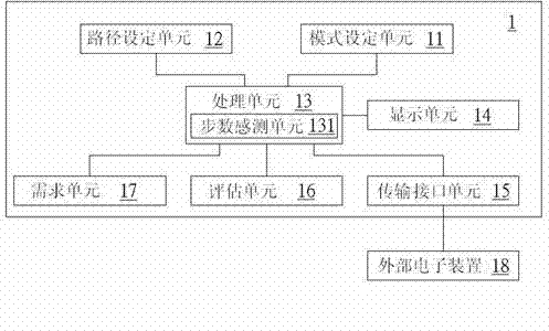
[0032] see figure 1 , which is a block diagram of the satellite navigation pedometer 1 of the present invention, which includes a mode setting unit 11, a path setting unit 12, a processing unit 13, a display unit 14, a transmission interface unit 15, a demand unit 16 and an evaluation unit 17, The processing unit 13 further includes a step count sensing unit 131 .
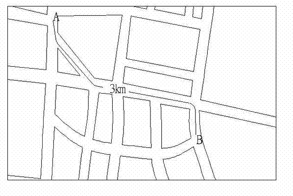
[0033] Wherein, the mode setting unit 11 provides an input of an exercise mode, and the exercise mode is one of walking, running or cycling, and transmits the input exercise mode to the path setting unit 12 by the processing unit 13 . The path setting unit 12 provides a motion path according to the motion start point, the end point and the ...
PUM
 Abstract
Description
Claims
Application Information
 - R&D
- Intellectual Property
- Life Sciences
- Materials
- Tech Scout
- Unparalleled Data Quality
- Higher Quality Content
- 60% Fewer Hallucinations
Browse by: Latest US Patents, China's latest patents, Technical Efficacy Thesaurus, Application Domain, Technology Topic, Popular Technical Reports.
© 2025 PatSnap. All rights reserved.Legal|Privacy policy|Modern Slavery Act Transparency Statement|Sitemap|About US| Contact US: help@patsnap.com


