Method for communicating with GPS (Global Positioning System) terminal in designated area and server
A GPS terminal and designated area technology, applied in the directions of instruments, satellite radio beacon positioning systems, measuring devices, etc., can solve the problems of poor scalability, single function of GPS terminals, low positioning accuracy, etc., to achieve easy operation, strong scalability, Accurate effect
- Summary
- Abstract
- Description
- Claims
- Application Information
AI Technical Summary
Problems solved by technology
Method used
Image


Examples
Embodiment 1
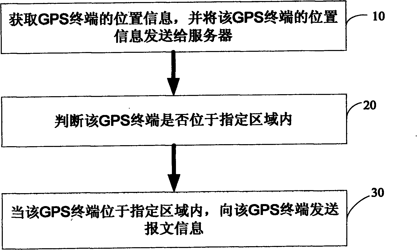
[0045] Such as figure 1 As shown, a method for communicating with a GPS terminal in a designated area provided by the present invention includes steps:
[0046] Step 10, obtain the location information of the GPS terminal, and send the location information of the GPS terminal to the server; the location information can be geographic coordinate longitude information, geographic coordinate latitude information, speed information, moving direction information, altitude information and other information one or more of
[0047] Step 20, judging whether the GPS terminal is located in the specified area;
[0048] Step 30, when the GPS terminal is located in the designated area, send message information to the GPS terminal. The message information may be one or more of various information such as parking fee information, speed limit information, and geographical indication information.
Embodiment 2
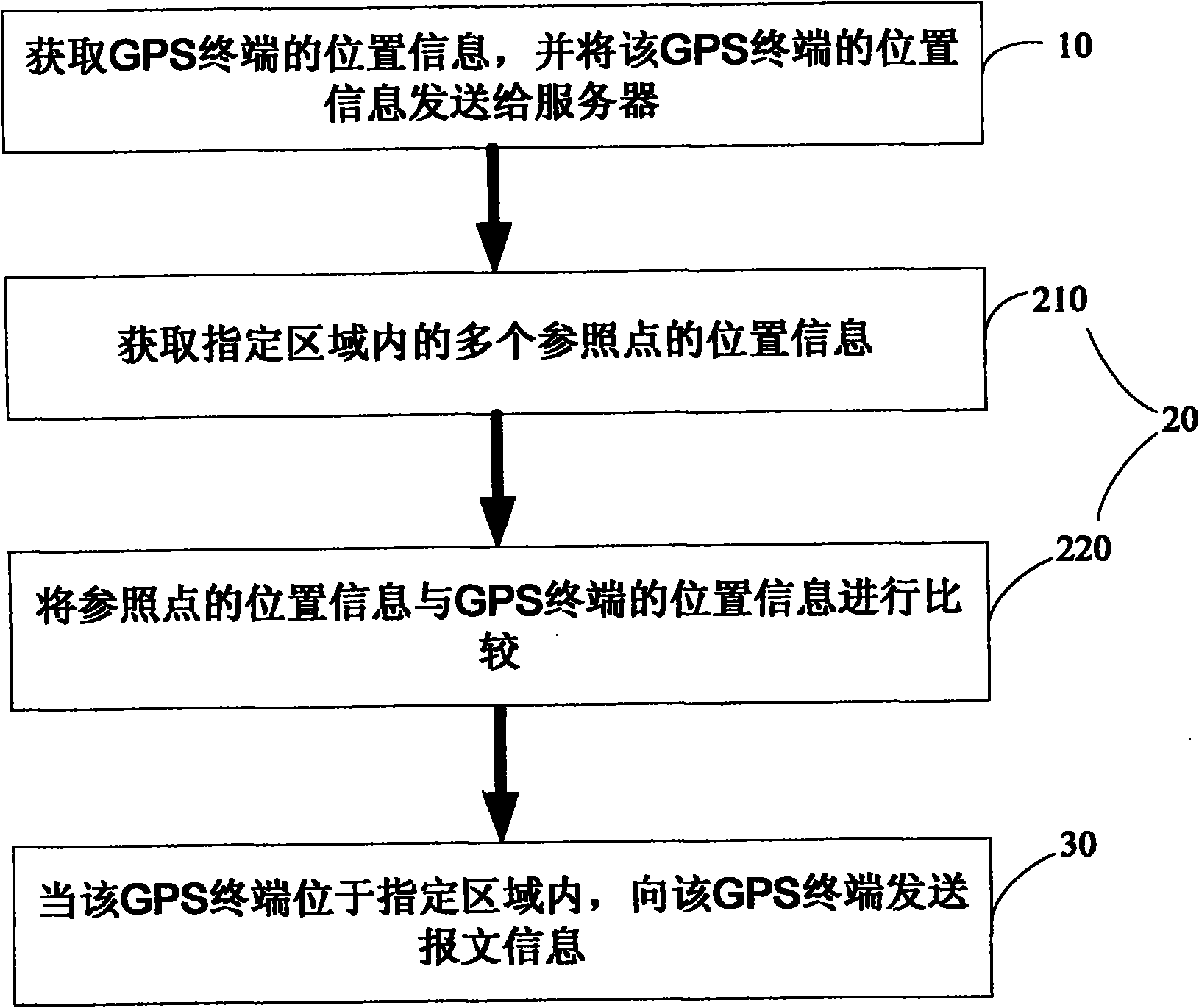
[0050] Such as figure 2 As shown, the method for communicating with the GPS terminal in the designated area provided by the present invention comprises steps:
[0051] Step 10, obtain the location information of the GPS terminal, and send the location information of the GPS terminal to the server; the location information can be geographic coordinate longitude information, geographic coordinate latitude information, speed information, moving direction information, altitude information and other information one or more of
[0052] Step 20, judging whether the GPS terminal is located in the designated area; step 20 specifically includes step 210, step 220, namely:
[0053] Step 210, acquiring position information of multiple reference points within the specified area;
[0054] Step 220, comparing the position information of the reference point with the position information of the GPS terminal; when step 220 is completed, proceed to step 30, namely:
[0055] Step 30, when the...
Embodiment 3
[0057] The method for communicating with a GPS terminal in a designated area provided by the present invention comprises the steps of:
[0058] Step 10, obtain the location information of the GPS terminal, and send the location information of the GPS terminal to the server; the location information can be geographic coordinate longitude information, geographic coordinate latitude information, speed information, moving direction information, altitude information and other information one or more of
[0059] Step 20, judging whether the GPS terminal is located in the designated area; step 20 specifically includes step 210, step 220, namely:
[0060] Step 210, obtaining the location information of multiple reference points in the specified area; step 210 specifically includes steps 212 and 214, namely:
[0061] Step 212, divide the specified area into grid-like array cells, and select grid nodes as reference points; the horizontal dividing line of the grid in the specified area is...
PUM
 Abstract
Description
Claims
Application Information
 - Generate Ideas
- Intellectual Property
- Life Sciences
- Materials
- Tech Scout
- Unparalleled Data Quality
- Higher Quality Content
- 60% Fewer Hallucinations
Browse by: Latest US Patents, China's latest patents, Technical Efficacy Thesaurus, Application Domain, Technology Topic, Popular Technical Reports.
© 2025 PatSnap. All rights reserved.Legal|Privacy policy|Modern Slavery Act Transparency Statement|Sitemap|About US| Contact US: help@patsnap.com