
Quick low altitude remote sensing image automatic matching and airborne triangulation method

An aerial triangulation, low-altitude remote sensing technology, applied in photogrammetry/video surveying, measuring devices, radio wave measurement systems, etc., can solve the problem that the attitude angle of digital cameras cannot be kept fixed, not strictly consistent, and automatically matched Difficulties and other problems, to achieve the effect of improving the accuracy of elevation measurement, reducing the number, and eliminating gross errors.

Inactive Publication Date: 2008-02-20
WUHAN UNIV
View PDF0 Cites 61 Cited by
  • Summary
  • Abstract
  • Description
  • Claims
  • Application Information

AI Technical Summary

Problems solved by technology

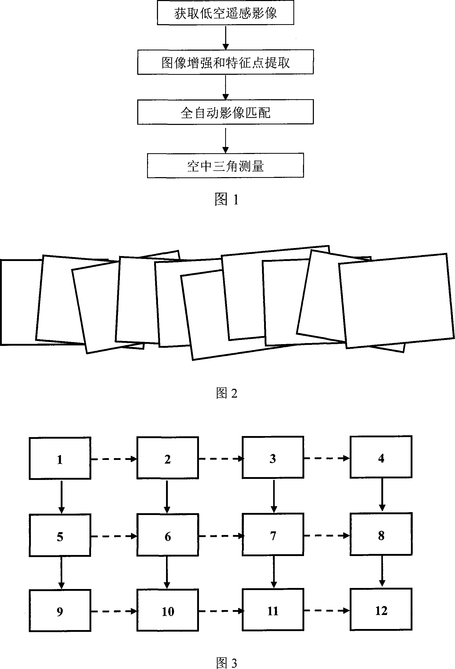
[0004] However, due to the control characteristics and the influence of the wind, it is difficult for the low-altitude remote sensing platform to fly in a straight line strictly according to the predetermined route, and can only fly in the "air pipe" with a certain radius (such as 10-30 meters). In addition, the digital camera needs to constantly change the direction of the main optical axis when shooting from multiple angles, so the overlap between the captured images will not be strictly consistent, and there may be a certain rotation angle between adjacent images ; and due to the influence of occlusion, height difference, shadow, lighting, etc., ground features may have great deformation on different images, making automatic matching very difficult

Method used


Image

  • Quick low altitude remote sensing image automatic matching and airborne triangulation method

Examples


Embodiment Construction

[0019] Automatic matching of low-altitude remote sensing images and high-precision aerial triangulation (see Figure 1):

[0020] 1. Use the low-altitude remote sensing platform to obtain single or multi-airband images of the target in the survey area according to the following image shooting methods, and import the images into the computer:

[0021] During the flight of the low-altitude platform, it is impossible to strictly follow the preset route to fly in a straight line, and the attitude angle of the digital camera cannot be kept fixed. Therefore, when designing the route, it is generally necessary to design the route according to the range of the survey area, the camera parameters and the preset ground resolution. In-band overlap 80%, between air belt 40% overlap Design route and low-altitude remote sensing platform flight height, to ensure that the obtained low-altitude remote sensing images fully meet the minimum overlap requirements; low-altitude remote sensing platforms c...


PUM


Abstract

The utility model relates to a method of rapid automatic matching for the low altitude remote sensing image and the aerial triangulation, which is characterized in that: capture serial images with the low altitude remote platform; extract the characteristic point from the image with the feature extraction technology; save automatically all extracted characteristic points of the images; match automatically characteristic points with same name of the adjacent images and transmit automatically the matched characteristic points with same names to all superimposed image to obtain a large quantity of characteristic points with three degree or more and same names; the semi-automatic measurement control point and the checkpoint of the image coordinate can combine with other observation values of non-photogrammetry to carry out the high precision aerial triangulation and the precision evaluation of the balancing results. The utility model has the advantages that the stable and reliable matching results and higher precision of the aerial triangulation can be obtained even the low altitude remote sensing images have large rotation deviation angle and the applicative demand of the large scale survey and the high precision three-dimensional reconstruction can be met.

Description

Technical field [0001] The invention belongs to the field of surveying and mapping science and technology, and relates to a method for quickly performing automatic matching and aerial triangulation of low-altitude remote sensing images. Automatic matching and high-precision regional network aerial triangulation can be applied to dynamic monitoring of land use changes, large-scale mapping and fine three-dimensional reconstruction. Background technique [0002] With the rapid progress of photogrammetry and related science and technology, the photogrammetry technology in the earth observation system has evolved from ground-based photogrammetry to aerial photogrammetry to aerospace (satellite) photogrammetry. A large number of studies have been carried out internationally on "high-altitude" photogrammetry based on aerospace technology and "hollow" photogrammetry based on aerospace technology (the altitude is generally greater than 1000 meters), and fruitful theoretical and applicatio...

Claims


Application Information

Patent Timeline
IPC IPC(8): G01C11/00G01C11/34G01S17/89
Inventor 张永军张祖勋万幼川柯涛杜全叶
Owner WUHAN UNIV
Learn More