One-time all-polarization synthetic aperture radar image inverse method for digital elevation model
A technology of synthetic aperture radar and digital elevation model, applied in the direction of radio wave reflection/re-radiation, using re-radiation, measuring devices, etc., can solve complex problems and achieve easy-to-achieve effects
- Summary
- Abstract
- Description
- Claims
- Application Information
AI Technical Summary
Problems solved by technology
Method used
Image
Examples
Embodiment Construction
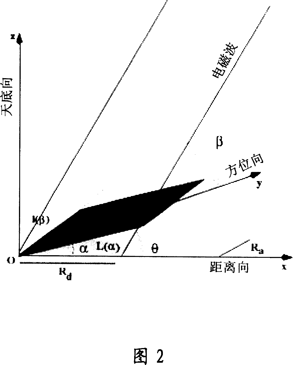
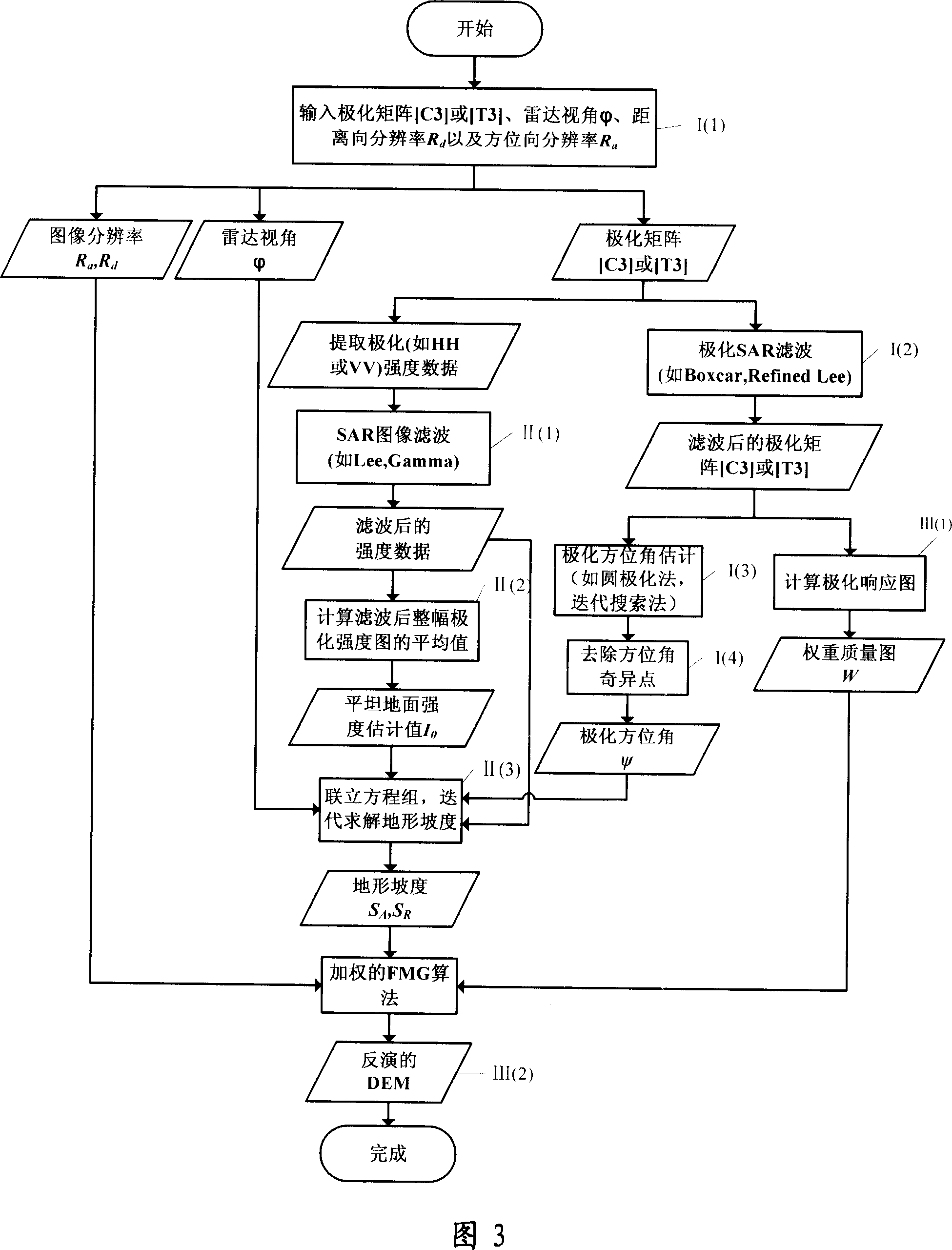
[0025] The present invention will be specifically described below with reference to the accompanying drawings. According to the method of the present invention, at first, the polarization azimuth angle ψ offset is estimated from the polarimetric SAR image by using the circular polarization method, and the polarization azimuth angle ψ offset and the terrain slope are established, that is, the range gradient angle α and the azimuth direction Data relationship between slope angle β. In the case of only a single full-polarization SAR image, assuming that the imaging area satisfies the conditions of homogeneity of surface coverage and small slope fluctuations, the Shape from Shading technology in radar angle measurement is introduced to establish the surface The data relationship between the backscattering intensity and surface geometric parameters (including range slope angle α and azimuth slope angle β). In this way, from the above two data relationships, the range gradient α an...
PUM
 Abstract
Description
Claims
Application Information
 - Generate Ideas
- Intellectual Property
- Life Sciences
- Materials
- Tech Scout
- Unparalleled Data Quality
- Higher Quality Content
- 60% Fewer Hallucinations
Browse by: Latest US Patents, China's latest patents, Technical Efficacy Thesaurus, Application Domain, Technology Topic, Popular Technical Reports.
© 2025 PatSnap. All rights reserved.Legal|Privacy policy|Modern Slavery Act Transparency Statement|Sitemap|About US| Contact US: help@patsnap.com


