Eureka AIR delivers breakthrough ideas for toughest innovation challenges, trusted by R&D personnel around the world.

Three dimension visual method based on geological body of geophysical field data

A technology of geophysics and geological bodies, applied in geophysical surveying, image data processing, electric/magnetic exploration, etc., can solve the problems of small data volume, incomplete geological information, waste of computing time and computer storage space, etc.

Inactive Publication Date: 2007-10-10
INST OF GEOLOGY & GEOPHYSICS CHINESE ACAD OF SCI
View PDF0 Cites 41 Cited by
  • Summary
  • Abstract
  • Description
  • Claims
  • Application Information

AI Technical Summary

Problems solved by technology

[0009] First, the plan view, section view and their combined expression are two-dimensional information, while the geological body structure has three-dimensional spatial characteristics. This traditional expression method will inevitably lead to incomplete geological information
[0010] Second, it is very difficult to mine geological information with three-dimensional spatial characteristics through two-dimensional geophysical information
However, the original data he uses is the original data generated at any point in the space at will, the amount of data is small, and the three-dimensional geological model is generated purely based on mathematical methods, which mainly wastes computing time and computer storage space, resulting in low model generation efficiency. High, not very practical

Method used

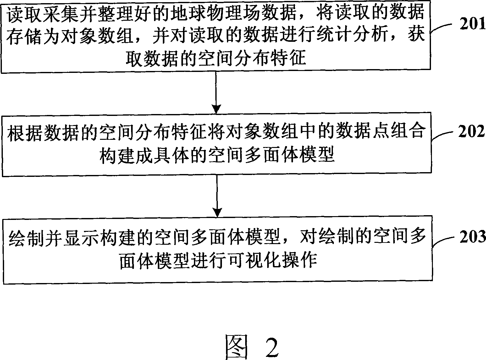
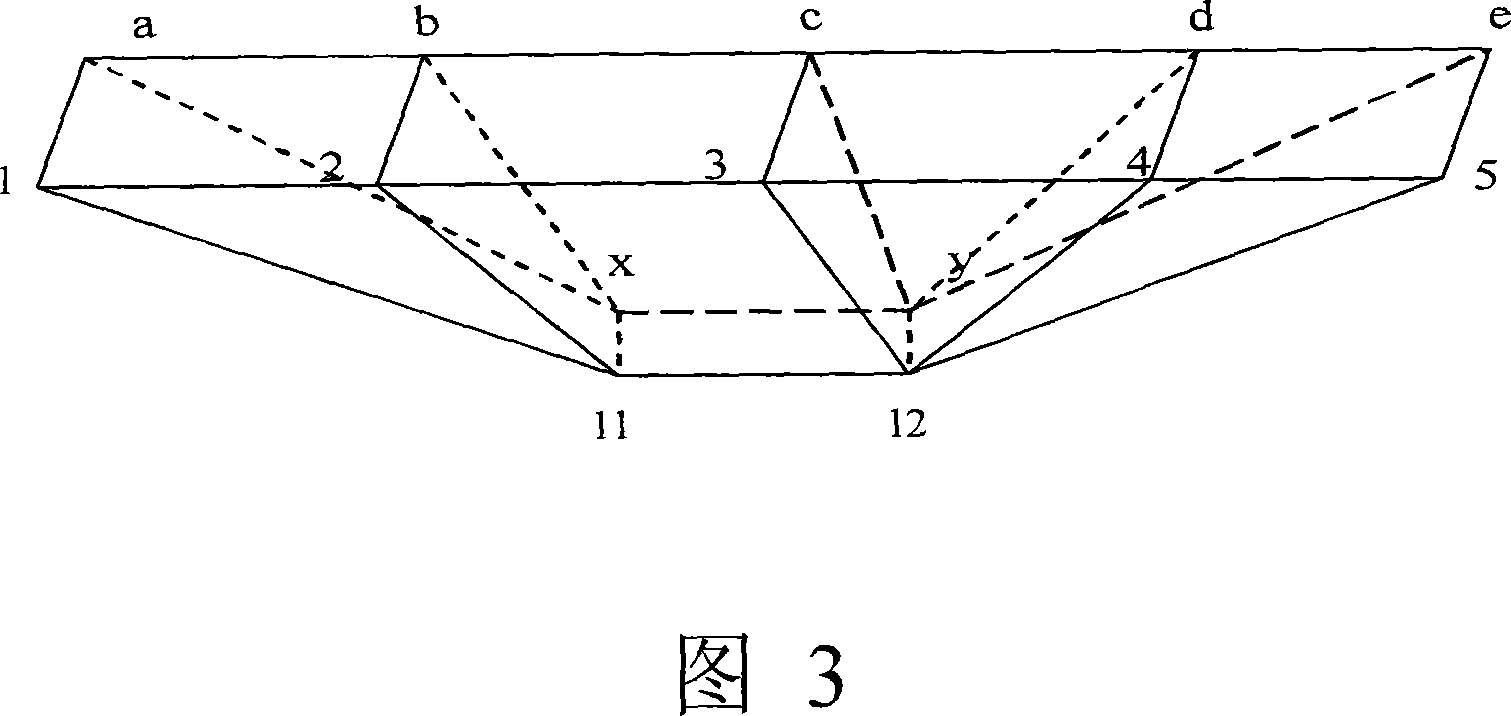

Image

  • Three dimension visual method based on geological body of geophysical field data
  • Three dimension visual method based on geological body of geophysical field data
  • Three dimension visual method based on geological body of geophysical field data

Examples


Embodiment 1

[0113] This embodiment is an example of high-density electrical method. In the field measurement of this embodiment, the DUK-2 high-density electrical instrument measuring system produced by Chongqing Geological Instrument Factory is used. The instrument is composed of a multi-channel electrode converter DUK-2 and a multifunctional direct current instrument DZD-6. , the observation parameter is the apparent resistivity ρs, and the cross-section electrodes are laid out at one time during the field measurement, and the acquisition parameters and device parameters of the instrument are set, then the measurement and storage of the apparent resistivity value of the cross-section can be performed automatically; data recovery to the laptop.

[0114] This field wiring method adopts the classic Wenner AMNB device (that is, the symmetrical quadrupole device method, WN). As shown in Figures 6 and 7, Figure 6 is an overall effect diagram of the sixth block of a certain work area accordin...

Embodiment 2

[0118] This embodiment is an example of magnetotelluric sounding. In the field work of this embodiment, the most advanced magnetotelluric depth sounder GMS-06 produced by Metronix, Germany, which can not only process in real time, but also record and store the original time series, is used for data collection. There are six instruments in total, including two five-component systems and four two-component systems. During work, the six instruments are used at the same time, relying on the precise GPS system that comes with the instrument for synchronous recording.

[0119] As shown in Figures 9 and 10, Figure 9 is an overall effect diagram of the MT data measurement results in a certain work area according to the second embodiment of the present invention, and Figure 10 is a cutting effect of the MT data measurement results in a certain work area according to the second embodiment of the present invention picture.

[0120] As shown in Figures 11 and 12, Figure 11 is a statistic...


PUM


Abstract

The present invention discloses a geologic body three-dimensional visualization method based on geophysical field data. Said method includes the following steps: (A), fetching collected geophysical field data, making fetched data be stored as object array, and statistically analyzing the fetched data so as to obtain space distribution characteristics of fetched data; (B), according to the space distribution characteristics of data combining data points in the object array and constructing them into concrete space polygonal mode; and (c), drawing and displaying said constructed space polygonal model, and making said space polygonal model undergo the process of visualization operation treatment.

Description

technical field [0001] The invention relates to the technical field of three-dimensional visualization of geological bodies based on geophysical field data, in particular to a method for three-dimensional visualization of geological bodies based on geophysical field data. Background technique [0002] With the deepening of geological exploration and the continuous development and improvement of various geophysical detection technologies, it has become a relatively common means to use geophysical methods to detect geological bodies and obtain structural parameters of geological bodies. As a result, the demand for computational visualization of geophysical data is also increasing. How to transform or simulate a large amount of boring geophysical data into a three-dimensional model of geological bodies that geoscientists can see and touch has become a hot research topic at present. [0003] In the field of 3D simulation of geological bodies, predecessors have proposed more tha...

Claims


Application Information

Patent Timeline
Patent Type & Authority Applications(China)
IPC IPC(8): G06T17/50G06T15/00G01V3/00G06T17/05
Inventor 祁民张宝林
Owner INST OF GEOLOGY & GEOPHYSICS CHINESE ACAD OF SCI
Why Eureka
Eureka Blog
Learn More