
System and methods for upscaling petrophysical data

a technology of petrophysical data and upscaling, applied in the field of petrophysical data processing, can solve the problems of increasing the resistance of the petrophysical industry to perform well testing, difficult to create upscaled logs for paths comprising a plurality of possibly different spatial units,

Active Publication Date: 2007-05-29
HALLIBURTON ENERGY SERVICES INC
View PDF47 Cites 18 Cited by
  • Summary
  • Abstract
  • Description
  • Claims
  • Application Information

AI Technical Summary

Benefits of technology

The present invention provides a method for studying a geological formation by measuring properties along a path in the formation and associating them with spatial units. This data is then used to create a directional property log that is upscaled from the original measurements. The invention also includes a system for performing the measurements and data upscaling using software programs. The technical effect of this invention is the ability to better understand the properties of geological formations and improve oil and gas exploration.

Problems solved by technology

Up-scaling can be very difficult because the measurement data are often taken at various scales and using different sample sizes.
Moreover, without a well-defined algorithm to combine the data, an upscaled log is difficult to create for a path comprising a plurality of possibly different spatial units.
However, the petrophysical industry is becoming more and more reluctant to perform well testing due to the increasing economical and environmental costs.

Method used


Image

  • System and methods for upscaling petrophysical data
  • System and methods for upscaling petrophysical data
  • System and methods for upscaling petrophysical data

Examples


Embodiment Construction

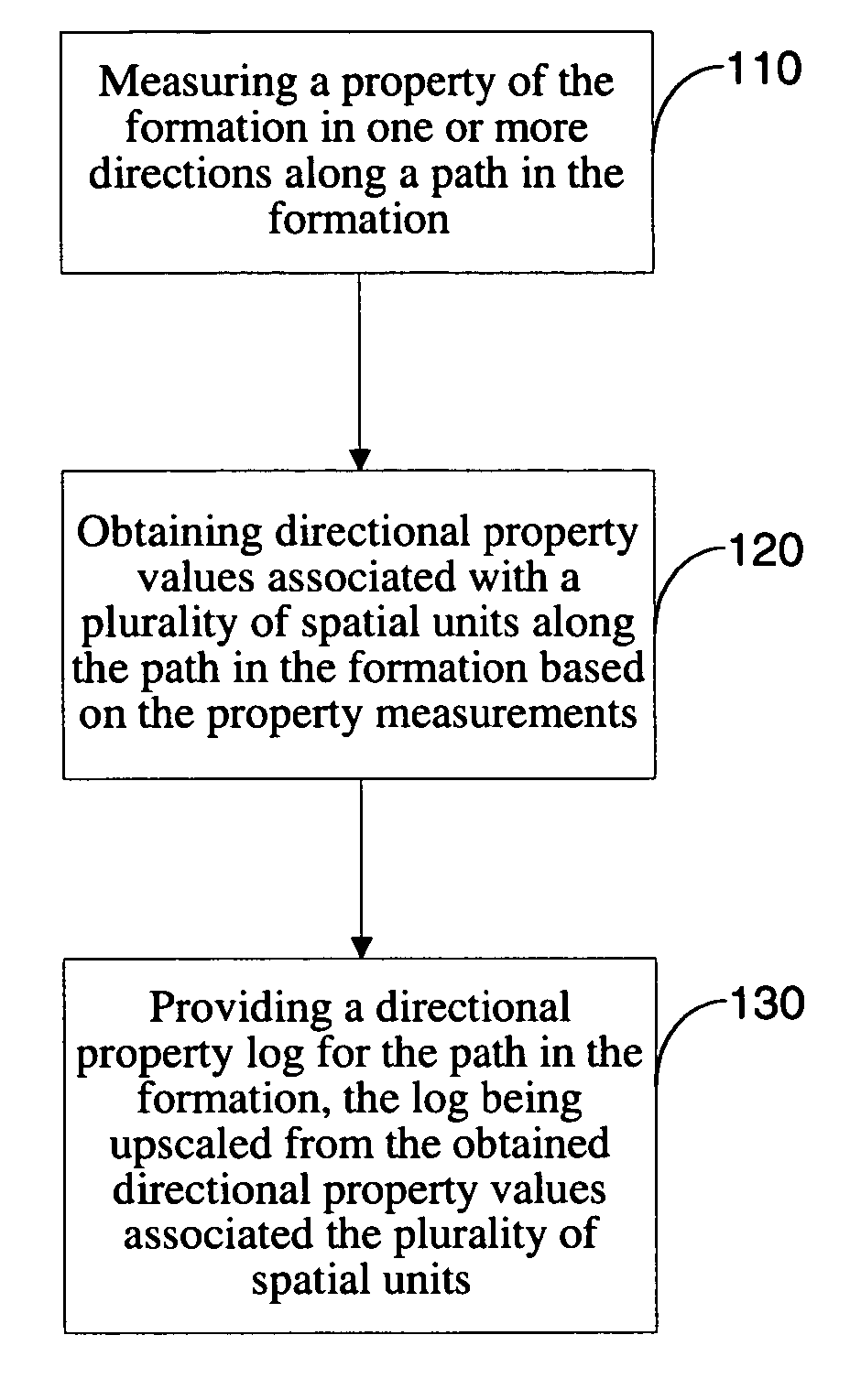
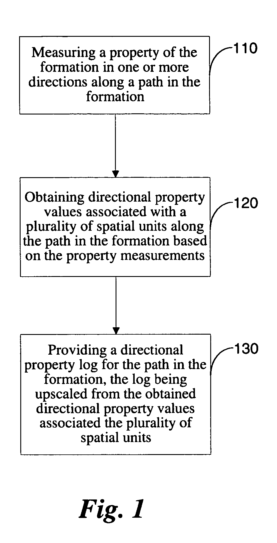
[0020]In one aspect, the present invention is directed to methods for upscaling data in the investigation of a geologic formation. A flow chart illustrating the generalized method is shown in FIG. 1. In step 110, measurements of a property of the formation are obtained in one or more preferably orthogonal directions (usually horizontal or vertical), along a path in the formation. This path may be provided by a borehole drilled in the formation or, in a specific embodiment, may be generated in the process of drilling a borehole.

[0021]It is desirable that the type of property being measured or estimated is useful in the petrophysical examination of the formation and may be anisotropic in nature. Examples of properties that can be used include, without limitation, permeability, resistivity, porosity, diffusivity and viscosity. In a preferred embodiment of the invention discussed for illustration purposes below, the property being determined is the formation permeability.

[0022]In accord...


PUM


Abstract

System and methods for estimating properties of a geologic formation are disclosed. A preferred embodiment includes a method for estimating properties of a geologic formation, comprising the steps of: measuring a property of the formation in two or more directions along a path in the formation; obtaining directional property values for at least one spatial unit along the path in the formation based on the property measurements; and providing an anisotropy estimate of the formation from the obtained directional property values.

Description

FIELD OF THE INVENTION[0001]The present invention relates generally to petrophysical data processing and in particular to a system and methods for generating directional formation property values based on measurement data obtained at different locations along a measurement path.BACKGROUND OF THE INVENTION[0002]In oil and gas exploration it is desirable to understand the structure and properties of the geological formation surrounding a borehole in order to determine if the formation contains hydrocarbon resources (oil and / or gas), to estimate the amount and producibility of hydrocarbon contained in the formation, and to evaluate the best options for completing the well in production. A significant aid in this evaluation is the use of wireline logging and / or logging-while-drilling (LWD) or measurement-while-drilling (MWD) measurements of the formation surrounding the borehole (referred to collectively as “logs” or “log measurements”). Typically, one or more logging tools are lowered ...

Claims


Application Information

Patent Timeline
Patent Type & Authority Patents(United States)
IPC IPC(8): G01V3/00G01R33/44G01V3/32G06F
CPCG01N24/081G01V3/32
Inventor PROETT, MARK A.FOGAL, JAMES M.CHIN, WILSON C.AADIREDDY, PRABHAKAR R.
Owner HALLIBURTON ENERGY SERVICES INC
Learn More