Look ahead information for a geo-steering system

a geo-steering system and look-ahead technology, applied in earth drilling and mining, detection using electromagnetic waves, borehole/well accessories, etc., can solve problems such as inaccurate or missing marks on adjacent boreholes

Active Publication Date: 2022-04-21
HALLIBURTON ENERGY SERVICES INC
View PDF8 Cites 3 Cited by
  • Summary
  • Abstract
  • Description
  • Claims
  • Application Information

AI Technical Summary

Benefits of technology

The patent describes a method and system for analyzing resistivity data collected from a downhole tool in a well. The data is parsed into slices, which are non-overlapping and aligned with a central point depth. Selected slices are analyzed along with the original data to identify boundaries and generate an output analysis. The technical effect of this invention is improved accuracy and resolution in identifying the location of oil and gas reservoirs, leading to more efficient well drilling and better oil and gas production.

Problems solved by technology

In some aspects, the marked positions of adjacent boreholes may be inaccurate or missing.

Method used


Image

  • Look ahead information for a geo-steering system
  • Look ahead information for a geo-steering system
  • Look ahead information for a geo-steering system

Examples


Embodiment Construction

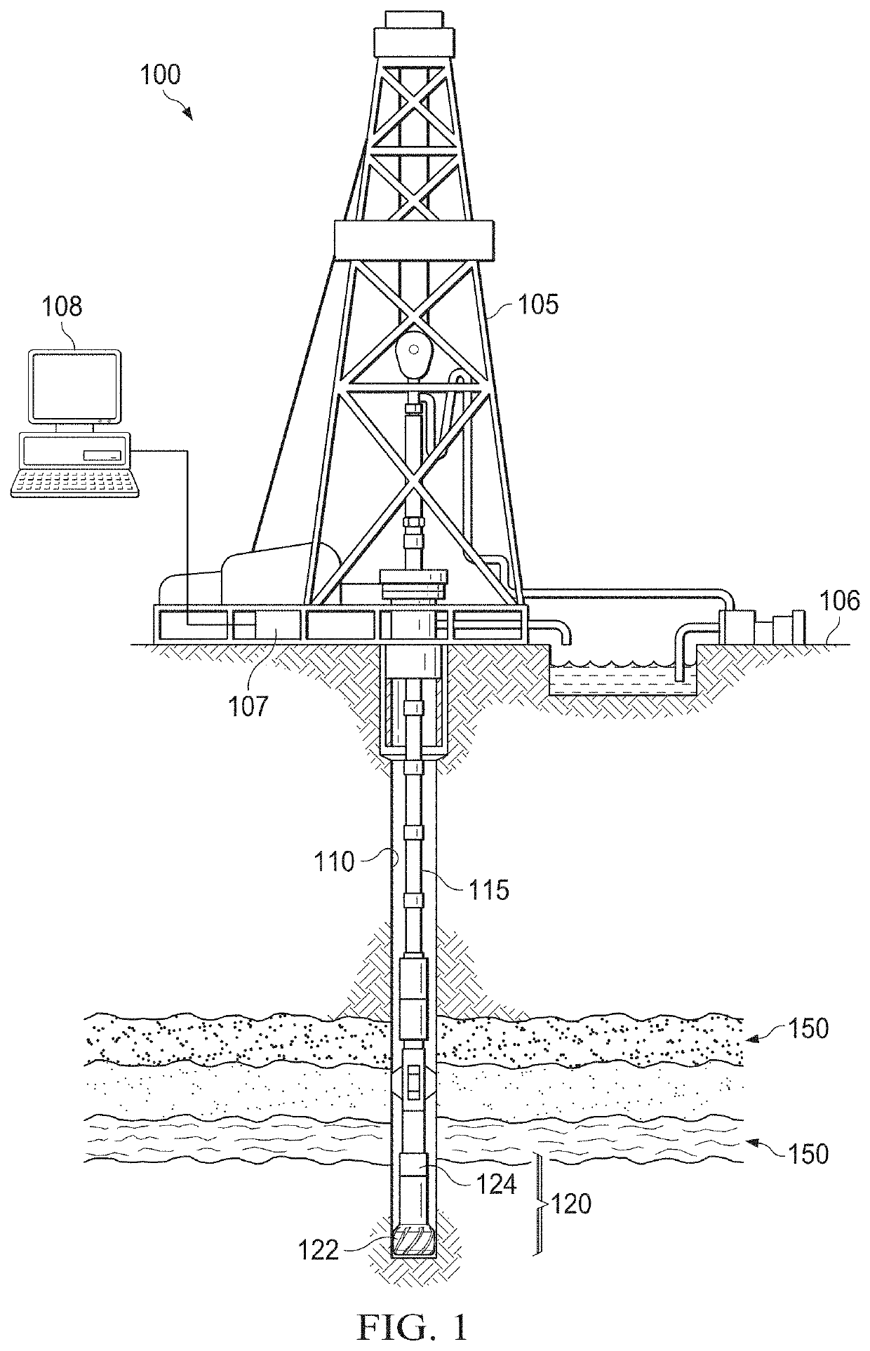
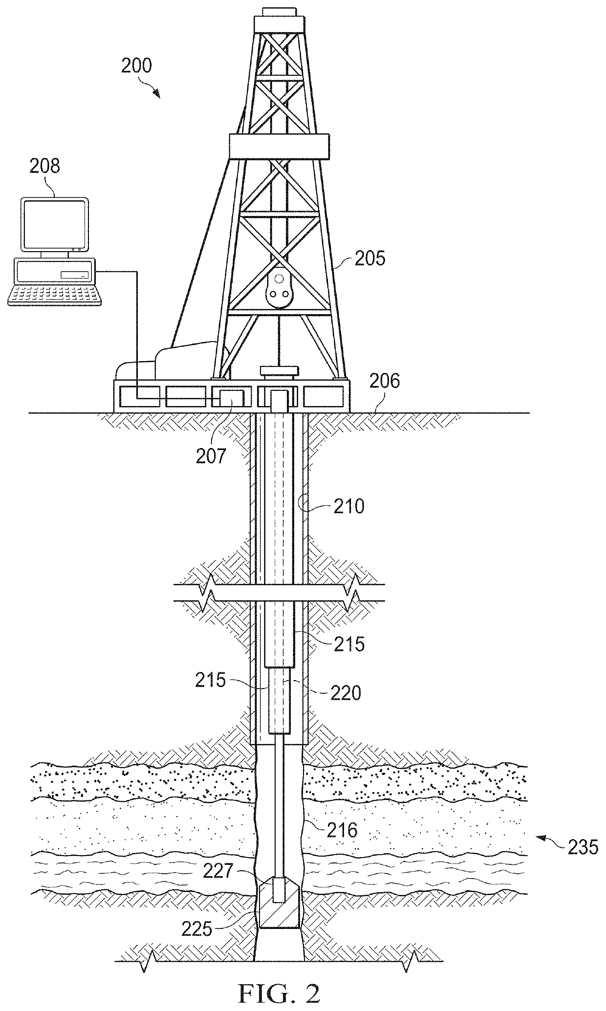
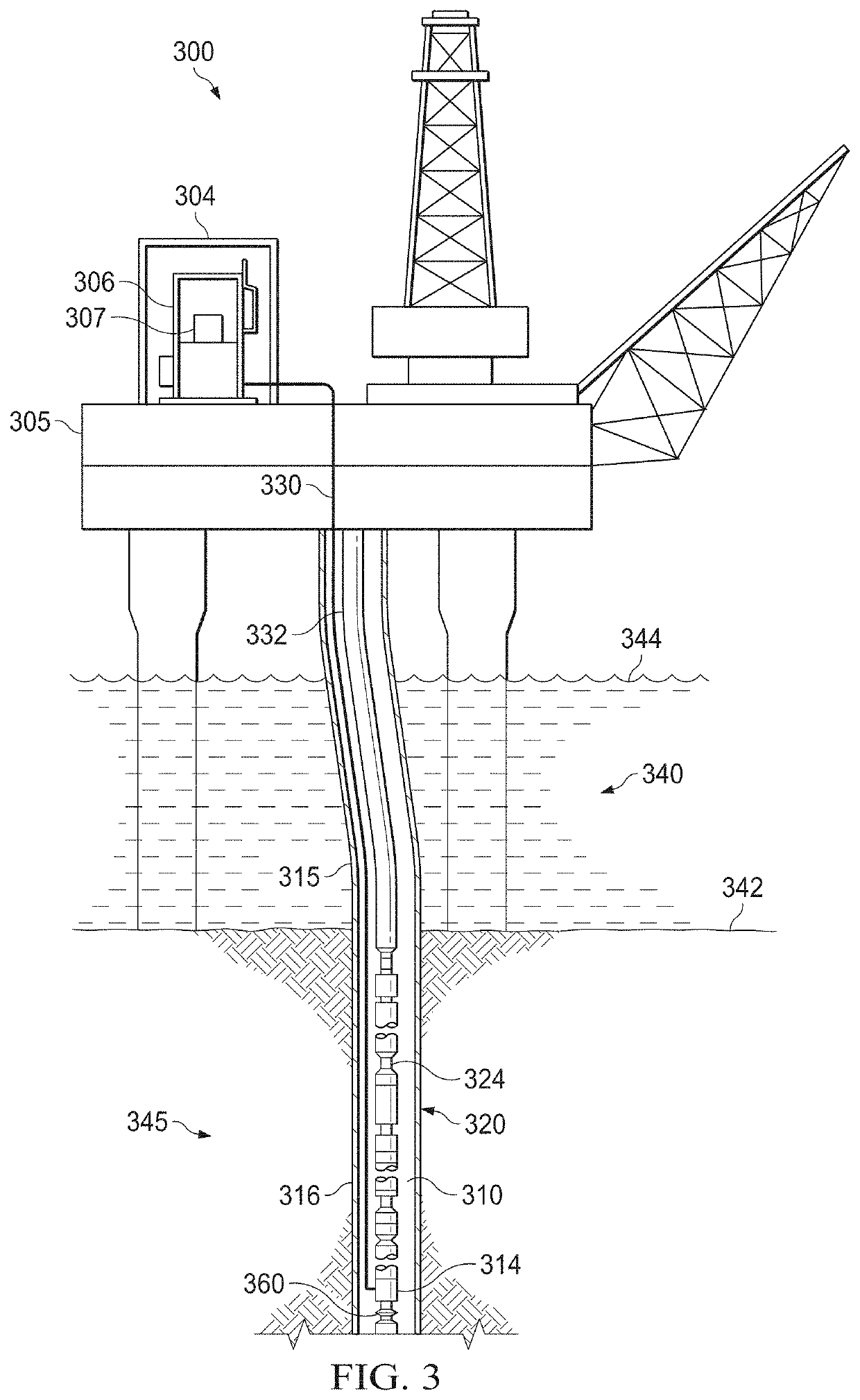
[0016]In borehole system development, users, such as well operators or engineers, use geo-steering techniques to maintain borehole development, e.g., drilling operations, along an intended path and direction. Knowing the position of the borehole relative to nearby, e.g., adjacent or proximate, boreholes, e.g., objects, or subterranean formation changes can be beneficial to ensure borehole separation or to ensure borehole intercept at the desired location. Adjacent boreholes can be active or abandoned, and the borehole positioning data of the adjacent borehole can be accurate, inaccurate, or missing, such as a borehole drilled by another operator. The borehole development can be for various uses, for example, hydrocarbon production, geothermal uses, scientific uses, mining uses, and other uses of boreholes.

[0017]Hydrocarbon borehole operators would prefer access to a large quantity of information regarding the parameters and conditions encountered downhole. Such information typically...


PUM


Abstract

The disclosure presents processes to generate look ahead data to guide borehole operations, such as drilling operations. The processes can array collected resistivity data around a representation of an active borehole. The array can be in various patterns, such as an interleaved helix pattern. Each slice of data from the collected resistivity data can be positioned and oriented corresponding to the central point depth parameter for each slice of data. A selection of one or more card views can be enabled to display details of the collected resistivity data corresponding to the selected slice of data. An analysis of the resistivity data can generate an identification of a boundary, such as an object or a subterranean formation change, in the subterranean formation look ahead portion of the active borehole. The boundary identification can be used as inputs to a borehole operation plan or to a geo-steering system.

Description

TECHNICAL FIELD[0001]This application is directed, in general, to using resistivity data collected in a borehole and, more specifically, to providing look ahead information to a geo-steering system.BACKGROUND[0002]When developing and drilling boreholes, it is important to be able to position an active borehole where desired proximate the surrounding geology of the subterranean formation and proximate adjacent objects or boreholes. As drilling operations progress, the borehole position can change over time relative to adjacent boreholes, objects, or subterranean formations. In some aspects, the marked positions of adjacent boreholes may be inaccurate or missing. Being able to accurately position an active borehole proximate an adjacent borehole, object, or subterranean formation can reduce the uncertainty of relative positioning of the active borehole, which can improve well planning and active borehole positioning.SUMMARY[0003]In one aspect, a method is disclosed. In one embodiment ...

Claims


Application Information

Patent Timeline
IPC IPC(8): G01V3/30G01V3/34E21B49/00
CPCG01V3/30E21B49/00G01V3/34G01V3/28
Inventor KISELEV, VLADIMIR YURYEVICHUSAITIS, VYTAUTAS
Owner HALLIBURTON ENERGY SERVICES INC
Why Eureka
Try Eureka