Method for autonomous determination of protection levels for GNSS positioning based on navigation residuals and an isotropic confidence ratio
What is Al technical title?
Al technical title is built by PatSnap Al team. It summarizes the technical point description of the patent document.
a technology of protection level and residuals, applied in satellite radio beaconing, measurement devices, instruments, etc., can solve the problem that the computation method is difficult to justify from a theoretical point of view
Active Publication Date: 2009-11-05
GMV AEROSPACE & DEFENCE
View PDF4 Cites 13 Cited by
Summary
Abstract
Description
Claims
Application Information
AI Technical Summary
This helps you quickly interpret patents by identifying the three key elements:
Problems solved by technology
Method used
Benefits of technology
Problems solved by technology
The GNSS navigation problem is the problem of estimating the position of a GNSS user by means of the information provided by the GNSS signal as received by a GNSS user receiver.
Such PL computation methods are, however, difficult to justify from a theoretical point of view, since they rely on hypotheses that rarely hold in real world.
Method used
Image
Click on the blue label to locate the original text in one second.
Reading with bidirectional positioning of images and text.
Examples
Embodiment Construction
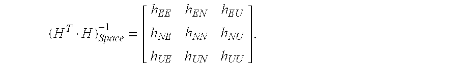
[0026]The present invention relates to a method for autonomous computation of protection levels for GNSS positioning according to claim 1. Preferred embodiments of the method are defined in the dependent claims.
[0027]According to the method of the present invention, statistically consistent receiver autonomous protection levels—both horizontal and vertical—are computed. They are applicable to a least squares based GNSS navigation solution, and as such, they are applicable to different navigation techniques from absolute positioning to differential and relative, and also for multiple constellation solutions.
[0028]The present invention provides a method for computing Protection Levels which is autonomous (like the method for computing PLs provided by RAIM algorithms), that is, the Protection Levels are computed without any external information about the statistical nature of the measurement errors (unlike the PLs computed with GBAS o SBAS, which require an external source of informati...
PUM
Abstract
Method for the computation of horizontal and vertical protection levels, HPL VPL, that bound up to a given confidence level 1-α the horizontal and vertical components, respectively, of the position estimation error δ of a least squares-based GNSS navigation solution, wherein the HPL and VPL are computed as follows:HPL=k·∥r∥·aH, VPL=k·∥r∥aV,where:∥r∥ is the Euclidean norm of the least squares estimation residuals vector r;aH is defined as:aH=hEE+hNN2+(hEE-hNN2)2+(hEN+hNE2)2,andaV is defined as: aV=√{square root over (hUU)}, wherehEE, hNN, hEN, hNE, hEU, hUE, hUU, hNU, hUN are the spatial components of the dilution of precision matrix DoP (HT·H)−1 of the least squares estimation expressed in the local horizontal coordinate system of the estimated position:(HT·H)Space-1=[hEEhENhEUhNEhNNhNUhUEhUNhUU],H being the n×m observation matrix of the least squares-based navigation solution;and wherek is an isotropic confidence ratio computed by numerically solving the following expression Eq. 3 which links k with n, m and a, n and m being the number of observations and of estimated parameters, respectively, of the least squares estimation:Γ(n2)·∫z∈ℜm,z2≤k21+k2(1-z2)n-m-22·z=Γ(n-m2)·πm2·(1-α)[Eq.3]where Γ is Euler's Gamma function; and m denotes a standard m-dimensional real vector space.
Description
FIELD OF THE INVENTION[0001]The present invention arose in the field of satellite-based navigation (or GNSS), but it is applicable in any field in which least squares estimation is used. The invention gives response to the need for reliable bounds to the position error in a variety of applications of GNSS navigation, ranging from civil aviation to electronic (road) fee collection, among others.BACKGROUND OF THE INVENTION[0002]The GNSS navigation problem is the problem of estimating the position of a GNSS user by means of the information provided by the GNSS signal as received by a GNSS user receiver.[0003]There are several standard GNSS navigation techniques, the most common of which is absolute navigation. In absolute navigation, the navigation system computes its absolute position with no more information than that contained in the GNSS satellite signals, by means of so-called pseudo-range measurements (noisy measurements of the distance between the receiver and the GNSS satellite...
Claims
Application Information
Patent Timeline
Application Date:The date an application was filed.
Publication Date:The date a patent or application was officially published.
First Publication Date:The earliest publication date of a patent with the same application number.
Issue Date:Publication date of the patent grant document.
PCT Entry Date:The Entry date of PCT National Phase.
Estimated Expiry Date:The statutory expiry date of a patent right according to the Patent Law, and it is the longest term of protection that the patent right can achieve without the termination of the patent right due to other reasons(Term extension factor has been taken into account ).
Invalid Date:Actual expiry date is based on effective date or publication date of legal transaction data of invalid patent.
Patent Type & Authority Applications(United States)