
Method and apparatus for displaying terrain elevation information

a technology of terrain elevation and information, applied in the field of improved, can solve the problems of pilot fatigue, control flight into terrain, and navigation equipment may mislead the crew into guiding the aircra

Active Publication Date: 2009-01-22
THE BOEING CO
View PDF4 Cites 22 Cited by
  • Summary
  • Abstract
  • Description
  • Claims
  • Application Information

AI Technical Summary

Problems solved by technology

In these types of accidents, the pilots are generally unaware of the danger until it is too late to avoid the terrain.
Pilots with any level of experience, even highly experienced professionals, may be involved in these types of accidents in which a controlled flight into terrain occurs.
Factors that may cause these types of accidents include, for example, pilot fatigue.
Further, many accidents often involve impact with significantly raised terrain such as hills or mountains.
Other times, cloudy, foggy, or other reduced visibility conditions may cause this type of accident.
A controlled flight into terrain also may occur due to equipment malfunction.
For example, if a malfunction occurs in navigation equipment, the navigation equipment may mislead the crew into guiding the aircraft into the terrain despite other information received from properly functioning equipment.

Method used


Image

  • Method and apparatus for displaying terrain elevation information
  • Method and apparatus for displaying terrain elevation information
  • Method and apparatus for displaying terrain elevation information

Examples


Embodiment Construction

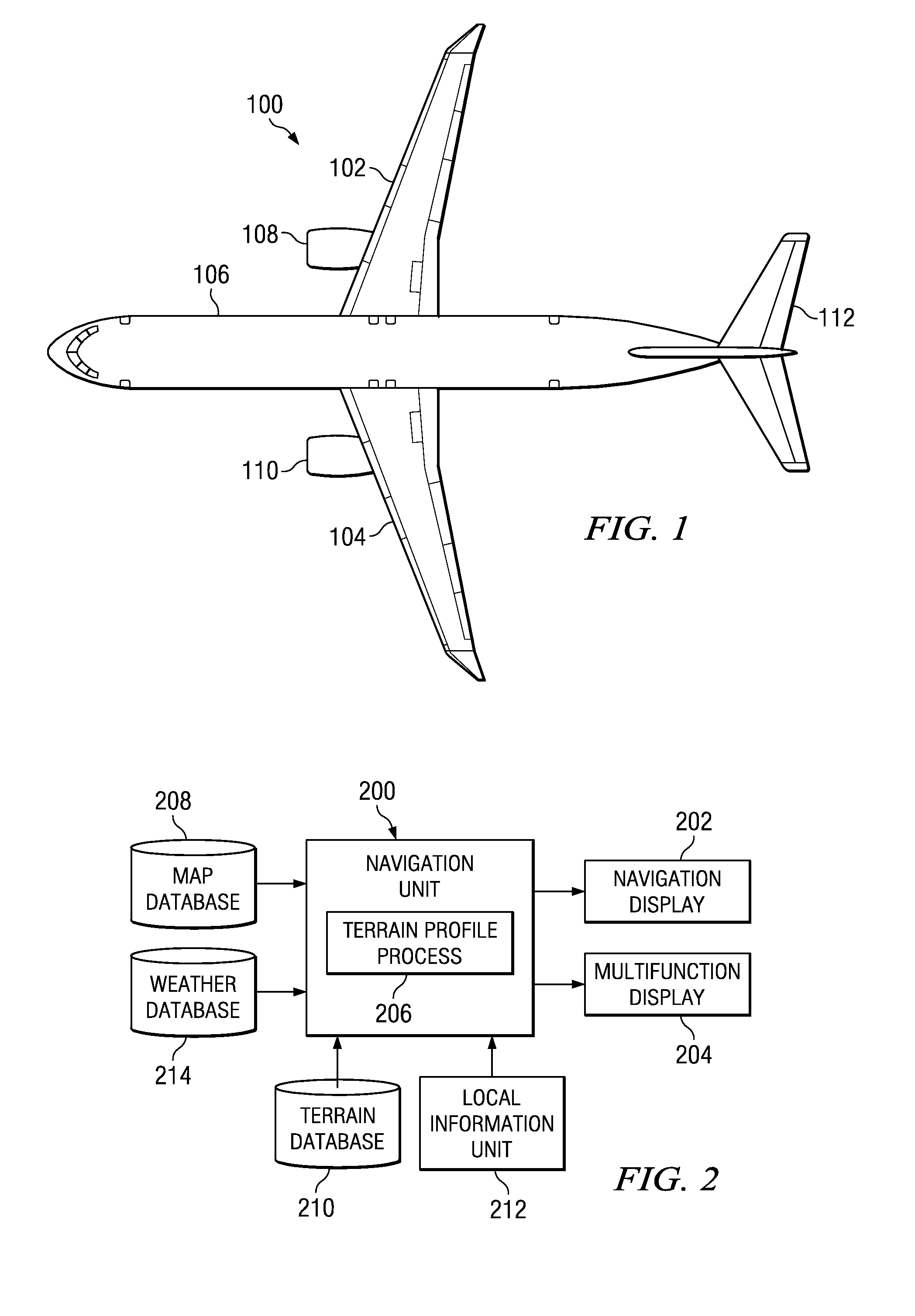
[0028]With reference now to the figures, and in particular with reference to FIG. 1, a diagram of an aircraft is depicted in which an advantageous embodiment may be implemented. Aircraft 100 is an example of an aircraft in which a method and apparatus for displaying terrain information may be implemented. In this illustrative example, aircraft 100 has wings 102 and 104 attached to body 106. Aircraft 100 includes wing mounted engine 108, wing mounted engine 110, and tail 112.

[0029]The different advantageous embodiments recognize that currently, a profile view of terrain is shown in which data for the terrain is for the terrain under the route. This profile view is a two dimensional display that provides an identification of the height of terrain relative to the route on which the aircraft is traveling or plans to travel.

[0030]This type of situational awareness is useful and provides for improved safety in flying aircrafts. The different embodiments also recognize that this type of te...


PUM


Abstract

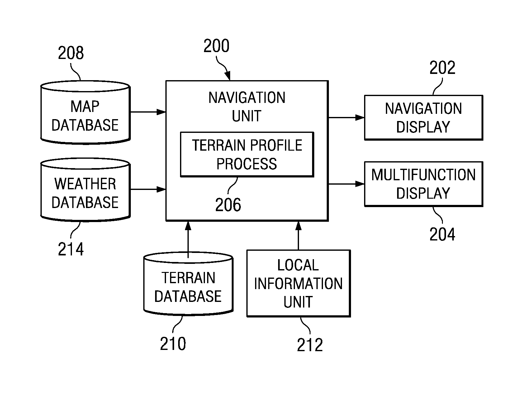
A method, apparatus, and computer usable program code for presenting terrain elevation information on a vehicle display. In one advantageous embodiment, a swath representing an area ahead of the vehicle is identified, wherein the swath has a length and a width. A two dimensional elevation view is presented on the vehicle display, wherein a vertical axis of the two dimensional elevation view represents a highest elevation along a width of a swath for a particular point along the length of the swath. The width of the swath is updated in response to vehicle movement to form an updated swath width. The two dimensional elevation view is updated using the updated swath width.

Description

BACKGROUND INFORMATION[0001]1. Field:[0002]The present disclosure relates generally to an improved data processing system for use with an aircraft and in particular to a method and apparatus for displaying information relating to an aircraft. Still more particularly, the present disclosure relates to a computer implemented method, apparatus, and computer usable program code for displaying terrain information for an aircraft.[0003]2. Background:[0004]Controlled flight into terrain is an accident where an airworthy aircraft under the control of the pilot inadvertently flies into terrain, an obstacle, or water. In these types of accidents, the pilots are generally unaware of the danger until it is too late to avoid the terrain. Pilots with any level of experience, even highly experienced professionals, may be involved in these types of accidents in which a controlled flight into terrain occurs.[0005]Factors that may cause these types of accidents include, for example, pilot fatigue. Fu...

Claims


Application Information

Patent Timeline
Patent Type & Authority Applications(United States)
IPC IPC(8): G01C21/00G06F17/00
CPCG01C23/005
Inventor HESS, MICHAEL DEAN
Owner THE BOEING CO
Learn More