
System and method for displaying location-specific images on a mobile device

a mobile device and location-specific technology, applied in traffic control systems, navigation instruments, instruments, etc., can solve the problems of not displaying a ground-level image of the destination location in the current navigation system, and , if there is a system, it is not possible to display any other image,

Active Publication Date: 2006-04-27
A9 COM INC
View PDF70 Cites 306 Cited by
  • Summary
  • Abstract
  • Description
  • Claims
  • Application Information

AI Technical Summary

Benefits of technology

[0004] Thus, for example, a user of a car navigation system will be able to enter a destination location using its street address, and the method and system of the present invention will permit the car navigation system to display the image of the destination location and additional images of other landmark points along the way toward the destination location in addition to the usual maps-and-directions to the destination location. The timing at which each of these location-specific images is to be displayed will depend on the current position of the car navigation system as determined by its position identification system (e.g., GPS system). In one example, an image of a landmark point will be displayed when the car navigation system comes within a certain distance from the landmark point with an appropriate text message, such as “Look for this, and turn left at this.” Likewise, an image of the final destination location may be displayed when the car navigation system comes within a certain distance from the destination location, or whenever the user requests to view such an image, with an appropriate text message, such as “Look for this at your destination.” Timely display of these location-specific images will assist the user in following the directions and finding the final destination location easily. Further, the image of a destination location may be displayed at the beginning (prior to starting the user's journey to the destination location) so as to assist the user in deciding whether or not to go there (e.g., based on how appealing the image of the destination location looks to the user), remembering whether the user has been there before, etc.

Problems solved by technology

Current navigation systems, however, do not display a ground-level image of the destination location (i.e., an image taken at the destination location), or any other images of locations that the user will pass along the way toward the destination location.
More particularly, what is lacking is a system and method for displaying location-specific images (i.e., ground-level images of objects taken at particular locations) on a mobile device, such as a cellular phone and a car navigation system, based on the determined position of the mobile device.

Method used


Image

  • System and method for displaying location-specific images on a mobile device
  • System and method for displaying location-specific images on a mobile device
  • System and method for displaying location-specific images on a mobile device

Examples


Embodiment Construction

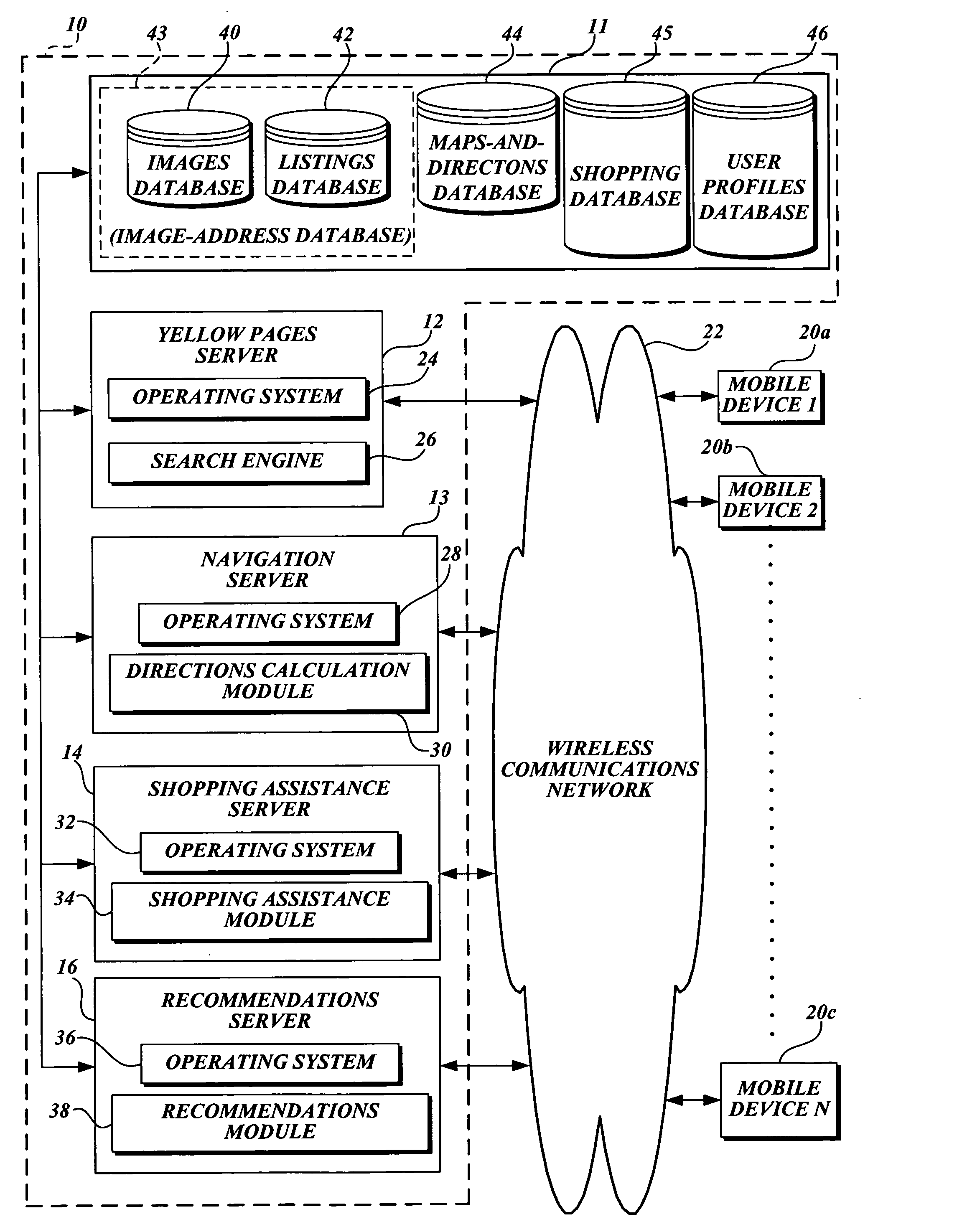
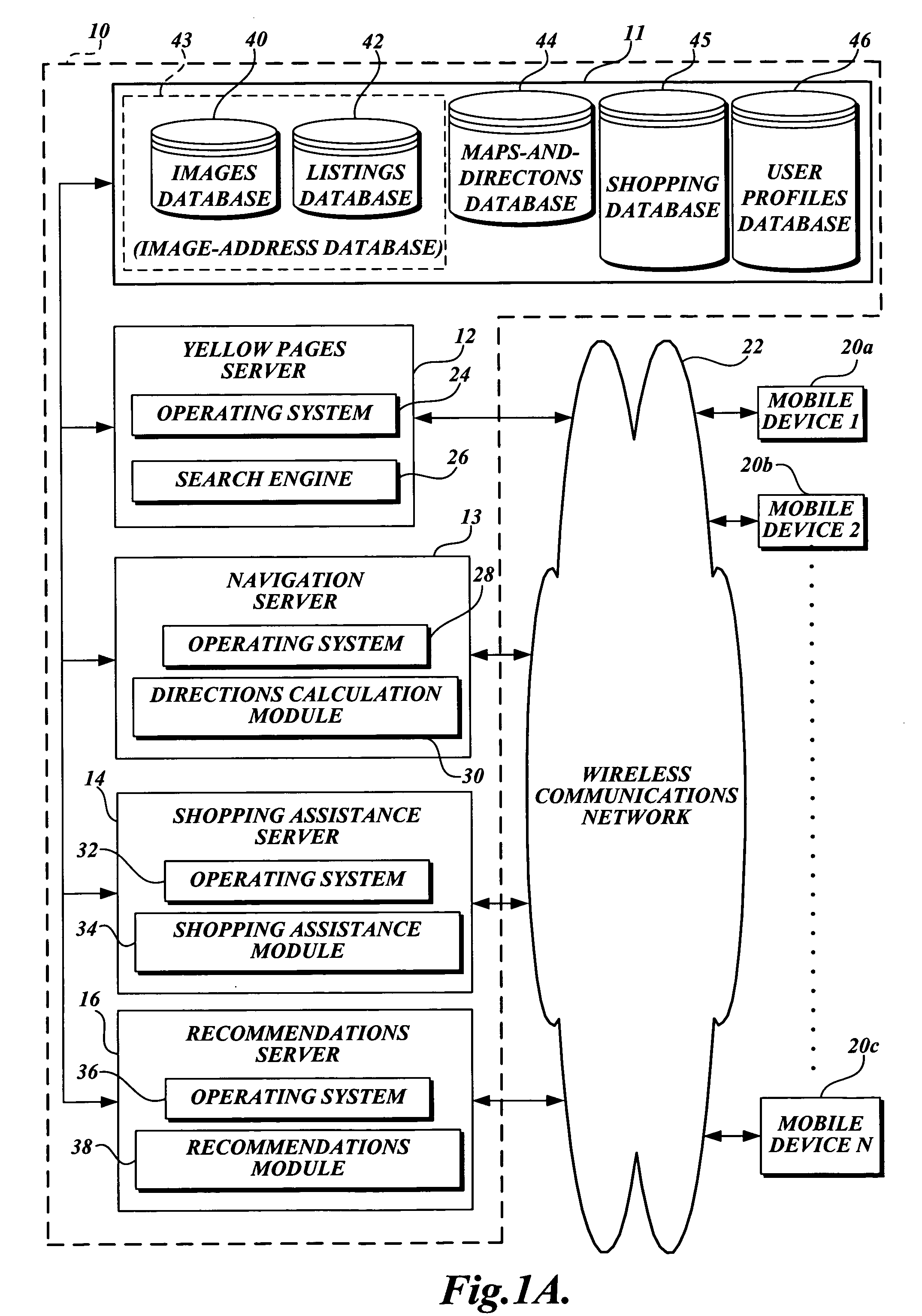
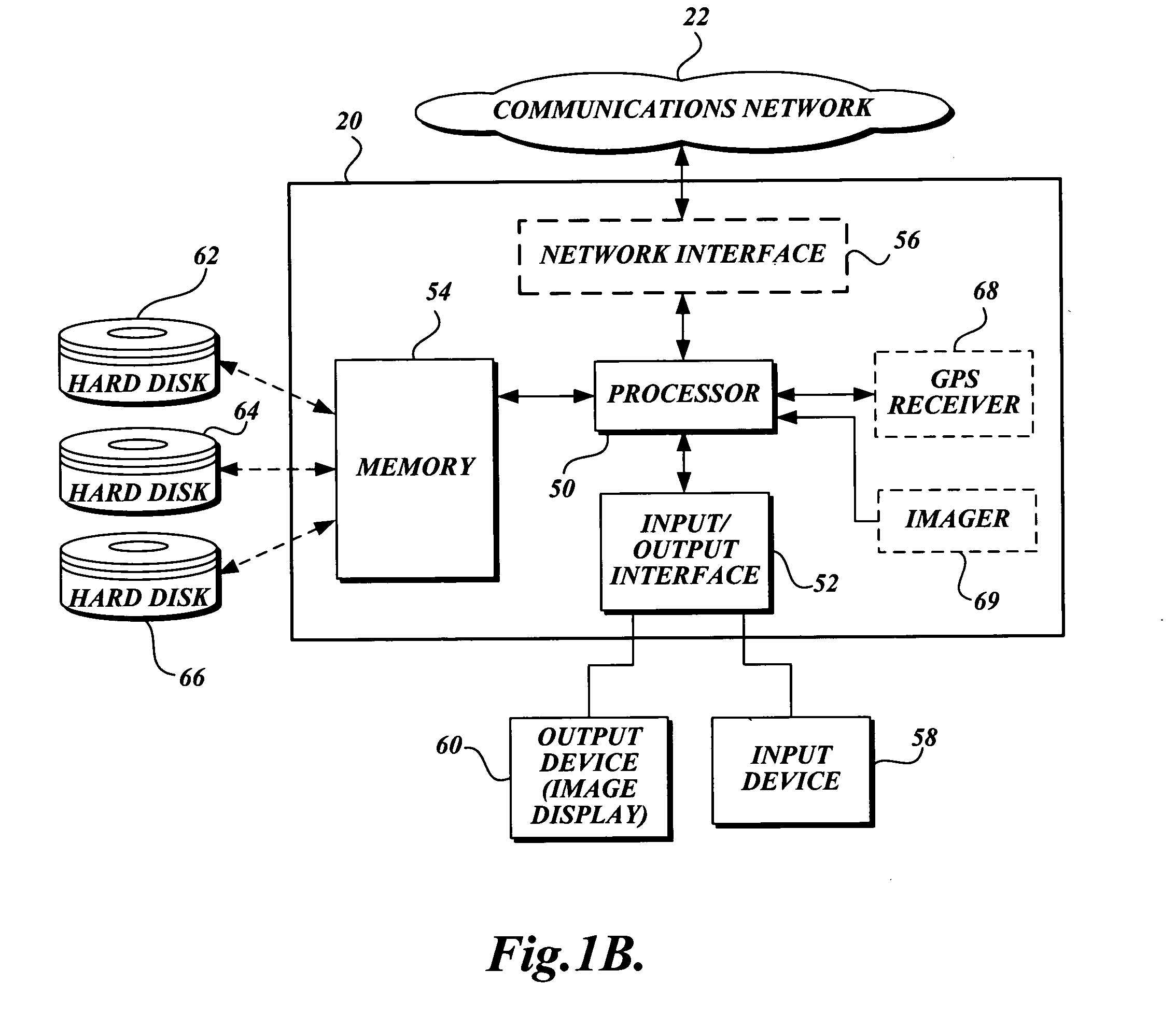
[0026] The present invention is directed to a system and method for providing a mobile image service. The mobile image service, as used herein, refers to one or more services that provide and display location-specific images on a mobile device based on the determined position of the mobile device. A location-specific image, as used herein, refers to an image taken at a location, and is thus associated with the geographic coordinates (e.g., longitude / latitude coordinates) of the location at which the image was taken. In various exemplary embodiments, location-specific images are ground-level location-specific images that show objects as generally perceived by people on the ground, as opposed to aerial or rooftop images. The following detailed description provides several exemplary implementations of the mobile image service. Although specific system configurations and flow diagrams are illustrated, it should be understood that the examples provided are not exhaustive and do not limit...


PUM


Abstract

A system is provided for providing location-specific images to a mobile device for display. The system generally comprises three components: a mobile device having a screen, a position identification system (e.g., a GPS receiver) that determines the position of the mobile device, and a database containing location-specific images taken at various locations. Each location-specific image is associated with geographic coordinates of the location at which the image was taken. Based on the position of the mobile device as determined by the position identification system, a location-specific image is selected from the database and displayed on the screen of the mobile device. For example, when a user is using the mobile device as a car navigation system, a location-specific image of the user's destination location can be selected and displayed when the determined position of the mobile device comes within a certain distance from the geographic coordinates of the destination location.

Description

FIELD OF THE INVENTION [0001] The present invention is related to providing location-specific services to mobile devices, and more specifically, to displaying a location-specific image on a mobile device based on a determined position of the mobile device. BACKGROUND OF THE INVENTION [0002] Various types of mobile devices are available to transmit / receive various information wirelessly, such as cellular phones, personal digital assistants (PDAs), Blackberry® devices, etc. These devices can store and process an increasing amount of information, including real-time images in the form of a video clip. Many of these devices include a color screen that can display images (graphics) as well as text. Further, some of these devices are equipped with a global positioning system (GPS) receiver so as to function as a navigation system, in addition to functioning as a communications device. As is well known in the art, a navigation system can receive a destination location from a user, calculat...

Claims


Application Information

Patent Timeline
IPC IPC(8): G01C21/36H04M1/72427H04M1/72457H04W4/02H04W4/029H04W4/20
CPCG01C21/3644G01C21/3647G01C21/3655G06F17/3087H04M1/72544H04M1/72572H04M2250/10H04W4/02H04W4/20H04L67/04H04L67/18H04W4/029G06F16/248G06F16/252G06F16/9537G06F16/24575G06Q30/0633G06Q30/0639G06Q30/0643H04W4/023H04M1/72427H04M1/72457H04L67/52G08G1/096861G01C21/3629H04L67/535H04L67/306
Inventor MANBER, UDIDORFMAN, BARNABY M.GOLD, JONATHAN A.
Owner A9 COM INC
Learn More